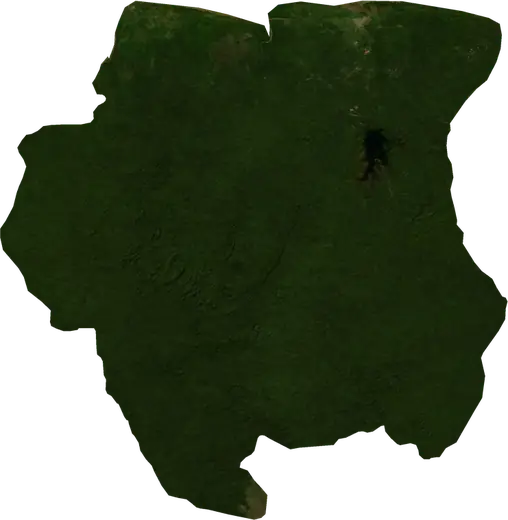
 Suriname
Wildfires in Suriname
Active wildfires in Suriname on a live satellite map, the largest fires on record and major fires per year.
Live map – Suriname
Key statistics (30 days)
Earthquakes M2.5+ and the wildfire fronts shown on the map.
Fire danger
Forecast for the area around: Paramaribo. Danger can vary locally; follow official guidance. Source: Copernicus EMS – EFFIS (FWI).
Severe weather (forecast)
- Today: Rain – Very heavy rain (25–50 mm) · Lelydorp
- Tomorrow: Rain – Very heavy rain (25–50 mm) · Lelydorp
Forecast for the area around: Suriname. It does not replace warnings from the national weather service. Source: ECMWF / Copernicus EMS.
Recent events in Suriname
- 30 h agoWildfire near Wageningen, Suriname – active880 acres · near Wageningen, Suriname
- 30 h agoWildfire near Brownsweg, Suriname – active1,962 acres · 32 mi SSW of Brownsweg, Suriname
- 30 h agoWildfire near Nieuw Nickerie, Suriname – active976 acres · 4 mi E of Nieuw Nickerie, Suriname
- 31 h agoWildfire near Wageningen, Suriname – active2,827 acres · 10 mi NNW of Wageningen, Suriname
- 42 h agoWildfire near Totness, Suriname – active778 acres · 4 mi WNW of Totness, Suriname
- 43 h agoWildfire near Pontbuiten, Suriname – active1,218 acres · 33 mi SSE of Pontbuiten, Suriname
Historical overview
Earthquakes M3.0+ and significant events of other hazards.
About Suriname
Satellites have detected 6 significant wildfires here; the largest burned about 6,435 acres.
Know the official emergency number, prepare an emergency kit and follow the instructions of your civil protection authority.
Learn more ›Wildfires
6 major fires since 2026. The largest covered about 6,435 acres.
Recent fires
| Area | Location | Since | Status |
|---|---|---|---|
| 880 acres | near Wageningen, Suriname | Active | |
| 1,962 acres | 32 mi SSW of Brownsweg, Suriname | Active | |
| 976 acres | 4 mi E of Nieuw Nickerie, Suriname | Active | |
| 2,827 acres | 10 mi NNW of Wageningen, Suriname | Active | |
| 778 acres | 4 mi WNW of Totness, Suriname | Active | |
| 1,218 acres | 33 mi SSE of Pontbuiten, Suriname | Active | |
| 1,310 acres | 9 mi E of Nieuw Nickerie, Suriname | Inactive | |
| 2,481 acres | 11 mi WNW of Wageningen, Suriname | Inactive | |
| 2,829 acres | near Nieuw Nickerie, Suriname | Inactive | |
| 2,409 acres | 25 mi W of Brownsweg, Suriname | Inactive |
Show all (28)
| Area | Location | Since | Status |
|---|---|---|---|
| 1,868 acres | 27 mi S of Brokopondo, Suriname | Inactive | |
| 1,364 acres | 12 mi E of Nieuw Nickerie, Suriname | Inactive | |
| 1,033 acres | 18 mi SSW of Brownsweg, Suriname | Inactive | |
| 927 acres | 17 mi WNW of Brownsweg, Suriname | Inactive | |
| 2,355 acres | 27 mi SSW of Brownsweg, Suriname | Inactive | |
| 2,259 acres | 9 mi W of Brownsweg, Suriname | Inactive | |
| 2,310 acres | 11 mi SW of Brownsweg, Suriname | Inactive | |
| 1,226 acres | 14 mi WSW of Brownsweg, Suriname | Inactive | |
| 1,616 acres | 23 mi W of Brownsweg, Suriname | Inactive | |
| 2,899 acres | 20 mi W of Brownsweg, Suriname | Inactive | |
| 1,174 acres | 9 mi S of Albina, Suriname | Inactive | |
| 830 acres | 18 mi SSW of Paramaribo, Suriname | Inactive | |
| 969 acres | 11 mi W of Wageningen, Suriname | Inactive | |
| 1,416 acres | 8 mi SSW of Nieuw Nickerie, Suriname | Inactive | |
| 3,556 acres | 9 mi ESE of Nieuw Nickerie, Suriname | Inactive | |
| 840 acres | 15 mi W of Brownsweg, Suriname | Inactive | |
| 6,435 acres | 4 mi SSW of Calcutta, Suriname | Inactive | |
| 1,661 acres | 61 mi SSW of Paramaribo, Suriname | Inactive |
Largest fires on record
| Area | Location | Since | Status |
|---|---|---|---|
| 6,435 acres | 4 mi SSW of Calcutta, Suriname | Inactive | |
| 3,556 acres | 9 mi ESE of Nieuw Nickerie, Suriname | Inactive | |
| 2,899 acres | 20 mi W of Brownsweg, Suriname | Inactive | |
| 2,829 acres | near Nieuw Nickerie, Suriname | Active | |
| 2,827 acres | 10 mi NNW of Wageningen, Suriname | Active | |
| 2,481 acres | 11 mi WNW of Wageningen, Suriname | Active |