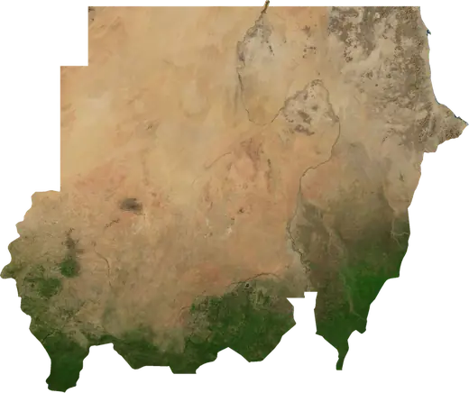
 Sudan
Sudan: earthquakes and wildfires
Latest earthquakes and active wildfires in Sudan on a live map, the strongest earthquakes and largest fires on record, and statistics by year.
Live map – Sudan
Key statistics (30 days)
Earthquakes M2.5+ and the wildfire fronts shown on the map.
Fire danger
Forecast for the area around: Nyala. Danger can vary locally; follow official guidance. Source: Copernicus EMS – EFFIS (FWI).
Severe weather (forecast)
- Today: Rain – Heavy rain (10–25 mm) · Port Sudan
- Tomorrow: Rain – Heavy rain (10–25 mm) · Port Sudan
Forecast for the area around: Sudan. It does not replace warnings from the national weather service. Source: ECMWF / Copernicus EMS.
Recent events in Sudan
- 4 h agoWildfire near Abyei, Sudan – active10,252 acres · 11 mi SSW of Abyei, Sudan
- 4 h agoWildfire near Umm Dafog, Sudan – active2,706 acres · 49 mi SE of Umm Dafog, Sudan
- 4 h agoWildfire near Abyei, Sudan – active6,007 acres · 8 mi ESE of Abyei, Sudan
- 4 h agoWildfire near Abyei, Sudan – active1,599 acres · 10 mi WSW of Abyei, Sudan
- 4 h agoWildfire near Kaduqli, Sudan – active27,928 acres · 35 mi SSW of Kaduqli, Sudan
- 4 h agoWildfire near Kaduqli, Sudan – active2,461 acres · 77 mi S of Kaduqli, Sudan
Historical overview
Earthquakes M3.0+ and significant events of other hazards.
About Sudan
Sudan has recorded 74 earthquakes of magnitude 3.0 or more since 1976. The strongest was M5.7 in 1993.
Satellites have detected 524 significant wildfires here; the largest burned about 584,645 acres.
Know the official emergency number, prepare an emergency kit and follow the instructions of your civil protection authority.
Learn more ›Earthquakes
74 earthquakes of magnitude 3.0 or more since 1976. The strongest was M5.7.
Recent earthquakes
No earthquakes of magnitude 2.5+ in the last 12 months.
Strongest earthquakes on record
| Mag | Location | Time (UTC) | Depth |
|---|---|---|---|
| 5.7 | 102 mi ENE of Suakin, Sudan | 6.2 mi | |
| 5.5 | 55 mi WSW of Omdurman, Sudan | 8.1 mi | |
| 5.3 | 98 mi ENE of Suakin, Sudan | 6.2 mi | |
| 5.3 | 98 mi ENE of Suakin, Sudan | 6.2 mi | |
| 5.2 | 95 mi ENE of Suakin, Sudan | 6.2 mi | |
| 5.1 | 95 mi ENE of Suakin, Sudan | 6.2 mi | |
| 5.1 | 96 mi NE of Tokar, Sudan | 6.2 mi | |
| 5.0 | 102 mi ENE of Suakin, Sudan | 6.2 mi | |
| 5.0 | 95 mi ENE of Suakin, Sudan | 6.2 mi | |
| 5.0 | 100 mi ENE of Suakin, Sudan | 6.2 mi | |
| 5.0 | 93 mi E of Port Sudan, Sudan | 6.2 mi | |
| 5.0 | 93 mi ENE of Suakin, Sudan | 9.6 mi | |
| 4.9 | 100 mi ENE of Suakin, Sudan | 6.2 mi | |
| 4.9 | 93 mi ENE of Suakin, Sudan | 8.3 mi | |
| 4.8 | 45 mi W of Omdurman, Sudan | 10.6 mi |
Earthquakes per year (M3.0+)
Year
| 2025 | 3 | M4.5 |
| 2024 | 2 | M4.3 |
| 2020 | 1 | M4.4 |
| 2015 | 1 | M4.4 |
| 2014 | 2 | M4.2 |
| 2013 | 1 | M4.5 |
| 2012 | 1 | M4.2 |
| 2010 | 1 | M4.4 |
| 2009 | 2 | M4.5 |
| 2008 | 2 | M4.2 |
| 2007 | 4 | M4.4 |
| 2006 | 2 | M4.7 |
| 2005 | 1 | M4.6 |
| 2004 | 1 | M4.4 |
| 2001 | 1 | M4.4 |
| 1999 | 1 | M4.2 |
| 1998 | 1 | M4.6 |
| 1996 | 1 | M3.9 |
| 1994 | 1 | M4.7 |
| 1993 | 37 | M5.7 |
| 1991 | 1 | M4.6 |
| 1988 | 1 | M4.0 |
| 1979 | 2 | M4.8 |
| 1977 | 1 | M4.3 |
| 1976 | 3 | M4.4 |
Wildfires
524 major fires since 2025. The largest covered about 584,645 acres.
Recent fires
| Area | Location | Since | Status |
|---|---|---|---|
| 10,252 acres | 11 mi SSW of Abyei, Sudan | Active | |
| 2,706 acres | 49 mi SE of Umm Dafog, Sudan | Active | |
| 6,007 acres | 8 mi ESE of Abyei, Sudan | Active | |
| 1,599 acres | 10 mi WSW of Abyei, Sudan | Active | |
| 27,928 acres | 35 mi SSW of Kaduqli, Sudan | Active | |
| 2,461 acres | 77 mi S of Kaduqli, Sudan | Active | |
| 7,257 acres | 46 mi SW of Talodi, Sudan | Active | |
| 1,018 acres | 14 mi SSW of Abyei, Sudan | Active | |
| 4,688 acres | 44 mi S of Talodi, Sudan | Active | |
| 820 acres | 23 mi SSW of Talodi, Sudan | Active |
Show all (200)
| Area | Location | Since | Status |
|---|---|---|---|
| 3,917 acres | 78 mi S of Kaduqli, Sudan | Active | |
| 7,304 acres | 64 mi NE of Abyei, Sudan | Active | |
| 4,781 acres | 52 mi S of Talodi, Sudan | Active | |
| 32,741 acres | 61 mi SSW of Kaduqli, Sudan | Active | |
| 3,222 acres | 36 mi S of Kaduqli, Sudan | Active | |
| 9,990 acres | 58 mi S of Kaduqli, Sudan | Active | |
| 825 acres | 69 mi S of Kaduqli, Sudan | Active | |
| 16,376 acres | 85 mi SSW of Kaduqli, Sudan | Active | |
| 391,360 acres | 47 mi ESE of Abyei, Sudan | Active | |
| 18,479 acres | 17 mi S of Talodi, Sudan | Active | |
| 13,082 acres | 51 mi S of Tullus, Sudan | Active | |
| 870 acres | 20 mi SE of Abyei, Sudan | Active | |
| 13,136 acres | 46 mi SW of Tullus, Sudan | Active | |
| 773 acres | 31 mi ESE of Abyei, Sudan | Active | |
| 1,243 acres | 23 mi ENE of Talodi, Sudan | Active | |
| 5,328 acres | 22 mi SSE of Abyei, Sudan | Active | |
| 21,958 acres | 51 mi ESE of Umm Dafog, Sudan | Active | |
| 2,740 acres | 13 mi NE of Talodi, Sudan | Active | |
| 74,280 acres | 43 mi SSE of Umm Dafog, Sudan | Active | |
| 2,451 acres | 18 mi SSE of Kaduqli, Sudan | Active | |
| 6,674 acres | 40 mi SE of Umm Dafog, Sudan | Active | |
| 2,780 acres | 5 mi S of Dilling, Sudan | Active | |
| 4,359 acres | 39 mi NNW of Abyei, Sudan | Active | |
| 19,163 acres | 62 mi NNE of Abyei, Sudan | Active | |
| 1,727 acres | 19 mi NW of Umm Dafog, Sudan | Active | |
| 969 acres | 20 mi SSE of Talodi, Sudan | Active | |
| 8,105 acres | 61 mi S of Tullus, Sudan | Active | |
| 584,645 acres | 39 mi ENE of Abyei, Sudan | Active | |
| 6,037 acres | 87 mi SE of Buram, Sudan | Active | |
| 103,532 acres | 100 mi SE of Buram, Sudan | Active | |
| 12,382 acres | 93 mi SSW of Kaduqli, Sudan | Active | |
| 72,335 acres | 40 mi SSE of Umm Dafog, Sudan | Active | |
| 1,485 acres | 32 mi E of Dilling, Sudan | Active | |
| 2,654 acres | 21 mi S of Umm Dafog, Sudan | Active | |
| 15,385 acres | 39 mi S of Tullus, Sudan | Active | |
| 8,177 acres | 57 mi ENE of Er Roseires, Sudan | Active | |
| 764 acres | 54 mi NE of Ad-Damazin, Sudan | Active | |
| 2,478 acres | 21 mi NNE of Kurmuk, Sudan | Active | |
| 17,433 acres | 55 mi ENE of Ad-Damazin, Sudan | Active | |
| 45,477 acres | 79 mi SSE of Ad-Damazin, Sudan | Active | |
| 3,160 acres | 52 mi WNW of Abu Jibeha, Sudan | Active | |
| 1,053 acres | 51 mi NE of Er Roseires, Sudan | Active | |
| 1,535 acres | 88 mi S of Kūstī, Sudan | Active | |
| 9,724 acres | 52 mi SSE of Ad-Damazin, Sudan | Active | |
| 17,722 acres | 57 mi SE of Ad-Damazin, Sudan | Active | |
| 5,985 acres | 44 mi SSE of Ad-Damazin, Sudan | Active | |
| 4,942 acres | 22 mi WSW of Talodi, Sudan | Active | |
| 5,029 acres | 55 mi ESE of Ad-Damazin, Sudan | Active | |
| 7,094 acres | 8 mi SE of Talodi, Sudan | Active | |
| 1,631 acres | 51 mi S of Abu Jibeha, Sudan | Active | |
| 19,551 acres | 49 mi SE of Abu Jibeha, Sudan | Active | |
| 5,575 acres | 47 mi S of Abu Jibeha, Sudan | Active | |
| 2,058 acres | 51 mi ENE of Er Roseires, Sudan | Active | |
| 191,756 acres | 65 mi ESE of Ad-Damazin, Sudan | Active | |
| 3,168 acres | 25 mi ENE of Kaduqli, Sudan | Active | |
| 32,408 acres | 68 mi ENE of Er Roseires, Sudan | Active | |
| 1,003 acres | 93 mi S of Gedaref, Sudan | Active | |
| 1,263 acres | 33 mi SSE of Umm Dafog, Sudan | Active | |
| 907 acres | 18 mi N of Kurmuk, Sudan | Active | |
| 3,912 acres | 92 mi S of Gedaref, Sudan | Active | |
| 3,865 acres | 41 mi S of Umm Dafog, Sudan | Active | |
| 36,025 acres | 50 mi WSW of Talodi, Sudan | Active | |
| 101,738 acres | 64 mi NE of Ad-Damazin, Sudan | Active | |
| 44,232 acres | 49 mi ESE of Umm Dafog, Sudan | Active | |
| 7,215 acres | 63 mi SE of Al Hawatah, Sudan | Active | |
| 15,802 acres | 52 mi ENE of Er Roseires, Sudan | Active | |
| 18,004 acres | 14 mi NE of Kurmuk, Sudan | Active | |
| 3,556 acres | 24 mi NNE of Talodi, Sudan | Active | |
| 13,321 acres | 18 mi SW of Umm Dafog, Sudan | Active | |
| 24,812 acres | 40 mi ENE of Er Roseires, Sudan | Active | |
| 14,767 acres | 66 mi NE of Ad-Damazin, Sudan | Active | |
| 5,347 acres | 56 mi SSE of Al Hawatah, Sudan | Active | |
| 4,801 acres | 20 mi SSW of Buram, Sudan | Active | |
| 5,604 acres | 88 mi SSE of Ad-Damazin, Sudan | Active | |
| 150,657 acres | 21 mi S of Kurmuk, Sudan | Active | |
| 4,688 acres | 41 mi S of Talodi, Sudan | Active | |
| 3,699 acres | 91 mi SSE of Ad-Damazin, Sudan | Active | |
| 3,395 acres | 22 mi SSE of Abyei, Sudan | Active | |
| 2,859 acres | 47 mi ESE of Abyei, Sudan | Active | |
| 4,171 acres | 10 mi ESE of Kurmuk, Sudan | Active | |
| 8,987 acres | 78 mi S of Kaduqli, Sudan | Active | |
| 8,691 acres | 35 mi NNE of Kaduqli, Sudan | Active | |
| 9,973 acres | 15 mi WSW of Kurmuk, Sudan | Active | |
| 12,029 acres | 3 mi SE of Kurmuk, Sudan | Active | |
| 2,676 acres | 19 mi NW of Abu Zabad, Sudan | Active | |
| 3,768 acres | 48 mi E of Ad-Damazin, Sudan | Active | |
| 27,923 acres | 42 mi ENE of Er Roseires, Sudan | Active | |
| 3,442 acres | 32 mi ENE of Kurmuk, Sudan | Active | |
| 1,352 acres | 9 mi S of Abyei, Sudan | Active | |
| 778 acres | 17 mi S of Umm Dafog, Sudan | Active | |
| 9,914 acres | 24 mi ENE of Umm Dafog, Sudan | Active | |
| 1,594 acres | 17 mi WSW of Umm Dafog, Sudan | Active | |
| 10,198 acres | 21 mi S of Buram, Sudan | Active | |
| 1,359 acres | 18 mi S of Umm Dafog, Sudan | Active | |
| 1,058 acres | 59 mi SSW of Al Lagowa, Sudan | Active | |
| 1,915 acres | 51 mi W of Abu Jibeha, Sudan | Active | |
| 3,067 acres | 26 mi W of Talodi, Sudan | Active | |
| 1,675 acres | 44 mi SE of Abu Jibeha, Sudan | Active | |
| 764 acres | 16 mi SE of Dilling, Sudan | Active | |
| 2,926 acres | 46 mi SSE of Abu Jibeha, Sudan | Active | |
| 764 acres | 40 mi SSE of Abu Jibeha, Sudan | Active | |
| 6,721 acres | 13 mi SSW of Umm Dafog, Sudan | Active | |
| 1,547 acres | 57 mi S of Umm Dafog, Sudan | Active | |
| 14,290 acres | 54 mi SW of Buram, Sudan | Active | |
| 1,552 acres | 45 mi SSE of Umm Dafog, Sudan | Active | |
| 1,203 acres | 32 mi ENE of Umm Dafog, Sudan | Active | |
| 2,110 acres | 8 mi NE of Kurmuk, Sudan | Active | |
| 8,839 acres | 27 mi SSE of Buram, Sudan | Active | |
| 1,878 acres | 23 mi ESE of Talodi, Sudan | Active | |
| 4,947 acres | 68 mi SSE of Ad-Damazin, Sudan | Active | |
| 1,505 acres | 36 mi SW of Talodi, Sudan | Active | |
| 1,836 acres | 57 mi SW of Kurmuk, Sudan | Active | |
| 909 acres | 32 mi ESE of Talodi, Sudan | Active | |
| 12,368 acres | 62 mi SSE of Ad-Damazin, Sudan | Active | |
| 3,823 acres | 19 mi SSW of Abyei, Sudan | Active | |
| 19,180 acres | 39 mi SW of Talodi, Sudan | Active | |
| 4,132 acres | 34 mi S of Kaduqli, Sudan | Active | |
| 1,868 acres | 55 mi S of Ad-Damazin, Sudan | Active | |
| 3,111 acres | 21 mi W of Talodi, Sudan | Active | |
| 5,881 acres | 23 mi S of Talodi, Sudan | Active | |
| 5,612 acres | 32 mi SSW of Kurmuk, Sudan | Active | |
| 13,485 acres | 60 mi SE of Ad-Damazin, Sudan | Active | |
| 8,083 acres | 34 mi SW of Kurmuk, Sudan | Active | |
| 3,721 acres | 27 mi NE of Abyei, Sudan | Active | |
| 2,869 acres | 48 mi SSE of Ad-Damazin, Sudan | Active | |
| 766 acres | 18 mi SE of Talodi, Sudan | Active | |
| 1,164 acres | 33 mi WSW of Talodi, Sudan | Active | |
| 5,224 acres | 35 mi WSW of Talodi, Sudan | Active | |
| 2,110 acres | 29 mi SSE of Kaduqli, Sudan | Active | |
| 2,733 acres | 51 mi S of Abu Jibeha, Sudan | Active | |
| 1,290 acres | 37 mi WSW of Talodi, Sudan | Active | |
| 3,768 acres | 87 mi SSE of El Daein, Sudan | Active | |
| 8,698 acres | 11 mi N of Talodi, Sudan | Active | |
| 5,948 acres | 80 mi SE of Buram, Sudan | Active | |
| 818 acres | 29 mi ESE of Talodi, Sudan | Active | |
| 815 acres | 63 mi E of Ad-Damazin, Sudan | Active | |
| 2,352 acres | 11 mi W of Kurmuk, Sudan | Active | |
| 114,177 acres | 87 mi SSE of Buram, Sudan | Active | |
| 2,782 acres | 24 mi N of Kaduqli, Sudan | Active | |
| 4,112 acres | 43 mi SSE of Umm Dafog, Sudan | Active | |
| 1,008 acres | 42 mi SSW of Abu Jibeha, Sudan | Active | |
| 3,069 acres | 59 mi ENE of Er Roseires, Sudan | Active | |
| 909 acres | 42 mi W of Abu Jibeha, Sudan | Active | |
| 3,724 acres | 18 mi NE of Abyei, Sudan | Active | |
| 1,535 acres | 35 mi SSE of Dilling, Sudan | Active | |
| 6,326 acres | 54 mi SE of Buram, Sudan | Active | |
| 4,982 acres | 56 mi SSE of Umm Dafog, Sudan | Active | |
| 2,686 acres | 30 mi NNW of Talodi, Sudan | Active | |
| 2,871 acres | 3 mi E of Dilling, Sudan | Active | |
| 1,287 acres | 64 mi SSE of Al-Ubayyid, Sudan | Active | |
| 6,375 acres | 83 mi SSE of Buram, Sudan | Active | |
| 22,941 acres | 36 mi SW of Kaduqli, Sudan | Active | |
| 9,187 acres | 46 mi S of Umm Dafog, Sudan | Active | |
| 1,003 acres | 52 mi SSE of Ad-Damazin, Sudan | Active | |
| 64,228 acres | 66 mi SE of Ad-Damazin, Sudan | Active | |
| 3,600 acres | 52 mi SSE of Ad-Damazin, Sudan | Active | |
| 1,631 acres | 15 mi SSW of Kaduqli, Sudan | Active | |
| 3,153 acres | 26 mi SE of Talodi, Sudan | Active | |
| 3,459 acres | 15 mi N of Umm Dafog, Sudan | Active | |
| 1,967 acres | 43 mi WNW of Abu Jibeha, Sudan | Active | |
| 1,811 acres | 60 mi SSE of Al-Ubayyid, Sudan | Active | |
| 4,366 acres | 4 mi E of Kaduqli, Sudan | Active | |
| 1,169 acres | 47 mi SSE of Umm Dafog, Sudan | Active | |
| 1,102 acres | 14 mi NW of Umm Dafog, Sudan | Active | |
| 6,029 acres | 17 mi SE of Umm Dafog, Sudan | Active | |
| 2,133 acres | 57 mi S of Umm Dafog, Sudan | Active | |
| 5,802 acres | 42 mi NE of Kaduqli, Sudan | Active | |
| 2,271 acres | 82 mi ESE of Buram, Sudan | Active | |
| 1,240 acres | 50 mi E of Ad-Damazin, Sudan | Active | |
| 9,516 acres | 65 mi E of Jalqani, Sudan | Active | |
| 4,838 acres | 24 mi N of El Daein, Sudan | Active | |
| 4,468 acres | 57 mi SSW of Al Lagowa, Sudan | Active | |
| 1,796 acres | 49 mi SE of Umm Dafog, Sudan | Active | |
| 1,787 acres | 40 mi SE of Umm Dafog, Sudan | Active | |
| 2,834 acres | 35 mi SSE of Abu Jibeha, Sudan | Active | |
| 1,767 acres | 74 mi S of Gedaref, Sudan | Active | |
| 5,140 acres | 30 mi ENE of Kaduqli, Sudan | Active | |
| 7,186 acres | 61 mi ENE of Ad-Damazin, Sudan | Active | |
| 36,720 acres | 40 mi WSW of Abu Jibeha, Sudan | Active | |
| 2,108 acres | 35 mi ESE of Dilling, Sudan | Active | |
| 1,063 acres | 62 mi WSW of Kurmuk, Sudan | Active | |
| 3,455 acres | 26 mi NNE of Kurmuk, Sudan | Active | |
| 14,537 acres | 58 mi S of Ad-Damazin, Sudan | Active | |
| 3,361 acres | 17 mi WNW of Kurmuk, Sudan | Active | |
| 9,640 acres | 59 mi ESE of Ad-Damazin, Sudan | Active | |
| 761 acres | 29 mi W of Kurmuk, Sudan | Active | |
| 1,628 acres | 66 mi SSE of Ad-Damazin, Sudan | Active | |
| 13,262 acres | 28 mi S of Kaduqli, Sudan | Active | |
| 1,347 acres | 56 mi SE of Abu Jibeha, Sudan | Active | |
| 13,910 acres | 61 mi NE of Abyei, Sudan | Active |
Largest fires on record
| Area | Location | Since | Status |
|---|---|---|---|
| 576,990 acres | 39 mi ENE of Abyei, Sudan | Active | |
| 382,627 acres | 47 mi ESE of Abyei, Sudan | Active | |
| 189,700 acres | 65 mi ESE of Ad-Damazin, Sudan | Active | |
| 150,072 acres | 21 mi S of Kurmuk, Sudan | Active | |
| 114,177 acres | 87 mi SSE of Buram, Sudan | Active | |
| 101,600 acres | 100 mi SE of Buram, Sudan | Active | |
| 98,676 acres | 64 mi NE of Ad-Damazin, Sudan | Active | |
| 74,132 acres | 43 mi SSE of Umm Dafog, Sudan | Active | |
| 71,992 acres | 40 mi SSE of Umm Dafog, Sudan | Active | |
| 64,228 acres | 66 mi SE of Ad-Damazin, Sudan | Active | |
| 44,808 acres | 79 mi SSE of Ad-Damazin, Sudan | Active | |
| 44,706 acres | 29 mi ENE of Abyei, Sudan | Active | |
| 44,182 acres | 49 mi ESE of Umm Dafog, Sudan | Active | |
| 40,130 acres | 93 mi SE of Buram, Sudan | Inactive | |
| 36,720 acres | 40 mi WSW of Abu Jibeha, Sudan | Active |
Major fires per year
Year
| 2026 | 363 | 576,990 acres |
| 2025 | 157 | 64,228 acres |
Regions
Places
- Khartoum
- Omdurman
- Bahri
- Port Sudan
- Kaduqli
- Abyei
- Dilling
- Abu Jibeha
- Er Roseires
- Ad-Damazin
- Abu Zabad
- Buram
- Tullus
- Al Mijlad
- Ar Rahad
- Rahad al Bardi
- Babanusah
- El Daein
- Kutum
- Kabkabiyah
- Sh'iariah
- An Nuhud
- Gereida
- Zalinjay
- Mellit
- Al Fulah
- 'Ardamata
- Umm Ruwaba
- Ghubaysh
- Al-Ubayyid
- Al Hawatah
- El Geneina Fort
- Geneina
- Al-Fashir
- Nyala
- Kassala
- Kas
- Singa