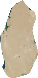
 Qatar
Wildfires in Qatar
Active wildfires in Qatar on a live satellite map, the largest fires on record and major fires per year.
Live map – Qatar
Key statistics (30 days)
Earthquakes M2.5+ and the wildfire fronts shown on the map.
Fire danger
Forecast for the area around: Umm Ghuwaylinah. Danger can vary locally; follow official guidance. Source: Copernicus EMS – EFFIS (FWI).
Severe weather (forecast)
The forecast shows no heavy rain, gales or thunderstorms for today and tomorrow.
Forecast for the area around: Qatar. It does not replace warnings from the national weather service. Source: ECMWF / Copernicus EMS.
Recent events in Qatar
- 4 h agoWildfire near Lusail, Qatar – active26,359 acres · 33 mi N of Lusail, Qatar
- 4 h agoWildfire near Doha, Qatar – active11,770 acres · 84 mi E of Doha, Qatar
- 4 h agoWildfire near Al Matar al 'Atiq, Qatar – active16,858 acres · 23 mi S of Al Matar al 'Atiq, Qatar
- 4 h agoWildfire near Lusail, Qatar – active3,198 acres · 66 mi E of Lusail, Qatar
- 4 h agoWildfire near Lusail, Qatar – active1,023 acres · 59 mi ENE of Lusail, Qatar
- 14 h agoWildfire near Dukhan, Qatar – active1,688 acres · near Dukhan, Qatar
Historical overview
Earthquakes M3.0+ and significant events of other hazards.
About Qatar
Satellites have detected 7 significant wildfires here; the largest burned about 26,359 acres.
Know the official emergency number, prepare an emergency kit and follow the instructions of your civil protection authority.
Learn more ›Wildfires
7 major fires since 2026. The largest covered about 26,359 acres.
Recent fires
| Area | Location | Since | Status |
|---|---|---|---|
| 26,359 acres | 33 mi N of Lusail, Qatar | Active | |
| 11,770 acres | 84 mi E of Doha, Qatar | Active | |
| 16,858 acres | 23 mi S of Al Matar al 'Atiq, Qatar | Active | |
| 3,198 acres | 66 mi E of Lusail, Qatar | Active | |
| 1,023 acres | 59 mi ENE of Lusail, Qatar | Active | |
| 1,688 acres | near Dukhan, Qatar | Active | |
| 2,802 acres | near Dukhan, Qatar | Active | |
| 756 acres | 30 mi WSW of Mu'aydhir Rawdat Rashid, Qatar | Active | |
| 3,244 acres | 4 mi N of Umm Bab, Qatar | Active | |
| 3,692 acres | 76 mi E of Doha, Qatar | Active |
Largest fires on record
| Area | Location | Since | Status |
|---|---|---|---|
| 26,359 acres | 33 mi N of Lusail, Qatar | Active | |
| 16,858 acres | 23 mi S of Al Matar al 'Atiq, Qatar | Active | |
| 11,770 acres | 84 mi E of Doha, Qatar | Active | |
| 3,692 acres | 76 mi E of Doha, Qatar | Active | |
| 3,244 acres | 4 mi N of Umm Bab, Qatar | Active | |
| 3,198 acres | 66 mi E of Lusail, Qatar | Active | |
| 2,802 acres | near Dukhan, Qatar | Active |
Regions
Places
- Umm Ghuwaylinah
- Farij Kulayb
- Al Matar al 'Atiq
- Ath Thumamah Sab'ah wa Arba'un
- Ath Thumamah Sittah wa Arba'un
- Ath Thumamah Khamsun
- Farij al Amir
- Lusail
- Al 'Unayzah
- Umm Salal Muhammad
- Mu'aydhir Rawdat Rashid
- Madinat Khalifah
- Az Za'ayin
- Al Rayyan
- Al Wakrah
- Doha
- As Sultah al Jadidah
- Al Mansurah
- An Najmah
- As Sadd