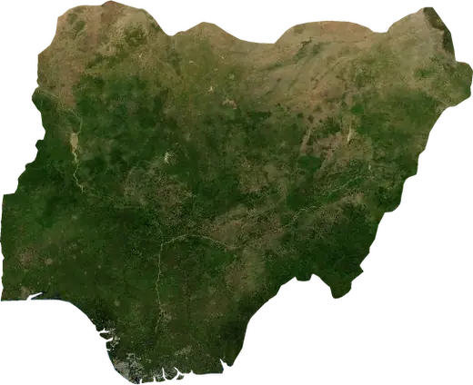
 Tambuwal
Wildfires near Tambuwal
Is there a fire near Tambuwal right now? Active wildfires within 62 mi of Tambuwal, Nigeria, from NASA satellites, and the largest fires on record.
Live map – Tambuwal
Loading live map…
Latest event2,189 acres12 h ago5 mi W of Sokoto, Nigeria
Low
Moderate
High
Very high
Extreme
Very extreme
Forecast: Copernicus EFFIS (FWI index)
Very light rain (0.1–1 mm)
Light rain (1–5 mm)
Moderate rain (5–10 mm)
Heavy rain (10–25 mm)
Very heavy rain (25–50 mm)
Extreme rain (≥ 50 mm)
Forecast: ECMWF via Copernicus EMS – GWIS
Calm (< 7 km/h, 0–1 Bf)
Light breeze (7–18 km/h, 2–3 Bf)
Moderate breeze (18–36 km/h, 4–5 Bf)
Strong breeze (36–54 km/h, 5–7 Bf)
Gale (54–72 km/h, 7–8 Bf)
Storm (≥ 72 km/h, 9+ Bf)
Forecast: ECMWF via Copernicus EMS – GWIS
Very low lightning
Low lightning
Moderate lightning
High lightning
Very high lightning
Extreme lightning
Forecast: ECMWF via Copernicus EMS – GWIS
Earthquakes
Wildfires
Floods
Storms
Volcanoes
Tsunamis
Earthquakes within 62 mi of the city center.
Key statistics (30 days)
Earthquakes M2.5+ and the wildfire fronts shown on the map.
Recent events in Tambuwal
- 12 h agoWildfire near Sokoto, Nigeria – active2,189 acres · 5 mi W of Sokoto, Nigeria
- 12 h agoWildfire near Mahuta, Nigeria – active49,515 acres · 15 mi NNE of Mahuta, Nigeria
- 12 h agoWildfire near Gummi, Nigeria – active9,252 acres · 28 mi SW of Gummi, Nigeria
- 12 h agoWildfire near Gummi, Nigeria – active1,772 acres · 13 mi WNW of Gummi, Nigeria
- 13 h agoWildfire near Sokoto, Nigeria – active764 acres · 34 mi SSW of Sokoto, Nigeria
- 25 h agoWildfire near Gummi, Nigeria – active909 acres · 19 mi SW of Gummi, Nigeria
Historical overview
Earthquakes M3.0+ and significant events of other hazards.
About Tambuwal
Satellites have detected 22 significant wildfires here; the largest burned about 49,515 acres.
Know the official emergency number, prepare an emergency kit and follow the instructions of your civil protection authority.
Learn more ›Wildfires
22 major fires since 2025 within 62 mi. The largest covered about 49,515 acres.
Recent fires
| Area | Location | Since | Status |
|---|---|---|---|
| 2,189 acres | 5 mi W of Sokoto, Nigeria | Active | |
| 49,515 acres | 15 mi NNE of Mahuta, Nigeria | Active | |
| 9,252 acres | 28 mi SW of Gummi, Nigeria | Active | |
| 1,772 acres | 13 mi WNW of Gummi, Nigeria | Active | |
| 764 acres | 34 mi SSW of Sokoto, Nigeria | Active | |
| 909 acres | 19 mi SW of Gummi, Nigeria | Active | |
| 862 acres | 21 mi SW of Gummi, Nigeria | Active | |
| 4,739 acres | 13 mi SW of Gummi, Nigeria | Active | |
| 4,109 acres | 47 mi S of Sokoto, Nigeria | Active | |
| 9,378 acres | 15 mi NE of Gummi, Nigeria | Active |
Show all (34)
| Area | Location | Since | Status |
|---|---|---|---|
| 2,056 acres | 31 mi ENE of Gummi, Nigeria | Active | |
| 14,720 acres | 14 mi SSE of Gummi, Nigeria | Active | |
| 2,686 acres | 15 mi S of Gummi, Nigeria | Inactive | |
| 860 acres | 42 mi SSE of Sokoto, Nigeria | Inactive | |
| 1,147 acres | 10 mi S of Sokoto, Nigeria | Inactive | |
| 1,003 acres | 10 mi NNW of Gummi, Nigeria | Inactive | |
| 12,301 acres | 61 mi SSE of Sokoto, Nigeria | Inactive | |
| 1,001 acres | 37 mi W of Sokoto, Nigeria | Inactive | |
| 4,020 acres | 27 mi SSE of Dange, Nigeria | Inactive | |
| 2,350 acres | 60 mi SSE of Birnin Kebbi, Nigeria | Inactive | |
| 20,080 acres | 24 mi NNE of Dabai, Nigeria | Inactive | |
| 2,194 acres | 16 mi ENE of Gummi, Nigeria | Inactive | |
| 2,590 acres | 59 mi SSE of Birnin Kebbi, Nigeria | Inactive | |
| 2,874 acres | 17 mi SE of Gummi, Nigeria | Inactive | |
| 2,632 acres | 13 mi SSW of Gummi, Nigeria | Inactive | |
| 2,488 acres | 19 mi SE of Gummi, Nigeria | Inactive | |
| 3,252 acres | 26 mi SSE of Dange, Nigeria | Inactive | |
| 4,317 acres | 18 mi NNW of Mahuta, Nigeria | Inactive | |
| 2,493 acres | 25 mi NW of Mahuta, Nigeria | Inactive | |
| 2,639 acres | 14 mi N of Mahuta, Nigeria | Inactive | |
| 4,102 acres | 42 mi WNW of Sokoto, Nigeria | Inactive | |
| 2,908 acres | 35 mi WNW of Sokoto, Nigeria | Inactive | |
| 4,364 acres | 14 mi NNW of Mahuta, Nigeria | Inactive | |
| 5,130 acres | 25 mi SE of Gummi, Nigeria | Inactive |
Largest fires on record
| Area | Location | Since | Status |
|---|---|---|---|
| 49,515 acres | 15 mi NNE of Mahuta, Nigeria | Active | |
| 20,080 acres | 24 mi NNE of Dabai, Nigeria | Inactive | |
| 14,720 acres | 14 mi SSE of Gummi, Nigeria | Active | |
| 12,301 acres | 61 mi SSE of Sokoto, Nigeria | Inactive | |
| 9,378 acres | 15 mi NE of Gummi, Nigeria | Active | |
| 9,252 acres | 28 mi SW of Gummi, Nigeria | Active | |
| 5,130 acres | 25 mi SE of Gummi, Nigeria | Inactive | |
| 4,739 acres | 13 mi SW of Gummi, Nigeria | Active | |
| 4,364 acres | 14 mi NNW of Mahuta, Nigeria | Inactive | |
| 4,317 acres | 18 mi NNW of Mahuta, Nigeria | Inactive | |
| 4,109 acres | 47 mi S of Sokoto, Nigeria | Active | |
| 4,102 acres | 42 mi WNW of Sokoto, Nigeria | Inactive | |
| 4,020 acres | 27 mi SSE of Dange, Nigeria | Inactive | |
| 3,252 acres | 26 mi SSE of Dange, Nigeria | Inactive | |
| 2,908 acres | 35 mi WNW of Sokoto, Nigeria | Inactive |
Major fires per year
Year
| 2026 | 17 | 49,515 acres |
| 2025 | 5 | 20,080 acres |
Nearby places
- Jega 22 mi
- Argungu 25 mi
- Birnin Kebbi 30 mi
- Gummi 37 mi
- Sokoto 61 mi
- Kamba 77 mi
- Zuru 78 mi
- Gaya 89 mi
- Malanville 93 mi