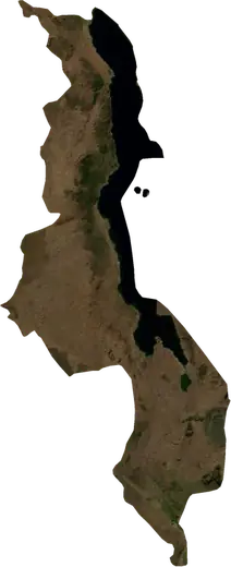
 Southern Region
: earthquakes and wildfires
Latest earthquakes and wildfires in Southern Region (Malawi) on a live map, the strongest earthquakes and largest fires on record.
Live map – Southern Region
Key statistics (30 days)
Earthquakes M2.5+ and the wildfire fronts shown on the map.
Recent events in Southern Region
- 4 days agoWildfire near Blantyre, Malawi1,455 acres · 93 mi SW of Blantyre, Malawi
- 4 days agoWildfire near Blantyre, Malawi1,784 acres · 31 mi S of Blantyre, Malawi
- 4 days agoWildfire near Blantyre, Malawi4,319 acres · 41 mi S of Blantyre, Malawi
- 6 days agoWildfire near Ngabu, Malawi2,066 acres · 23 mi SSW of Ngabu, Malawi
- 6 days agoWildfire near Ngabu, Malawi1,127 acres · 21 mi SSW of Ngabu, Malawi
- 6 days agoWildfire near Ngabu, Malawi939 acres · 40 mi SW of Ngabu, Malawi
Historical overview
Earthquakes M3.0+ and significant events of other hazards.
About Southern Region
Southern Region has recorded 26 earthquakes of magnitude 3.0 or more since 1984. The strongest was M5.5 in 2018.
Satellites have detected 31 significant wildfires here; the largest burned about 19,203 acres.
Know the official emergency number, prepare an emergency kit and follow the instructions of your civil protection authority.
Learn more ›Earthquakes
26 earthquakes of magnitude 3.0 or more since 1984. The strongest was M5.5.
Recent earthquakes
No earthquakes of magnitude 2.5+ in the last 12 months.
Strongest earthquakes on record
| Mag | Location | Time (UTC) | Depth |
|---|---|---|---|
| 5.5 | 16 mi NE of Nsanje, Malawi | 10.6 mi | |
| 5.1 | 10 mi NW of Monkey Bay, Malawi | 6.2 mi | |
| 5.1 | 12 mi SSE of Monkey Bay, Malawi | 6.2 mi | |
| 4.9 | 25 mi E of Nsanje, Malawi | 6.2 mi | |
| 4.9 | 16 mi ENE of Nsanje, Malawi | 6.2 mi | |
| 4.8 | 14 mi NE of Nsanje, Malawi | 6.2 mi | |
| 4.8 | 20 mi WSW of Blantyre, Malawi | 5.9 mi | |
| 4.7 | 18 mi ENE of Nsanje, Malawi | 6.2 mi | |
| 4.6 | near Blantyre, Malawi | 20.5 mi | |
| 4.5 | 22 mi S of Monkey Bay, Malawi | 6.2 mi | |
| 4.5 | 11 mi WNW of Monkey Bay, Malawi | 6.2 mi | |
| 4.5 | 17 mi S of Nsanje, Malawi | 20.5 mi | |
| 4.5 | 64 mi WSW of Blantyre, Malawi | 6.2 mi | |
| 4.3 | 6 mi NNW of Nsanje, Malawi | 7.5 mi | |
| 4.3 | 4 mi WNW of Zomba, Malawi | 6.2 mi |
Earthquakes per year (M3.0+)
Year
| 2025 | 1 | M4.5 |
| 2022 | 3 | M4.9 |
| 2019 | 2 | M4.2 |
| 2018 | 5 | M5.5 |
| 2015 | 2 | M4.7 |
| 2012 | 1 | M4.3 |
| 2007 | 1 | M4.8 |
| 2005 | 1 | M4.0 |
| 2000 | 1 | M3.9 |
| 1998 | 1 | M4.6 |
| 1995 | 1 | M5.1 |
| 1992 | 1 | M4.5 |
| 1989 | 1 | M4.0 |
| 1987 | 1 | M3.5 |
| 1986 | 3 | M4.5 |
| 1984 | 1 | M5.1 |
Wildfires
31 major fires since 2025. The largest covered about 19,203 acres.
Recent fires
| Area | Location | Since | Status |
|---|---|---|---|
| 1,455 acres | 93 mi SW of Blantyre, Malawi | Inactive | |
| 1,784 acres | 31 mi S of Blantyre, Malawi | Inactive | |
| 4,319 acres | 41 mi S of Blantyre, Malawi | Inactive | |
| 2,066 acres | 23 mi SSW of Ngabu, Malawi | Inactive | |
| 1,127 acres | 21 mi SSW of Ngabu, Malawi | Inactive | |
| 939 acres | 40 mi SW of Ngabu, Malawi | Inactive | |
| 1,418 acres | 22 mi S of Monkey Bay, Malawi | Inactive | |
| 754 acres | 52 mi ESE of Zomba, Malawi | Inactive | |
| 1,878 acres | 17 mi SE of Nsanje, Malawi | Inactive | |
| 1,594 acres | 39 mi SW of Ngabu, Malawi | Inactive |
Show all (59)
| Area | Location | Since | Status |
|---|---|---|---|
| 2,629 acres | 12 mi SSW of Ngabu, Malawi | Inactive | |
| 2,019 acres | 35 mi W of Nsanje, Malawi | Inactive | |
| 7,796 acres | 47 mi SSE of Blantyre, Malawi | Inactive | |
| 2,819 acres | 44 mi W of Blantyre, Malawi | Inactive | |
| 6,667 acres | 8 mi SW of Ngabu, Malawi | Inactive | |
| 1,737 acres | 52 mi SW of Blantyre, Malawi | Inactive | |
| 986 acres | 40 mi SW of Ngabu, Malawi | Inactive | |
| 2,120 acres | 46 mi ESE of Zomba, Malawi | Inactive | |
| 2,441 acres | 17 mi WNW of Ngabu, Malawi | Inactive | |
| 1,784 acres | 59 mi SW of Blantyre, Malawi | Inactive | |
| 944 acres | 20 mi WNW of Blantyre, Malawi | Inactive | |
| 6,761 acres | 11 mi ENE of Ngabu, Malawi | Inactive | |
| 3,815 acres | 25 mi WNW of Blantyre, Malawi | Inactive | |
| 1,460 acres | 62 mi W of Blantyre, Malawi | Inactive | |
| 2,113 acres | 47 mi SSW of Blantyre, Malawi | Inactive | |
| 1,787 acres | 29 mi WNW of Blantyre, Malawi | Inactive | |
| 15,634 acres | 29 mi SSW of Ngabu, Malawi | Inactive | |
| 3,660 acres | 10 mi ESE of Nsanje, Malawi | Inactive | |
| 13,860 acres | 52 mi SSE of Blantyre, Malawi | Inactive | |
| 1,972 acres | 9 mi NNE of Nsanje, Malawi | Inactive | |
| 2,347 acres | 20 mi N of Nsanje, Malawi | Inactive | |
| 3,771 acres | near Zomba, Malawi | Inactive | |
| 1,408 acres | 18 mi SW of Ngabu, Malawi | Inactive | |
| 2,916 acres | 16 mi SW of Blantyre, Malawi | Inactive | |
| 848 acres | 5 mi NNE of Mulanje, Malawi | Inactive | |
| 19,203 acres | 59 mi WNW of Blantyre, Malawi | Inactive | |
| 4,507 acres | 18 mi WSW of Ngabu, Malawi | Inactive | |
| 1,507 acres | 21 mi NW of Blantyre, Malawi | Inactive | |
| 1,129 acres | 8 mi NE of Mulanje, Malawi | Inactive | |
| 1,317 acres | 7 mi WSW of Blantyre, Malawi | Inactive | |
| 845 acres | 13 mi ESE of Liwonde, Malawi | Inactive | |
| 1,033 acres | 9 mi NW of Ngabu, Malawi | Inactive | |
| 2,731 acres | 68 mi W of Blantyre, Malawi | Inactive | |
| 3,052 acres | 11 mi WSW of Ngabu, Malawi | Inactive | |
| 2,602 acres | 9 mi NE of Mangochi, Malawi | Inactive | |
| 3,430 acres | 69 mi SW of Blantyre, Malawi | Inactive | |
| 3,099 acres | 43 mi SW of Blantyre, Malawi | Inactive | |
| 3,299 acres | 15 mi WSW of Balaka, Malawi | Inactive | |
| 4,611 acres | 59 mi W of Blantyre, Malawi | Inactive | |
| 5,901 acres | 59 mi WNW of Blantyre, Malawi | Inactive | |
| 4,376 acres | 57 mi WSW of Blantyre, Malawi | Inactive | |
| 2,689 acres | 18 mi WNW of Mwanza, Malawi | Inactive | |
| 3,944 acres | 22 mi E of Nsanje, Malawi | Inactive | |
| 5,145 acres | 73 mi W of Blantyre, Malawi | Inactive | |
| 3,447 acres | 55 mi WNW of Blantyre, Malawi | Inactive | |
| 7,512 acres | 54 mi SSE of Blantyre, Malawi | Inactive | |
| 4,478 acres | 52 mi W of Blantyre, Malawi | Inactive | |
| 3,566 acres | 13 mi SW of Nsanje, Malawi | Inactive | |
| 6,949 acres | 23 mi ENE of Nsanje, Malawi | Inactive |
Largest fires on record
| Area | Location | Since | Status |
|---|---|---|---|
| 19,203 acres | 59 mi WNW of Blantyre, Malawi | Inactive | |
| 15,634 acres | 29 mi SSW of Ngabu, Malawi | Inactive | |
| 13,860 acres | 52 mi SSE of Blantyre, Malawi | Inactive | |
| 7,796 acres | 47 mi SSE of Blantyre, Malawi | Inactive | |
| 7,512 acres | 54 mi SSE of Blantyre, Malawi | Inactive | |
| 6,949 acres | 23 mi ENE of Nsanje, Malawi | Inactive | |
| 6,761 acres | 11 mi ENE of Ngabu, Malawi | Inactive | |
| 6,667 acres | 8 mi SW of Ngabu, Malawi | Inactive | |
| 5,901 acres | 59 mi WNW of Blantyre, Malawi | Inactive | |
| 5,145 acres | 73 mi W of Blantyre, Malawi | Inactive | |
| 4,611 acres | 59 mi W of Blantyre, Malawi | Inactive | |
| 4,507 acres | 18 mi WSW of Ngabu, Malawi | Inactive | |
| 4,478 acres | 52 mi W of Blantyre, Malawi | Inactive | |
| 4,376 acres | 57 mi WSW of Blantyre, Malawi | Inactive | |
| 4,319 acres | 41 mi S of Blantyre, Malawi | Inactive |
Major fires per year
Year
| 2026 | 30 | 19,203 acres |
| 2025 | 1 | 15,634 acres |