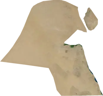
 Bayan
Bayan: earthquakes and wildfires
Was there an earthquake or a fire near Bayan just now? Live map within 62 mi, the strongest earthquakes, the largest fires and statistics for Bayan, Kuwait.
Live map – Bayan
Earthquakes within 62 mi of the city center.
Key statistics (30 days)
Earthquakes M2.5+ and the wildfire fronts shown on the map.
Recent events in Bayan
- 13 h agoWildfire near Al Ahmadi, Kuwait – active2,651 acres · 21 mi WSW of Al Ahmadi, Kuwait
- 13 h agoWildfire near Al Wafrah, Kuwait – active3,202 acres · 4 mi S of Al Wafrah, Kuwait
- 13 h agoWildfire near Al Fahahil, Kuwait – active17,821 acres · 6 mi SSE of Al Fahahil, Kuwait
- 13 h agoWildfire near Basra, Iraq – active7,250 acres · 45 mi S of Basra, Iraq
- 24 h agoWildfire near Al Wafrah, Kuwait – active1,789 acres · 13 mi SSW of Al Wafrah, Kuwait
- 24 h agoWildfire near Al Ahmadi, Kuwait – active3,887 acres · 26 mi W of Al Ahmadi, Kuwait
Historical overview
Earthquakes M3.0+ and significant events of other hazards.
About Bayan
Bayan has recorded 21 earthquakes of magnitude 3.0 or more since 1976. The strongest was M4.7 in 2020.
Satellites have detected 6 significant wildfires here; the largest burned about 17,821 acres.
Know the official emergency number, prepare an emergency kit and follow the instructions of your civil protection authority.
Learn more ›Did you feel an earthquake in Bayan?
No reports yet.
Earthquakes
21 earthquakes of magnitude 3.0 or more since 1976 within 62 mi. The strongest was M4.7.
Recent earthquakes
| Mag | Location | Time (UTC) | Depth |
|---|---|---|---|
| 4.2 | 27 mi WSW of Al Ahmadi, Kuwait | 6.2 mi |
Strongest earthquakes on record
| Mag | Location | Time (UTC) | Depth |
|---|---|---|---|
| 4.7 | 26 mi WSW of Al Ahmadi, Kuwait | 6.2 mi | |
| 4.7 | 30 mi WSW of Al Ahmadi, Kuwait | 6.2 mi | |
| 4.6 | 37 mi WSW of Al Ahmadi, Kuwait | 6.2 mi | |
| 4.6 | 39 mi W of Al Ahmadi, Kuwait | 6.2 mi |
Earthquakes per year (M3.0+)
Year
| 2026 | 1 | M4.2 |
| 2025 | 1 | M4.3 |
| 2022 | 1 | M4.4 |
| 2021 | 1 | M4.3 |
| 2020 | 2 | M4.7 |
| 2019 | 2 | M4.1 |
| 2017 | 1 | M4.0 |
| 2015 | 2 | M4.4 |
| 2012 | 3 | M4.2 |
| 2008 | 1 | M4.3 |
| 2007 | 1 | M4.0 |
| 2006 | 1 | M4.6 |
| 1997 | 2 | M4.6 |
| 1993 | 1 | M4.7 |
| 1976 | 1 | M3.8 |
Wildfires
6 major fires since 2026 within 62 mi. The largest covered about 17,821 acres.
Recent fires
| Area | Location | Since | Status |
|---|---|---|---|
| 2,651 acres | 21 mi WSW of Al Ahmadi, Kuwait | Active | |
| 3,202 acres | 4 mi S of Al Wafrah, Kuwait | Active | |
| 17,821 acres | 6 mi SSE of Al Fahahil, Kuwait | Active | |
| 7,250 acres | 45 mi S of Basra, Iraq | Active | |
| 1,789 acres | 13 mi SSW of Al Wafrah, Kuwait | Active | |
| 3,887 acres | 26 mi W of Al Ahmadi, Kuwait | Active | |
| 2,355 acres | 7 mi SW of Al Ahmadi, Kuwait | Active | |
| 2,091 acres | 29 mi SSE of Al Ahmadi, Kuwait | Active | |
| 756 acres | 40 mi SSW of Basra, Iraq | Active | |
| 3,983 acres | 14 mi SSW of Al Ahmadi, Kuwait | Active |
Show all (11)
| Area | Location | Since | Status |
|---|---|---|---|
| 2,135 acres | 13 mi SSW of Al Ahmadi, Kuwait | Active |
Largest fires on record
| Area | Location | Since | Status |
|---|---|---|---|
| 17,821 acres | 6 mi SSE of Al Fahahil, Kuwait | Active | |
| 7,250 acres | 45 mi S of Basra, Iraq | Active | |
| 3,983 acres | 14 mi SSW of Al Ahmadi, Kuwait | Active | |
| 3,887 acres | 26 mi W of Al Ahmadi, Kuwait | Active | |
| 3,202 acres | 4 mi S of Al Wafrah, Kuwait | Active | |
| 2,651 acres | 21 mi WSW of Al Ahmadi, Kuwait | Active |
Nearby places
- Ar Rumaythiyah 2 mi
- Salwa 2 mi
- Hawalli 2 mi
- As Salimiyah 3 mi
- Sabah Al Salem 3 mi
- Al Farwaniyah 6 mi
- Kuwait City 6 mi
- Ar Rabiyah 7 mi
- Al Fintas 10 mi
- Ar Riqqah 11 mi
- Al Manqaf 15 mi
- Al Ahmadi 16 mi
- Al Fahahil 16 mi
- Al Jahra' 24 mi
- Umm Qasr 51 mi
- Al Faw 53 mi
- Safwan 60 mi
- Al Khafji 65 mi
- Ābādān 73 mi
- Az Zubayr 78 mi