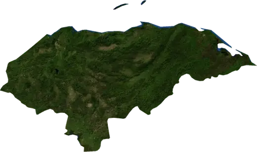
 Honduras
: earthquakes and wildfires
Latest earthquakes and active wildfires in Honduras on a live map, the strongest earthquakes and largest fires on record, and statistics by year.
Live map – Honduras
Key statistics (30 days)
Earthquakes M2.5+ and the wildfire fronts shown on the map.
Fire danger
Forecast for the area around: Tegucigalpa. Danger can vary locally; follow official guidance. Source: Copernicus EMS – EFFIS (FWI).
Severe weather (forecast)
- Today: Rain – Heavy rain (10–25 mm) · San Pedro Sula
- Tomorrow: Rain – Heavy rain (10–25 mm) · San Pedro Sula
Forecast for the area around: Honduras. It does not replace warnings from the national weather service. Source: ECMWF / Copernicus EMS.
Recent events in Honduras
- 9 h agoWildfire near Choloma, Honduras – active1,784 acres · 7 mi NNE of Choloma, Honduras
- 22 h agoWildfire near Brus Laguna, Honduras – active1,507 acres · 12 mi SSW of Brus Laguna, Honduras
- 46 h agoWildfire near Juticalpa, Honduras – active761 acres · 21 mi SE of Juticalpa, Honduras
- 4.383 days agoM4.3 earthquake near Savannah Bight, Honduras34 mi NNE of Savannah Bight, Honduras
- 4.1167 days agoM4.1 earthquake near Puerto Cortez, Honduras14 mi E of Puerto Cortez, Honduras
- 4.3168 days agoM4.3 earthquake near Barra Patuca, Honduras105 mi N of Barra Patuca, Honduras
Historical overview
Earthquakes M3.0+ and significant events of other hazards.
About Honduras
Honduras has recorded 467 earthquakes of magnitude 3.0 or more since 1976. The strongest was M7.5 in 2018.
Satellites have detected 11 significant wildfires here; the largest burned about 6,234 acres.
Know the official emergency number, prepare an emergency kit and follow the instructions of your civil protection authority.
Learn more ›Earthquakes
467 earthquakes of magnitude 3.0 or more since 1976. The strongest was M7.5.
Recent earthquakes
| Mag | Location | Time (UTC) | Depth |
|---|---|---|---|
| 4.3 | 34 mi NNE of Savannah Bight, Honduras | 6.2 mi | |
| 4.1 | 14 mi E of Puerto Cortez, Honduras | 6.2 mi | |
| 4.3 | 105 mi N of Barra Patuca, Honduras | 6.2 mi | |
| 4.4 | 5 mi SE of Sulaco, Honduras | 6.2 mi | |
| 5.0 | 36 mi W of Macuelizo, Honduras | 6.2 mi | |
| 5.2 | 23 mi NNW of San Pedro Sula, Honduras | 7.3 mi | |
| 4.3 | 39 mi NNW of Tela, Honduras | 6.2 mi |
Strongest earthquakes on record
| Mag | Location | Time (UTC) | Depth |
|---|---|---|---|
| 7.5 | 127 mi NNE of Barra Patuca, Honduras | 11.8 mi | |
| 7.3 | 29 mi NNE of French Harbor, Honduras | 6.2 mi | |
| 6.1 | 34 mi NNE of Savannah Bight, Honduras | 7.5 mi | |
| 6.1 | 23 mi N of Puerto Cortez, Honduras | 20.5 mi | |
| 6.0 | 37 mi NNE of Savannah Bight, Honduras | 20.5 mi | |
| 6.0 | 8 mi S of Amapala, Honduras | 23.9 mi | |
| 6.0 | 10 mi SSE of Amapala, Honduras | 3.7 mi | |
| 5.9 | 25 mi N of Tela, Honduras | 14.3 mi | |
| 5.9 | 130 mi NNE of Barra Patuca, Honduras | 6.2 mi | |
| 5.9 | 9 mi ESE of Amapala, Honduras | 135.3 mi | |
| 5.9 | 121 mi NNE of Barra Patuca, Honduras | 6.2 mi | |
| 5.9 | 26 mi N of Sandy Bay, Honduras | 22.4 mi | |
| 5.8 | 79 mi N of Iriona, Honduras | 4.3 mi | |
| 5.7 | 26 mi N of Savannah Bight, Honduras | 6.2 mi | |
| 5.7 | 84 mi N of Iriona, Honduras | 6.2 mi |
Earthquakes per year (M3.0+)
Year
| 2026 | 7 | M5.2 |
| 2025 | 23 | M4.9 |
| 2024 | 9 | M4.9 |
| 2023 | 18 | M5.5 |
| 2022 | 11 | M5.4 |
| 2021 | 8 | M5.2 |
| 2020 | 14 | M6.1 |
| 2019 | 12 | M5.1 |
| 2018 | 25 | M7.5 |
| 2017 | 6 | M4.6 |
| 2016 | 17 | M5.4 |
| 2015 | 8 | M4.9 |
| 2014 | 8 | M5.2 |
| 2013 | 22 | M5.4 |
| 2012 | 12 | M4.8 |
| 2011 | 9 | M5.8 |
| 2010 | 6 | M5.1 |
| 2009 | 34 | M7.3 |
| 2008 | 20 | M5.6 |
| 2007 | 6 | M5.6 |
| 2006 | 8 | M5.5 |
| 2005 | 8 | M5.9 |
| 2004 | 9 | M5.9 |
| 2003 | 4 | M4.8 |
| 2002 | 5 | M6.0 |
| 2001 | 12 | M5.5 |
| 2000 | 7 | M4.6 |
| 1999 | 22 | M6.0 |
| 1998 | 3 | M5.6 |
| 1997 | 14 | M6.1 |
| 1996 | 8 | M5.6 |
| 1995 | 5 | M5.4 |
| 1994 | 5 | M5.5 |
| 1993 | 7 | M5.9 |
| 1992 | 2 | M5.2 |
| 1991 | 7 | M5.4 |
| 1990 | 8 | M5.4 |
| 1989 | 1 | M4.9 |
| 1988 | 2 | M4.8 |
| 1987 | 1 | M4.6 |
| 1986 | 2 | M4.6 |
| 1985 | 4 | M4.7 |
| 1984 | 5 | M5.0 |
| 1982 | 15 | M6.0 |
| 1981 | 7 | M5.3 |
| 1980 | 4 | M5.3 |
| 1979 | 3 | M4.9 |
| 1978 | 2 | M4.8 |
| 1977 | 5 | M5.9 |
| 1976 | 7 | M5.3 |
Wildfires
11 major fires since 2026. The largest covered about 6,234 acres.
Recent fires
| Area | Location | Since | Status |
|---|---|---|---|
| 1,784 acres | 7 mi NNE of Choloma, Honduras | Active | |
| 1,507 acres | 12 mi SSW of Brus Laguna, Honduras | Active | |
| 761 acres | 21 mi SE of Juticalpa, Honduras | Active | |
| 4,507 acres | 29 mi NW of Teupasenti, Honduras | Inactive | |
| 3,178 acres | 35 mi NNE of Tegucigalpa, Honduras | Inactive | |
| 6,234 acres | 22 mi S of Danli, Honduras | Inactive | |
| 5,488 acres | 30 mi S of Olanchito, Honduras | Inactive | |
| 2,797 acres | 10 mi SE of Juticalpa, Honduras | Inactive | |
| 2,701 acres | 12 mi ESE of Catacamas, Honduras | Inactive | |
| 3,180 acres | 24 mi NE of Tegucigalpa, Honduras | Inactive |
Show all (14)
| Area | Location | Since | Status |
|---|---|---|---|
| 2,901 acres | 16 mi ESE of Danli, Honduras | Inactive | |
| 3,704 acres | 11 mi ENE of Teupasenti, Honduras | Inactive | |
| 3,375 acres | 12 mi S of Guajiquiro, Honduras | Inactive | |
| 2,664 acres | 25 mi WSW of Tegucigalpa, Honduras | Inactive |
Largest fires on record
| Area | Location | Since | Status |
|---|---|---|---|
| 6,234 acres | 22 mi S of Danli, Honduras | Inactive | |
| 5,488 acres | 30 mi S of Olanchito, Honduras | Inactive | |
| 4,507 acres | 29 mi NW of Teupasenti, Honduras | Inactive | |
| 3,704 acres | 11 mi ENE of Teupasenti, Honduras | Inactive | |
| 3,375 acres | 12 mi S of Guajiquiro, Honduras | Inactive | |
| 3,180 acres | 24 mi NE of Tegucigalpa, Honduras | Inactive | |
| 3,178 acres | 35 mi NNE of Tegucigalpa, Honduras | Inactive | |
| 2,901 acres | 16 mi ESE of Danli, Honduras | Inactive | |
| 2,797 acres | 10 mi SE of Juticalpa, Honduras | Inactive | |
| 2,701 acres | 12 mi ESE of Catacamas, Honduras | Inactive | |
| 2,664 acres | 25 mi WSW of Tegucigalpa, Honduras | Inactive |
Regions
- Bay Islands
- Colón Department
- Gracias a Dios Department
- Atlántida Department
- Valle Department
- Cortés Department
- Choluteca Department
- Yoro Department
- Comayagua Department
- Copán Department
- Lempira Department
- Santa Bárbara Department
- Ocotepeque Department
- El Paraíso Department
- Francisco Morazán Department
- Olancho Department
Places
- Tegucigalpa
- San Pedro Sula
- Danli
- La Ceiba
- La Ceiba
- Puerto Cortez
- Catacamas
- Choloma
- Siguatepeque
- Olanchito
- Tocoa
- El Progreso
- Santa Cruz de Yojoa
- Ciudad Choluteca
- San Pedro de Copan
- Comayagua
- Omoa
- El Negrito
- Sonaguera
- Quimistan
- La Lima
- Teupasenti
- Lepaera
- Macuelizo
- Victoria
- Saba
- Juticalpa
- Villa de San Antonio
- Villanueva
- Dulce Nombre de Culmi
- El Rosario
- Tela
- Santa Rosa de Copan
- Potrerillos
- La Iguala
- Arizona
- San Francisco de Yojoa
- Marcovia
- San Luis
- Sabanagrande
- San Antonio de Cortes
- Gualaco
- San Lorenzo
- Yamaranguila
- Santa Rita
- Iriona
- Esquias
- Langue
- Cofradia
- Azacualpa