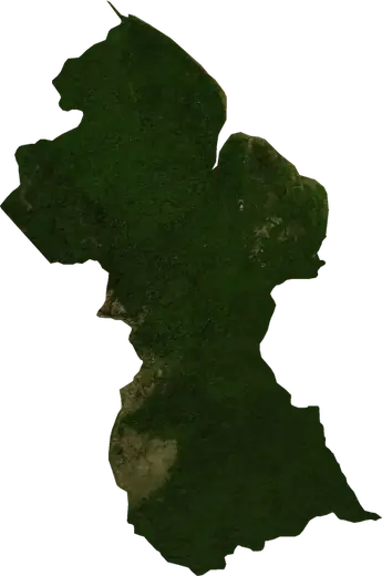
 Guyana
: earthquakes and wildfires
Latest earthquakes and active wildfires in Guyana on a live map, the strongest earthquakes and largest fires on record, and statistics by year.
Live map – Guyana
Key statistics (30 days)
Earthquakes M2.5+ and the wildfire fronts shown on the map.
Fire danger
Forecast for the area around: Georgetown. Danger can vary locally; follow official guidance. Source: Copernicus EMS – EFFIS (FWI).
Severe weather (forecast)
- Today: Rain – Very heavy rain (25–50 mm) · Georgetown
- Tomorrow: Rain – Very heavy rain (25–50 mm) · Georgetown
Forecast for the area around: Guyana. It does not replace warnings from the national weather service. Source: ECMWF / Copernicus EMS.
Recent events in Guyana
- 7 h agoWildfire near Lethem, Guyana – active880 acres · 21 mi SE of Lethem, Guyana
- 7 h agoWildfire near Georgetown, Guyana – active1,171 acres · 8 mi SW of Georgetown, Guyana
- 8 h agoWildfire near Georgetown, Guyana – active783 acres · 28 mi S of Georgetown, Guyana
- 8 h agoWildfire near Georgetown, Guyana – active1,221 acres · 24 mi SSW of Georgetown, Guyana
- 8 h agoWildfire near Linden, Guyana – active2,095 acres · 57 mi WSW of Linden, Guyana
- 8 h agoWildfire near Corriverton, Guyana – active2,288 acres · 18 mi W of Corriverton, Guyana
Historical overview
Earthquakes M3.0+ and significant events of other hazards.
About Guyana
Guyana has recorded 11 earthquakes of magnitude 3.0 or more since 1976. The strongest was M5.3 in 1976.
Satellites have detected 14 significant wildfires here; the largest burned about 77,596 acres.
Know the official emergency number, prepare an emergency kit and follow the instructions of your civil protection authority.
Learn more ›Earthquakes
11 earthquakes of magnitude 3.0 or more since 1976. The strongest was M5.3.
Recent earthquakes
| Mag | Location | Time (UTC) | Depth |
|---|---|---|---|
| 4.5 | 61 mi NNW of Mabaruma, Guyana | 6.2 mi |
Strongest earthquakes on record
| Mag | Location | Time (UTC) | Depth |
|---|---|---|---|
| 5.3 | 51 mi WNW of Mabaruma, Guyana | 20.5 mi | |
| 4.6 | 52 mi NW of Mabaruma, Guyana | 9.3 mi | |
| 4.6 | 48 mi E of Mabaruma, Guyana | 6.2 mi | |
| 4.5 | 61 mi NNW of Mabaruma, Guyana | 6.2 mi | |
| 4.1 | 137 mi NNE of Mabaruma, Guyana | 47.8 mi | |
| 4.0 | 55 mi NNE of Mabaruma, Guyana | 22.0 mi | |
| 4.0 | 135 mi NNE of Mabaruma, Guyana | 6.2 mi | |
| 3.8 | 73 mi NW of Mabaruma, Guyana | 21.8 mi | |
| 3.8 | 112 mi NNE of Mabaruma, Guyana | 20.5 mi | |
| 3.8 | 121 mi NNE of Mabaruma, Guyana | 20.5 mi | |
| 3.7 | 91 mi NNE of Mabaruma, Guyana | 20.5 mi |
Earthquakes per year (M3.0+)
Year
| 2026 | 1 | M4.5 |
| 2021 | 1 | M4.6 |
| 2013 | 1 | M4.1 |
| 2009 | 1 | M3.8 |
| 2008 | 1 | M4.6 |
| 2007 | 1 | M4.0 |
| 2006 | 1 | M4.0 |
| 1990 | 2 | M3.8 |
| 1988 | 1 | M3.7 |
| 1976 | 1 | M5.3 |
Wildfires
14 major fires since 2026. The largest covered about 77,596 acres.
Recent fires
| Area | Location | Since | Status |
|---|---|---|---|
| 880 acres | 21 mi SE of Lethem, Guyana | Active | |
| 1,171 acres | 8 mi SW of Georgetown, Guyana | Active | |
| 783 acres | 28 mi S of Georgetown, Guyana | Active | |
| 1,221 acres | 24 mi SSW of Georgetown, Guyana | Active | |
| 2,095 acres | 57 mi WSW of Linden, Guyana | Active | |
| 2,288 acres | 18 mi W of Corriverton, Guyana | Active | |
| 16,363 acres | 28 mi WNW of New Amsterdam, Guyana | Active | |
| 1,426 acres | 91 mi SSE of Lethem, Guyana | Active | |
| 77,596 acres | 12 mi NNW of Corriverton, Guyana | Active | |
| 833 acres | 19 mi SSE of Lethem, Guyana | Active |
Show all (66)
| Area | Location | Since | Status |
|---|---|---|---|
| 1,764 acres | 19 mi E of Lethem, Guyana | Active | |
| 4,238 acres | 7 mi SW of Rose Hall, Guyana | Active | |
| 1,218 acres | 27 mi NE of Linden, Guyana | Active | |
| 5,856 acres | 11 mi WSW of Rosignol, Guyana | Active | |
| 781 acres | 24 mi WNW of New Amsterdam, Guyana | Active | |
| 2,580 acres | 13 mi SSW of Georgetown, Guyana | Active | |
| 17,357 acres | 12 mi NW of Rosignol, Guyana | Active | |
| 1,122 acres | 11 mi SW of Rosignol, Guyana | Active | |
| 2,145 acres | 4 mi SW of Rosignol, Guyana | Active | |
| 2,291 acres | 21 mi SE of Georgetown, Guyana | Active | |
| 830 acres | 42 mi SSW of Linden, Guyana | Active | |
| 1,364 acres | 23 mi WSW of Skeldon, Guyana | Active | |
| 6,726 acres | 9 mi S of New Amsterdam, Guyana | Active | |
| 3,660 acres | 59 mi SW of Skeldon, Guyana | Active | |
| 825 acres | 35 mi SE of Linden, Guyana | Active | |
| 2,192 acres | 54 mi SSE of Linden, Guyana | Active | |
| 2,002 acres | 10 mi SSW of Skeldon, Guyana | Active | |
| 885 acres | 75 mi SSE of Lethem, Guyana | Active | |
| 3,190 acres | 20 mi ENE of Lethem, Guyana | Active | |
| 2,014 acres | 30 mi ENE of Lethem, Guyana | Active | |
| 1,557 acres | 19 mi WSW of Skeldon, Guyana | Active | |
| 1,903 acres | 20 mi WSW of Skeldon, Guyana | Active | |
| 986 acres | near Lethem, Guyana | Active | |
| 2,444 acres | 4 mi ENE of Linden, Guyana | Active | |
| 830 acres | 6 mi NE of Linden, Guyana | Active | |
| 1,226 acres | 31 mi SSE of Lethem, Guyana | Active | |
| 828 acres | 34 mi WSW of Skeldon, Guyana | Active | |
| 1,122 acres | 9 mi ENE of Linden, Guyana | Active | |
| 1,416 acres | 4 mi NE of New Amsterdam, Guyana | Active | |
| 2,385 acres | 22 mi NW of New Amsterdam, Guyana | Active | |
| 1,119 acres | 10 mi SSW of Georgetown, Guyana | Active | |
| 1,413 acres | 28 mi NW of Georgetown, Guyana | Active | |
| 1,559 acres | 19 mi NW of New Amsterdam, Guyana | Active | |
| 1,315 acres | 3 mi SSW of New Amsterdam, Guyana | Active | |
| 976 acres | 3 mi WSW of Skeldon, Guyana | Active | |
| 1,752 acres | 9 mi SSE of Rose Hall, Guyana | Active | |
| 825 acres | 18 mi S of Georgetown, Guyana | Active | |
| 929 acres | 61 mi SE of Lethem, Guyana | Inactive | |
| 1,520 acres | 55 mi SE of Lethem, Guyana | Inactive | |
| 1,801 acres | 23 mi SSW of New Amsterdam, Guyana | Inactive | |
| 1,750 acres | 24 mi SE of Georgetown, Guyana | Inactive | |
| 2,392 acres | 6 mi W of Georgetown, Guyana | Inactive | |
| 2,938 acres | 73 mi SSE of Linden, Guyana | Inactive | |
| 875 acres | 27 mi SE of Georgetown, Guyana | Inactive | |
| 778 acres | 11 mi WNW of Mahdia, Guyana | Inactive | |
| 979 acres | 4 mi NW of Anna Regina, Guyana | Inactive | |
| 833 acres | 73 mi SSE of Lethem, Guyana | Inactive | |
| 932 acres | 67 mi SE of Lethem, Guyana | Inactive | |
| 1,421 acres | 12 mi NNE of Lethem, Guyana | Inactive | |
| 1,604 acres | 26 mi ESE of Georgetown, Guyana | Inactive | |
| 2,649 acres | 91 mi SSE of Lethem, Guyana | Inactive | |
| 1,023 acres | 21 mi S of Georgetown, Guyana | Inactive | |
| 1,072 acres | 120 mi NE of Paradise, Guyana | Inactive | |
| 4,500 acres | 41 mi SSW of Mahdia, Guyana | Inactive | |
| 3,366 acres | 35 mi SE of Linden, Guyana | Inactive | |
| 2,535 acres | 33 mi SE of Linden, Guyana | Inactive |
Largest fires on record
| Area | Location | Since | Status |
|---|---|---|---|
| 77,596 acres | 12 mi NNW of Corriverton, Guyana | Active | |
| 17,357 acres | 12 mi NW of Rosignol, Guyana | Active | |
| 16,363 acres | 28 mi WNW of New Amsterdam, Guyana | Active | |
| 6,726 acres | 9 mi S of New Amsterdam, Guyana | Active | |
| 5,856 acres | 11 mi WSW of Rosignol, Guyana | Active | |
| 4,500 acres | 41 mi SSW of Mahdia, Guyana | Inactive | |
| 4,238 acres | 7 mi SW of Rose Hall, Guyana | Active | |
| 3,660 acres | 59 mi SW of Skeldon, Guyana | Active | |
| 3,366 acres | 35 mi SE of Linden, Guyana | Inactive | |
| 3,190 acres | 20 mi ENE of Lethem, Guyana | Active | |
| 2,938 acres | 73 mi SSE of Linden, Guyana | Inactive | |
| 2,649 acres | 91 mi SSE of Lethem, Guyana | Inactive | |
| 2,580 acres | 13 mi SSW of Georgetown, Guyana | Active | |
| 2,535 acres | 33 mi SE of Linden, Guyana | Inactive |