 Guinea
: earthquakes and wildfires
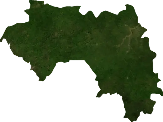
Latest earthquakes and active wildfires in Guinea on a live map, the strongest earthquakes and largest fires on record, and statistics by year.
Live map – Guinea
Key statistics (30 days)
Earthquakes M2.5+ and the wildfire fronts shown on the map.
Fire danger
Forecast for the area around: Siguiri. Danger can vary locally; follow official guidance. Source: Copernicus EMS – EFFIS (FWI).
Severe weather (forecast)
- Today: Rain – Heavy rain (10–25 mm) · Conakry
- Tomorrow: Rain – Heavy rain (10–25 mm) · Conakry
Forecast for the area around: Guinea. It does not replace warnings from the national weather service. Source: ECMWF / Copernicus EMS.
Recent events in Guinea
- 11 h agoWildfire near Tougue, Guinea – active3,408 acres · 15 mi WSW of Tougue, Guinea
- 11 h agoWildfire near Tougue, Guinea – active1,490 acres · 20 mi E of Tougue, Guinea
- 11 h agoWildfire near Dogomet, Guinea – active9,603 acres · 11 mi WSW of Dogomet, Guinea
- 22 h agoWildfire near Kamabi, Guinea – active764 acres · 17 mi SSW of Kamabi, Guinea
- 22 h agoWildfire near Sangaredi, Guinea – active5,758 acres · 8 mi NW of Sangaredi, Guinea
- 23 h agoWildfire near Labe, Guinea – active1,337 acres · 11 mi WNW of Labe, Guinea
Historical overview
Earthquakes M3.0+ and significant events of other hazards.
About Guinea
Guinea has recorded 11 earthquakes of magnitude 3.0 or more since 1983. The strongest was M6.2 in 1983.
Satellites have detected 404 significant wildfires here; the largest burned about 40,115 acres.
Know the official emergency number, prepare an emergency kit and follow the instructions of your civil protection authority.
Learn more ›Earthquakes
11 earthquakes of magnitude 3.0 or more since 1983. The strongest was M6.2.
Recent earthquakes
| Mag | Location | Time (UTC) | Depth |
|---|---|---|---|
| 4.7 | 11 mi NW of Mamou, Guinea | 6.2 mi |
Strongest earthquakes on record
| Mag | Location | Time (UTC) | Depth |
|---|---|---|---|
| 6.2 | 5 mi NNW of Koumbia, Guinea | 6.8 mi | |
| 5.0 | 26 mi NNW of Kindia, Guinea | 6.2 mi | |
| 4.8 | 20 mi ENE of Kerouane, Guinea | 6.2 mi | |
| 4.7 | 11 mi NW of Mamou, Guinea | 6.2 mi | |
| 4.6 | 40 mi NE of Labe, Guinea | 8.5 mi | |
| 4.4 | 28 mi NNW of Kindia, Guinea | 6.2 mi | |
| 4.4 | 33 mi SSW of Gueckedou, Guinea | 6.2 mi | |
| 4.3 | 41 mi ESE of Kamsar, Guinea | 6.2 mi | |
| 4.2 | 17 mi SW of Pita, Guinea | 6.2 mi | |
| 4.2 | 10 mi WNW of Gaoual, Guinea | 6.2 mi | |
| 4.2 | 25 mi S of Koumbia, Guinea | 6.2 mi |
Earthquakes per year (M3.0+)
Year
| 2026 | 1 | M4.7 |
| 2021 | 3 | M5.0 |
| 2018 | 1 | M4.6 |
| 2012 | 2 | M4.8 |
| 2004 | 1 | M4.3 |
| 2001 | 1 | M4.4 |
| 1987 | 1 | M4.2 |
| 1983 | 1 | M6.2 |
Wildfires
404 major fires since 2025. The largest covered about 40,115 acres.
Recent fires
| Area | Location | Since | Status |
|---|---|---|---|
| 3,408 acres | 15 mi WSW of Tougue, Guinea | Active | |
| 1,490 acres | 20 mi E of Tougue, Guinea | Active | |
| 9,603 acres | 11 mi WSW of Dogomet, Guinea | Active | |
| 764 acres | 17 mi SSW of Kamabi, Guinea | Active | |
| 5,758 acres | 8 mi NW of Sangaredi, Guinea | Active | |
| 1,337 acres | 11 mi WNW of Labe, Guinea | Active | |
| 857 acres | 21 mi NNE of Siguiri, Guinea | Active | |
| 1,152 acres | 19 mi WNW of Koumbia, Guinea | Active | |
| 1,626 acres | 8 mi WNW of Siguiri, Guinea | Active | |
| 1,260 acres | 14 mi W of Kankan, Guinea | Active |
Show all (200)
| Area | Location | Since | Status |
|---|---|---|---|
| 1,055 acres | 20 mi E of Wendou Borou, Guinea | Active | |
| 3,820 acres | 14 mi WNW of Nyagassola, Guinea | Active | |
| 3,536 acres | 26 mi NE of Kintinian, Guinea | Active | |
| 2,009 acres | 29 mi N of Kintinian, Guinea | Active | |
| 3,210 acres | 19 mi NNE of Gaoual, Guinea | Active | |
| 1,396 acres | 8 mi WSW of Timbo, Guinea | Active | |
| 6,781 acres | 25 mi WSW of Kankan, Guinea | Active | |
| 2,540 acres | 13 mi ESE of Mali, Guinea | Active | |
| 1,628 acres | 19 mi NW of Mali, Guinea | Active | |
| 1,006 acres | 10 mi SSE of Donghol-Sigon, Guinea | Active | |
| 2,004 acres | 8 mi N of Siguiri, Guinea | Active | |
| 1,332 acres | 8 mi NNW of Siguiri, Guinea | Active | |
| 1,236 acres | 12 mi N of Siguiri, Guinea | Active | |
| 11,609 acres | 8 mi SSE of Tougue, Guinea | Active | |
| 21,955 acres | 47 mi ENE of Kissidougou, Guinea | Active | |
| 1,725 acres | 31 mi WNW of Kintinian, Guinea | Active | |
| 5,251 acres | 35 mi E of Kankan, Guinea | Active | |
| 3,929 acres | 5 mi NE of Kintinian, Guinea | Active | |
| 2,866 acres | 16 mi E of Mandiana, Guinea | Active | |
| 12,946 acres | 22 mi ENE of Tougue, Guinea | Active | |
| 21,083 acres | 33 mi NE of Tougue, Guinea | Active | |
| 3,363 acres | 11 mi N of Selouma, Guinea | Active | |
| 1,441 acres | 17 mi SSE of Tougue, Guinea | Active | |
| 2,061 acres | 12 mi NW of Arfa Moussaia, Guinea | Active | |
| 9,249 acres | 59 mi NE of Labe, Guinea | Active | |
| 4,230 acres | 7 mi NNW of Timbo, Guinea | Active | |
| 7,295 acres | 15 mi S of Koumbia, Guinea | Active | |
| 2,691 acres | 39 mi NW of Dinguiraye, Guinea | Active | |
| 1,344 acres | 33 mi NE of Labe, Guinea | Active | |
| 1,633 acres | 65 mi WSW of Siguiri, Guinea | Active | |
| 2,160 acres | 20 mi SSE of Tougue, Guinea | Active | |
| 914 acres | 27 mi NE of Banko, Guinea | Active | |
| 2,128 acres | 38 mi N of Conakry, Guinea | Active | |
| 1,248 acres | 69 mi NE of Labe, Guinea | Active | |
| 1,245 acres | 8 mi E of Donghol-Sigon, Guinea | Active | |
| 9,135 acres | 49 mi NNW of Kintinian, Guinea | Active | |
| 2,713 acres | 19 mi SE of Kindia, Guinea | Active | |
| 3,642 acres | 74 mi NE of Labe, Guinea | Active | |
| 2,827 acres | 22 mi N of Kintinian, Guinea | Active | |
| 3,983 acres | 11 mi W of Dogomet, Guinea | Active | |
| 860 acres | 46 mi NW of Kintinian, Guinea | Active | |
| 4,880 acres | 44 mi NNW of Kintinian, Guinea | Active | |
| 1,021 acres | 56 mi N of Nzerekore, Guinea | Active | |
| 872 acres | 7 mi NNW of Macenta, Guinea | Active | |
| 6,061 acres | 25 mi E of Macenta, Guinea | Active | |
| 2,770 acres | 29 mi N of Nzerekore, Guinea | Active | |
| 2,394 acres | 71 mi NNE of Labe, Guinea | Active | |
| 1,964 acres | 21 mi NW of Koumbia, Guinea | Active | |
| 10,986 acres | 69 mi NW of Kintinian, Guinea | Active | |
| 7,277 acres | 42 mi NNW of Kintinian, Guinea | Active | |
| 9,998 acres | 20 mi E of Sangaredi, Guinea | Active | |
| 815 acres | 17 mi N of Tondon, Guinea | Active | |
| 3,971 acres | 40 mi W of Kintinian, Guinea | Active | |
| 1,574 acres | 4 mi WSW of Tougue, Guinea | Active | |
| 30,876 acres | 13 mi WSW of Telimele, Guinea | Active | |
| 3,116 acres | 19 mi NNW of Selouma, Guinea | Active | |
| 10,015 acres | 35 mi ENE of Tougue, Guinea | Active | |
| 6,254 acres | 51 mi NNW of Kintinian, Guinea | Active | |
| 1,480 acres | 23 mi NNW of Boke, Guinea | Active | |
| 3,450 acres | 14 mi NNE of Siguirini, Guinea | Active | |
| 1,964 acres | 12 mi W of Wendou Borou, Guinea | Active | |
| 1,964 acres | 19 mi W of Wendou Borou, Guinea | Active | |
| 1,915 acres | 8 mi E of Selouma, Guinea | Active | |
| 9,022 acres | 13 mi NE of Wendou Borou, Guinea | Active | |
| 4,643 acres | 9 mi WNW of Siguirini, Guinea | Active | |
| 4,018 acres | 30 mi SSE of Kindia, Guinea | Active | |
| 1,055 acres | 15 mi ESE of Kouroussa, Guinea | Active | |
| 1,055 acres | 37 mi NW of Kindia, Guinea | Active | |
| 1,626 acres | 9 mi ESE of Mandiana, Guinea | Active | |
| 6,373 acres | 70 mi NE of Labe, Guinea | Active | |
| 4,804 acres | 21 mi NNE of Timbo, Guinea | Active | |
| 1,003 acres | 18 mi NE of Mandiana, Guinea | Active | |
| 2,347 acres | 16 mi ESE of Timbo, Guinea | Active | |
| 815 acres | 18 mi SE of Timbo, Guinea | Active | |
| 13,571 acres | 37 mi NNW of Kindia, Guinea | Active | |
| 9,017 acres | 29 mi WSW of Siguiri, Guinea | Active | |
| 1,636 acres | 7 mi NNE of Bissikrima, Guinea | Active | |
| 2,214 acres | 23 mi NW of Fria, Guinea | Active | |
| 1,868 acres | 24 mi NNE of Gaoual, Guinea | Active | |
| 3,114 acres | 10 mi ENE of Siguiri, Guinea | Active | |
| 1,384 acres | 25 mi SE of Dinguiraye, Guinea | Active | |
| 2,565 acres | 15 mi E of Mamou, Guinea | Active | |
| 3,067 acres | 24 mi NNW of Arfa Moussaia, Guinea | Active | |
| 2,231 acres | 19 mi SSW of Kolente, Guinea | Active | |
| 21,291 acres | 13 mi SSW of Mamou, Guinea | Active | |
| 961 acres | 16 mi ESE of Pita, Guinea | Active | |
| 2,323 acres | 5 mi SSE of Kolente, Guinea | Active | |
| 5,078 acres | 15 mi NW of Kolente, Guinea | Active | |
| 2,659 acres | 7 mi W of Fria, Guinea | Active | |
| 2,212 acres | 8 mi NW of Fria, Guinea | Active | |
| 1,490 acres | 7 mi WSW of Pita, Guinea | Active | |
| 3,366 acres | 32 mi ESE of Dinguiraye, Guinea | Active | |
| 7,159 acres | 16 mi NNW of Kimbo, Guinea | Active | |
| 21,629 acres | 21 mi W of Telimele, Guinea | Active | |
| 2,928 acres | 24 mi SE of Telimele, Guinea | Active | |
| 1,581 acres | 13 mi W of Selouma, Guinea | Active | |
| 959 acres | 26 mi SW of Siguiri, Guinea | Active | |
| 7,566 acres | 21 mi SE of Kamabi, Guinea | Active | |
| 2,686 acres | 19 mi SSE of Tougue, Guinea | Active | |
| 1,727 acres | 32 mi ENE of Siguiri, Guinea | Active | |
| 3,452 acres | 18 mi ENE of Dinguiraye, Guinea | Active | |
| 4,542 acres | 13 mi ENE of Kintinian, Guinea | Active | |
| 3,833 acres | 25 mi NNW of Selouma, Guinea | Active | |
| 857 acres | 35 mi NNE of Siguiri, Guinea | Active | |
| 6,049 acres | 6 mi ESE of Wendou Borou, Guinea | Active | |
| 2,923 acres | 15 mi NE of Kintinian, Guinea | Active | |
| 2,157 acres | 27 mi NNE of Tougue, Guinea | Active | |
| 2,350 acres | 24 mi E of Labe, Guinea | Active | |
| 3,158 acres | 44 mi N of Kintinian, Guinea | Active | |
| 1,058 acres | near Gaoual, Guinea | Active | |
| 1,910 acres | 15 mi NNE of Kintinian, Guinea | Active | |
| 3,729 acres | 48 mi N of Kintinian, Guinea | Active | |
| 40,115 acres | near Tondon, Guinea | Active | |
| 9,573 acres | 25 mi NNE of Kintinian, Guinea | Active | |
| 5,355 acres | 63 mi NW of Kintinian, Guinea | Active | |
| 1,651 acres | 6 mi N of Forecariah, Guinea | Active | |
| 1,404 acres | 56 mi ENE of Conakry, Guinea | Active | |
| 3,830 acres | 28 mi NNE of Gaoual, Guinea | Active | |
| 1,408 acres | 27 mi SE of Kindia, Guinea | Active | |
| 2,061 acres | 14 mi E of Gaoual, Guinea | Active | |
| 4,221 acres | 11 mi ESE of Kindia, Guinea | Active | |
| 1,154 acres | 8 mi SSW of Arfa Moussaia, Guinea | Active | |
| 1,922 acres | 23 mi S of Telimele, Guinea | Active | |
| 5,024 acres | 48 mi E of Kankan, Guinea | Active | |
| 1,201 acres | 28 mi SE of Dinguiraye, Guinea | Active | |
| 9,266 acres | 4 mi W of Nyagassola, Guinea | Active | |
| 11,354 acres | 22 mi NNW of Kimbo, Guinea | Active | |
| 865 acres | 11 mi S of Sangaredi, Guinea | Active | |
| 3,405 acres | 23 mi NE of Tougue, Guinea | Active | |
| 1,011 acres | 19 mi E of Pita, Guinea | Active | |
| 2,009 acres | 30 mi W of Kintinian, Guinea | Active | |
| 1,196 acres | 57 mi NNE of Kamsar, Guinea | Active | |
| 12,528 acres | 40 mi WNW of Labe, Guinea | Active | |
| 1,055 acres | 33 mi NE of Kintinian, Guinea | Active | |
| 5,938 acres | 37 mi NNW of Kintinian, Guinea | Active | |
| 2,735 acres | 39 mi WNW of Labe, Guinea | Active | |
| 3,546 acres | 31 mi NNE of Tougue, Guinea | Active | |
| 1,725 acres | 45 mi NNE of Kintinian, Guinea | Active | |
| 5,884 acres | 21 mi NW of Kolente, Guinea | Active | |
| 1,436 acres | 48 mi NNE of Kintinian, Guinea | Active | |
| 5,844 acres | 63 mi NE of Labe, Guinea | Active | |
| 3,064 acres | 45 mi NNE of Kindia, Guinea | Active | |
| 2,535 acres | 70 mi NNW of Siguiri, Guinea | Active | |
| 1,006 acres | 15 mi NW of Wendou Borou, Guinea | Active | |
| 2,209 acres | 11 mi ENE of Dalaba, Guinea | Active | |
| 1,488 acres | 17 mi WNW of Donghol-Sigon, Guinea | Active | |
| 7,364 acres | 18 mi SSE of Kindia, Guinea | Active | |
| 4,791 acres | 32 mi NNW of Dinguiraye, Guinea | Active | |
| 1,816 acres | 48 mi N of Kintinian, Guinea | Active | |
| 17,680 acres | 43 mi NNE of Tougue, Guinea | Active | |
| 3,368 acres | 14 mi NW of Kolente, Guinea | Active | |
| 2,921 acres | 22 mi W of Mali, Guinea | Active | |
| 1,680 acres | 8 mi ENE of Bissikrima, Guinea | Active | |
| 1,149 acres | 16 mi N of Banko, Guinea | Active | |
| 2,780 acres | 34 mi ESE of Dinguiraye, Guinea | Active | |
| 1,107 acres | 18 mi WSW of Selouma, Guinea | Active | |
| 11,058 acres | 26 mi WSW of Telimele, Guinea | Active | |
| 1,876 acres | 33 mi E of Dinguiraye, Guinea | Active | |
| 1,436 acres | 16 mi N of Mali, Guinea | Active | |
| 2,592 acres | 22 mi E of Pita, Guinea | Active | |
| 1,055 acres | 28 mi N of Timbo, Guinea | Active | |
| 1,436 acres | 16 mi SE of Tougue, Guinea | Active | |
| 1,050 acres | 33 mi W of Kintinian, Guinea | Active | |
| 1,344 acres | 22 mi N of Dinguiraye, Guinea | Active | |
| 11,530 acres | 10 mi N of Sangaredi, Guinea | Active | |
| 4,166 acres | 21 mi E of Dinguiraye, Guinea | Active | |
| 5,938 acres | 6 mi NNW of Siguirini, Guinea | Active | |
| 8,757 acres | 11 mi NW of Fidako, Guinea | Active | |
| 34,459 acres | 26 mi SE of Sangaredi, Guinea | Active | |
| 4,080 acres | 11 mi ENE of Pita, Guinea | Active | |
| 7,193 acres | 16 mi N of Kouroussa, Guinea | Active | |
| 1,579 acres | 10 mi W of Pita, Guinea | Active | |
| 3,126 acres | 14 mi NNW of Kolente, Guinea | Active | |
| 966 acres | 12 mi WSW of Fria, Guinea | Active | |
| 764 acres | 25 mi WSW of Tomba-kanssa, Guinea | Active | |
| 2,397 acres | 42 mi NW of Kintinian, Guinea | Active | |
| 813 acres | 18 mi WSW of Donghol-Sigon, Guinea | Active | |
| 3,445 acres | 26 mi WNW of Selouma, Guinea | Active | |
| 3,244 acres | 23 mi SSE of Mamou, Guinea | Active | |
| 1,537 acres | 21 mi NW of Kolente, Guinea | Active | |
| 1,008 acres | 19 mi NW of Fria, Guinea | Active | |
| 2,614 acres | 43 mi NNE of Conakry, Guinea | Active | |
| 2,585 acres | 12 mi NE of Siguirini, Guinea | Active | |
| 1,152 acres | 13 mi NW of Kimbo, Guinea | Active | |
| 4,127 acres | 21 mi SE of Telimele, Guinea | Active | |
| 1,053 acres | 17 mi SW of Kintinian, Guinea | Active | |
| 1,915 acres | 8 mi SSW of Tougue, Guinea | Active | |
| 3,694 acres | 25 mi NW of Dinguiraye, Guinea | Active | |
| 3,366 acres | 27 mi ENE of Sangaredi, Guinea | Active | |
| 1,527 acres | 20 mi WNW of Tomba-kanssa, Guinea | Active |
Largest fires on record
| Area | Location | Since | Status |
|---|---|---|---|
| 40,115 acres | near Tondon, Guinea | Active | |
| 34,459 acres | 26 mi SE of Sangaredi, Guinea | Active | |
| 30,876 acres | 13 mi WSW of Telimele, Guinea | Active | |
| 21,955 acres | 47 mi ENE of Kissidougou, Guinea | Active | |
| 21,629 acres | 21 mi W of Telimele, Guinea | Active | |
| 21,291 acres | 13 mi SSW of Mamou, Guinea | Active | |
| 21,083 acres | 33 mi NE of Tougue, Guinea | Active | |
| 17,680 acres | 43 mi NNE of Tougue, Guinea | Active | |
| 16,101 acres | 22 mi ENE of Kissidougou, Guinea | Inactive | |
| 13,571 acres | 37 mi NNW of Kindia, Guinea | Active | |
| 13,316 acres | 24 mi NW of Telimele, Guinea | Inactive | |
| 13,186 acres | 48 mi NNE of Nzerekore, Guinea | Inactive | |
| 12,946 acres | 22 mi ENE of Tougue, Guinea | Active | |
| 12,528 acres | 40 mi WNW of Labe, Guinea | Active | |
| 11,762 acres | 25 mi SW of Dogomet, Guinea | Inactive |
Major fires per year
Year
| 2026 | 310 | 34,459 acres |
| 2025 | 94 | 40,115 acres |
Regions
Places
- Maneah
- Dubreka
- Kindia
- Kamsar
- Labe
- Pita
- Koundara
- Kerouane
- Douako
- Telimele
- Dinguiraye
- Kissidougou
- Sangaredi
- Kankan
- Tougue
- Kouroussa
- Wendou Borou
- Koumbia
- Kolente
- Kintinian
- Bissikrima
- Yende Millimou
- Donghol-Sigon
- Fria
- Banko
- Mamou
- Faranah
- Dabola
- Macenta
- Dogomet
- Gueckedou
- Boke
- Nzerekore
- Siguiri
- Forecariah
- Coyah
- Kolaboui
- Lola
- Dixinn
- Conakry
- Camayenne