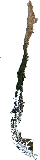
 Collipulli
: earthquakes and wildfires
Was there an earthquake or a fire near Collipulli just now? Live map within 62 mi, the strongest earthquakes, the largest fires and statistics for Collipulli, Chile.
Live map – Collipulli
Earthquakes within 62 mi of the city center.
Key statistics (30 days)
Earthquakes M2.5+ and the wildfire fronts shown on the map.
Recent events in Collipulli
- 7 days agoWildfire near Los Angeles, Chile11,107 acres · 21 mi NW of Los Angeles, Chile
- 7 days agoWildfire near Mulchen, Chile778 acres · 14 mi SE of Mulchen, Chile
- 7 days agoWildfire near Temuco, Chile16,467 acres · 23 mi NNE of Temuco, Chile
- 2.57 days agoM2.5 earthquake near Temuco, Chile27 mi NW of Temuco, Chile
- 4.375 days agoM4.3 earthquake near Lautaro, Chile7 mi SW of Lautaro, Chile
- 4.2194 days agoM4.2 earthquake near Canete, Chile8 mi NE of Canete, Chile
Historical overview
Earthquakes M3.0+ and significant events of other hazards.
About Collipulli
Collipulli has recorded 318 earthquakes of magnitude 3.0 or more since 1976. The strongest was M7.2 in 2011.
Satellites have detected 7 significant wildfires here; the largest burned about 16,467 acres.
Know the official emergency number, prepare an emergency kit and follow the instructions of your civil protection authority.
Learn more ›Did you feel an earthquake in Collipulli?
No reports yet.
Earthquakes
318 earthquakes of magnitude 3.0 or more since 1976 within 62 mi. The strongest was M7.2.
Recent earthquakes
| Mag | Location | Time (UTC) | Depth |
|---|---|---|---|
| 2.5 | 27 mi NW of Temuco, Chile | 28.3 mi | |
| 4.3 | 7 mi SW of Lautaro, Chile | 40.1 mi | |
| 4.2 | 8 mi NE of Canete, Chile | 17.5 mi | |
| 5.5 | 12 mi ENE of Canete, Chile | 21.7 mi | |
| 4.2 | near Canete, Chile | 21.7 mi |
Strongest earthquakes on record
| Mag | Location | Time (UTC) | Depth |
|---|---|---|---|
| 7.2 | 26 mi NNW of Carahue, Chile | 14.9 mi | |
| 6.6 | 6 mi SW of Contulmo, Chile | 13.7 mi | |
| 6.6 | 5 mi SSE of Los Alamos, Chile | 13.0 mi | |
| 6.3 | 13 mi WSW of Contulmo, Chile | 11.8 mi | |
| 6.0 | 16 mi W of Nacimiento, Chile | 19.9 mi | |
| 6.0 | 10 mi WSW of Canete, Chile | 12.4 mi | |
| 5.9 | 16 mi ENE of Villa Mercedes, Chile | 50.4 mi | |
| 5.9 | 4 mi NE of Curanilahue, Chile | 11.2 mi | |
| 5.9 | 4 mi WNW of Contulmo, Chile | 16.7 mi | |
| 5.9 | 9 mi NW of Angol, Chile | 28.1 mi | |
| 5.9 | 10 mi WNW of Angol, Chile | 19.8 mi | |
| 5.8 | near Los Alamos, Chile | 18.0 mi | |
| 5.8 | 10 mi WNW of Los Laureles, Chile | 21.7 mi | |
| 5.7 | 5 mi NW of Contulmo, Chile | 16.2 mi | |
| 5.6 | 9 mi W of Contulmo, Chile | 21.7 mi |
Earthquakes per year (M3.0+)
Year
| 2026 | 4 | M5.5 |
| 2025 | 3 | M4.4 |
| 2024 | 2 | M4.0 |
| 2023 | 1 | M4.8 |
| 2022 | 1 | M4.5 |
| 2021 | 4 | M4.4 |
| 2020 | 1 | M3.8 |
| 2019 | 2 | M4.3 |
| 2018 | 8 | M4.5 |
| 2017 | 3 | M5.9 |
| 2016 | 6 | M4.9 |
| 2015 | 2 | M4.1 |
| 2014 | 5 | M5.0 |
| 2013 | 4 | M4.5 |
| 2012 | 4 | M4.7 |
| 2011 | 12 | M7.2 |
| 2010 | 131 | M6.6 |
| 2009 | 4 | M4.8 |
| 2008 | 4 | M4.1 |
| 2007 | 4 | M4.6 |
| 2006 | 7 | M4.4 |
| 2005 | 2 | M4.4 |
| 2004 | 10 | M6.6 |
| 2003 | 8 | M4.0 |
| 2002 | 10 | M4.5 |
| 2001 | 3 | M4.2 |
| 2000 | 3 | M4.3 |
| 1999 | 13 | M5.4 |
| 1998 | 5 | M4.8 |
| 1997 | 2 | M4.4 |
| 1995 | 4 | M5.1 |
| 1994 | 2 | M4.6 |
| 1992 | 1 | M4.4 |
| 1991 | 2 | M5.1 |
| 1990 | 3 | M5.7 |
| 1989 | 1 | M4.5 |
| 1988 | 6 | M4.8 |
| 1987 | 4 | M5.9 |
| 1986 | 1 | M4.0 |
| 1985 | 5 | M4.7 |
| 1984 | 2 | M4.5 |
| 1983 | 1 | M5.4 |
| 1982 | 2 | M5.0 |
| 1981 | 3 | M5.1 |
| 1980 | 4 | M5.2 |
| 1978 | 3 | M4.8 |
| 1977 | 2 | M4.8 |
| 1976 | 4 | M5.1 |
Wildfires
7 major fires since 2025 within 62 mi. The largest covered about 16,467 acres.
Recent fires
| Area | Location | Since | Status |
|---|---|---|---|
| 11,107 acres | 21 mi NW of Los Angeles, Chile | Inactive | |
| 778 acres | 14 mi SE of Mulchen, Chile | Inactive | |
| 16,467 acres | 23 mi NNE of Temuco, Chile | Inactive | |
| 3,039 acres | near Tucapel, Chile | Inactive | |
| 3,563 acres | 4 mi W of Lautaro, Chile | Inactive | |
| 2,765 acres | 25 mi N of Temuco, Chile | Inactive | |
| 3,830 acres | 9 mi SSE of Mulchen, Chile | Inactive | |
| 5,755 acres | 8 mi WSW of Collipulli, Chile | Inactive |
Largest fires on record
| Area | Location | Since | Status |
|---|---|---|---|
| 16,467 acres | 23 mi NNE of Temuco, Chile | Inactive | |
| 11,107 acres | 21 mi NW of Los Angeles, Chile | Inactive | |
| 5,755 acres | 8 mi WSW of Collipulli, Chile | Inactive | |
| 3,830 acres | 9 mi SSE of Mulchen, Chile | Inactive | |
| 3,563 acres | 4 mi W of Lautaro, Chile | Inactive | |
| 3,039 acres | near Tucapel, Chile | Inactive | |
| 2,765 acres | 25 mi N of Temuco, Chile | Inactive |
Major fires per year
Year
| 2026 | 6 | 16,467 acres |
| 2025 | 1 | 11,107 acres |
Nearby places
- Angol 19 mi
- Mulchen 19 mi
- Victoria 20 mi
- Los Angeles 34 mi
- Nacimiento 34 mi
- Lautaro 40 mi
- Villa Mercedes 45 mi
- Vilcun 51 mi
- Canete 53 mi
- Canete 54 mi
- Temuco 55 mi
- Padre Las Casas 56 mi
- Labranza 59 mi
- Curanilahue 60 mi