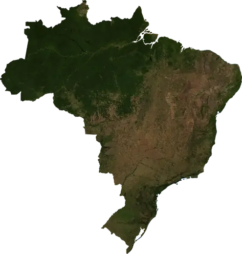
 Oeiras do Para
Wildfires near Oeiras do Para
Is there a fire near Oeiras do Para right now? Active wildfires within 62 mi of Oeiras do Para, Brazil, from NASA satellites, and the largest fires on record.
Live map – Oeiras do Para
Loading live map…
Latest event2,691 acres7 h ago40 mi SSE of Portel, Brazil
Low
Moderate
High
Very high
Extreme
Very extreme
Forecast: Copernicus EFFIS (FWI index)
Very light rain (0.1–1 mm)
Light rain (1–5 mm)
Moderate rain (5–10 mm)
Heavy rain (10–25 mm)
Very heavy rain (25–50 mm)
Extreme rain (≥ 50 mm)
Forecast: ECMWF via Copernicus EMS – GWIS
Calm (< 7 km/h, 0–1 Bf)
Light breeze (7–18 km/h, 2–3 Bf)
Moderate breeze (18–36 km/h, 4–5 Bf)
Strong breeze (36–54 km/h, 5–7 Bf)
Gale (54–72 km/h, 7–8 Bf)
Storm (≥ 72 km/h, 9+ Bf)
Forecast: ECMWF via Copernicus EMS – GWIS
Very low lightning
Low lightning
Moderate lightning
High lightning
Very high lightning
Extreme lightning
Forecast: ECMWF via Copernicus EMS – GWIS
Earthquakes
Wildfires
Floods
Storms
Volcanoes
Tsunamis
Earthquakes within 62 mi of the city center.
Key statistics (30 days)
Earthquakes M2.5+ and the wildfire fronts shown on the map.
Recent events in Oeiras do Para
- 7 h agoWildfire near Portel, Brazil – active2,691 acres · 40 mi SSE of Portel, Brazil
- 7 h agoWildfire near Portel, Brazil – active3,242 acres · 6 mi ESE of Portel, Brazil
- 7 h agoWildfire near Bagre, Brazil – active4,910 acres · 34 mi SSW of Bagre, Brazil
- 7 h agoWildfire near Bagre, Brazil – active786 acres · 30 mi SSW of Bagre, Brazil
- 7 h agoWildfire near Mocajuba, Brazil – active2,011 acres · 19 mi ESE of Mocajuba, Brazil
- 7 h agoWildfire near Bagre, Brazil – active1,127 acres · 18 mi SW of Bagre, Brazil
Historical overview
Earthquakes M3.0+ and significant events of other hazards.
About Oeiras do Para
Satellites have detected 20 significant wildfires here; the largest burned about 11,866 acres.
Know the official emergency number, prepare an emergency kit and follow the instructions of your civil protection authority.
Learn more ›Wildfires
20 major fires since 2026 within 62 mi. The largest covered about 11,866 acres.
Recent fires
| Area | Location | Since | Status |
|---|---|---|---|
| 2,691 acres | 40 mi SSE of Portel, Brazil | Active | |
| 3,242 acres | 6 mi ESE of Portel, Brazil | Active | |
| 4,910 acres | 34 mi SSW of Bagre, Brazil | Active | |
| 786 acres | 30 mi SSW of Bagre, Brazil | Active | |
| 2,011 acres | 19 mi ESE of Mocajuba, Brazil | Active | |
| 1,127 acres | 18 mi SW of Bagre, Brazil | Active | |
| 885 acres | 16 mi NW of Mocajuba, Brazil | Active | |
| 2,063 acres | 13 mi SSE of Bagre, Brazil | Active | |
| 11,866 acres | 18 mi ESE of Portel, Brazil | Active | |
| 6,188 acres | 12 mi SE of Portel, Brazil | Active |
Show all (38)
| Area | Location | Since | Status |
|---|---|---|---|
| 1,819 acres | 22 mi SE of Portel, Brazil | Active | |
| 7,215 acres | 13 mi SSE of Melgaco, Brazil | Active | |
| 4,122 acres | 40 mi S of Bagre, Brazil | Active | |
| 1,077 acres | 41 mi SSW of Bagre, Brazil | Active | |
| 783 acres | 19 mi SE of Portel, Brazil | Active | |
| 1,275 acres | 30 mi SW of Bagre, Brazil | Active | |
| 983 acres | 5 mi SSE of Bagre, Brazil | Inactive | |
| 4,408 acres | 27 mi NW of Baiao, Brazil | Inactive | |
| 983 acres | 20 mi WSW of Cameta, Brazil | Inactive | |
| 2,209 acres | 19 mi WNW of Mocajuba, Brazil | Inactive | |
| 981 acres | 11 mi W of Sao Sebastiao da Boa Vista, Brazil | Inactive | |
| 887 acres | 10 mi WNW of Baiao, Brazil | Inactive | |
| 783 acres | 15 mi NW of Cameta, Brazil | Inactive | |
| 4,416 acres | 18 mi WNW of Muana, Brazil | Inactive | |
| 979 acres | 23 mi N of Sao Sebastiao da Boa Vista, Brazil | Inactive | |
| 2,889 acres | 21 mi NNW of Sao Sebastiao da Boa Vista, Brazil | Inactive | |
| 3,039 acres | 13 mi NNW of Mocajuba, Brazil | Inactive | |
| 4,314 acres | 7 mi SE of Melgaco, Brazil | Inactive | |
| 3,875 acres | 21 mi N of Sao Sebastiao da Boa Vista, Brazil | Inactive | |
| 1,663 acres | 16 mi ESE of Mocajuba, Brazil | Inactive | |
| 1,223 acres | 15 mi WNW of Curralinho, Brazil | Inactive | |
| 11,228 acres | 9 mi NNW of Curralinho, Brazil | Inactive | |
| 2,693 acres | 31 mi SSW of Bagre, Brazil | Inactive | |
| 4,263 acres | 16 mi SW of Cameta, Brazil | Inactive | |
| 2,597 acres | 15 mi NW of Muana, Brazil | Inactive | |
| 4,552 acres | 12 mi S of Mocajuba, Brazil | Inactive | |
| 6,173 acres | 37 mi S of Bagre, Brazil | Inactive | |
| 4,411 acres | 18 mi E of Mocajuba, Brazil | Inactive |
Largest fires on record
| Area | Location | Since | Status |
|---|---|---|---|
| 11,866 acres | 18 mi ESE of Portel, Brazil | Active | |
| 11,228 acres | 9 mi NNW of Curralinho, Brazil | Inactive | |
| 7,215 acres | 13 mi SSE of Melgaco, Brazil | Active | |
| 6,188 acres | 12 mi SE of Portel, Brazil | Active | |
| 6,173 acres | 37 mi S of Bagre, Brazil | Inactive | |
| 4,910 acres | 34 mi SSW of Bagre, Brazil | Active | |
| 4,552 acres | 12 mi S of Mocajuba, Brazil | Inactive | |
| 4,416 acres | 18 mi WNW of Muana, Brazil | Inactive | |
| 4,411 acres | 18 mi E of Mocajuba, Brazil | Inactive | |
| 4,408 acres | 27 mi NW of Baiao, Brazil | Inactive | |
| 4,314 acres | 7 mi SE of Melgaco, Brazil | Inactive | |
| 4,263 acres | 16 mi SW of Cameta, Brazil | Inactive | |
| 4,122 acres | 40 mi S of Bagre, Brazil | Active | |
| 3,875 acres | 21 mi N of Sao Sebastiao da Boa Vista, Brazil | Inactive | |
| 3,242 acres | 6 mi ESE of Portel, Brazil | Active |
Nearby places
- Curralinho 14 mi
- Bagre 25 mi
- Cameta 30 mi
- Sao Sebastiao da Boa Vista 30 mi
- Limoeiro do Ajuru 34 mi
- Mocajuba 47 mi
- Breves 49 mi
- Muana 55 mi
- Baiao 56 mi
- Melgaco 61 mi
- Igarape Miri 62 mi
- Portel 67 mi
- Abaetetuba 70 mi
- Anajas 70 mi
- Moju 75 mi
- Ponta de Pedras 80 mi
- Tailandia 90 mi
- Barcarena 92 mi
- Cachoeira do Arari 92 mi