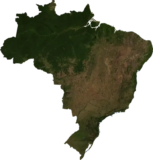
 Minas Gerais
: earthquakes and wildfires
M2.7 earthquake near Martinho Campos, Brazil (Nov 19, 2026, 3:45 PM UTC). Latest earthquakes and wildfires in Minas Gerais (Brazil) on a live map, the strongest earthquakes and largest fires on record.
Live map – Minas Gerais
Key statistics (30 days)
Earthquakes M2.5+ and the wildfire fronts shown on the map.
Recent events in Minas Gerais
- 2.711 h agoM2.7 earthquake near Martinho Campos, Brazil4 mi NE of Martinho Campos, Brazil
- 5 days agoWildfire near Montes Claros, Brazil1,502 acres · 4 mi NNW of Montes Claros, Brazil
- 5 days agoWildfire near Ouro Branco, Brazil8,654 acres · 4 mi WSW of Ouro Branco, Brazil
- 5 days agoWildfire near Ipatinga, Brazil6,106 acres · near Ipatinga, Brazil
- 6 days agoWildfire near Monte Carmelo, Brazil741 acres · 12 mi SSW of Monte Carmelo, Brazil
- 6 days agoWildfire near Augusto de Lima, Brazil1,307 acres · 9 mi WNW of Augusto de Lima, Brazil
Historical overview
Earthquakes M3.0+ and significant events of other hazards.
About Minas Gerais
Minas Gerais has recorded 5 earthquakes of magnitude 3.0 or more since 1998. The strongest was M4.6 in 2007.
Satellites have detected 24 significant wildfires here; the largest burned about 9,459 acres.
Know the official emergency number, prepare an emergency kit and follow the instructions of your civil protection authority.
Learn more ›Earthquakes
5 earthquakes of magnitude 3.0 or more since 1998. The strongest was M4.6.
Recent earthquakes
| Mag | Location | Time (UTC) | Depth |
|---|---|---|---|
| 2.7 | 4 mi NE of Martinho Campos, Brazil | 0.0 mi |
Strongest earthquakes on record
| Mag | Location | Time (UTC) | Depth |
|---|---|---|---|
| 4.6 | 10 mi WNW of Itacarambi, Brazil | 6.2 mi | |
| 4.4 | 14 mi NE of Januaria, Brazil | 6.2 mi | |
| 4.2 | 8 mi NE of Frutal, Brazil | 5.4 mi | |
| 4.1 | 9 mi WSW of Montes Claros, Brazil | 6.2 mi | |
| 4.1 | 32 mi SE of Uberlandia, Brazil | 20.5 mi | |
| 2.7 | 4 mi NE of Martinho Campos, Brazil | 0.0 mi |
Earthquakes per year (M3.0+)
Year
| 2024 | 1 | M4.2 |
| 2012 | 1 | M4.1 |
| 2007 | 2 | M4.6 |
| 1998 | 1 | M4.1 |
Wildfires
24 major fires since 2026. The largest covered about 9,459 acres.
Recent fires
| Area | Location | Since | Status |
|---|---|---|---|
| 1,502 acres | 4 mi NNW of Montes Claros, Brazil | Inactive | |
| 8,654 acres | 4 mi WSW of Ouro Branco, Brazil | Inactive | |
| 6,106 acres | near Ipatinga, Brazil | Inactive | |
| 741 acres | 12 mi SSW of Monte Carmelo, Brazil | Inactive | |
| 1,307 acres | 9 mi WNW of Augusto de Lima, Brazil | Inactive | |
| 751 acres | near Sao Romao, Brazil | Inactive | |
| 2,026 acres | 11 mi SSW of Barreiro do Jaiba, Brazil | Inactive | |
| 1,159 acres | 13 mi WNW of Conselheiro Lafaiete, Brazil | Inactive | |
| 2,646 acres | 38 mi N of Janauba, Brazil | Inactive | |
| 3,291 acres | 11 mi SW of Bandeira, Brazil | Inactive |
Show all (30)
| Area | Location | Since | Status |
|---|---|---|---|
| 3,613 acres | 10 mi ENE of Santa Helena de Minas, Brazil | Inactive | |
| 4,208 acres | 14 mi WNW of Jaiba, Brazil | Inactive | |
| 2,535 acres | 18 mi SSE of Unai, Brazil | Inactive | |
| 3,534 acres | 17 mi SW of Janauba, Brazil | Inactive | |
| 3,553 acres | 9 mi SW of Buritizeiro, Brazil | Inactive | |
| 2,834 acres | 9 mi SE of Sao Joao do Paraiso, Brazil | Inactive | |
| 2,622 acres | 16 mi E of Paracatu, Brazil | Inactive | |
| 3,672 acres | 15 mi SW of Janauba, Brazil | Inactive | |
| 4,112 acres | 14 mi NNE of Jaiba, Brazil | Inactive | |
| 3,966 acres | 21 mi ENE of Buritis, Brazil | Inactive | |
| 9,459 acres | 17 mi SSE of Formoso, Brazil | Inactive | |
| 5,076 acres | 7 mi W of Augusto de Lima, Brazil | Inactive | |
| 2,540 acres | 20 mi N of Uberaba, Brazil | Inactive | |
| 3,306 acres | 9 mi SE of Monte Azul, Brazil | Inactive | |
| 4,431 acres | 23 mi NNE of Arinos, Brazil | Inactive | |
| 2,980 acres | 17 mi S of Formoso, Brazil | Inactive | |
| 7,038 acres | 11 mi ESE of Lassance, Brazil | Inactive | |
| 2,609 acres | 15 mi SSW of Guarda-Mor, Brazil | Inactive | |
| 3,277 acres | 23 mi ENE of Uberaba, Brazil | Inactive | |
| 4,460 acres | 36 mi NNW of Passos, Brazil | Inactive |
Largest fires on record
| Area | Location | Since | Status |
|---|---|---|---|
| 9,459 acres | 17 mi SSE of Formoso, Brazil | Inactive | |
| 8,654 acres | 4 mi WSW of Ouro Branco, Brazil | Inactive | |
| 7,038 acres | 11 mi ESE of Lassance, Brazil | Inactive | |
| 6,106 acres | near Ipatinga, Brazil | Inactive | |
| 5,076 acres | 7 mi W of Augusto de Lima, Brazil | Inactive | |
| 4,460 acres | 36 mi NNW of Passos, Brazil | Inactive | |
| 4,431 acres | 23 mi NNE of Arinos, Brazil | Inactive | |
| 4,208 acres | 14 mi WNW of Jaiba, Brazil | Inactive | |
| 4,112 acres | 14 mi NNE of Jaiba, Brazil | Inactive | |
| 3,966 acres | 21 mi ENE of Buritis, Brazil | Inactive | |
| 3,672 acres | 15 mi SW of Janauba, Brazil | Inactive | |
| 3,613 acres | 10 mi ENE of Santa Helena de Minas, Brazil | Inactive | |
| 3,553 acres | 9 mi SW of Buritizeiro, Brazil | Inactive | |
| 3,534 acres | 17 mi SW of Janauba, Brazil | Inactive | |
| 3,306 acres | 9 mi SE of Monte Azul, Brazil | Inactive |
Places
- Uberlandia
- Montes Claros
- Uberaba
- Araguari
- Buritis
- Janauba
- Jaiba
- Porteirinha
- Sao Joao da Ponte
- Sacramento
- Varzea da Palma
- Unai
- Rio Pardo de Minas
- Paracatu
- Monte Azul
- Espinosa
- Araxa
- Tres Marias
- Taiobeiras
- Sao Sebastiao do Paraiso
- Sao Joao do Paraiso
- Pirapora
- Pedra Azul
- Passos
- Monte Carmelo
- Jequitinhonha
- Januaria
- Ibia
- Francisco Sa
- Diamantina
- Curvelo
- Corinto
- Conceicao das Alagoas
- Buritizeiro
- Bambui
- Almenara
- Vespasiano
- Santa Luzia
- Sabara
- Ribeirao das Neves
- Patos de Minas
- Nova Lima
- Ituiutaba
- Itabira
- Ipatinga
- Ibirite
- Governador Valadares
- Coronel Fabriciano
- Contagem
- Conselheiro Lafaiete
- Betim
- Belo Horizonte
- Barbacena