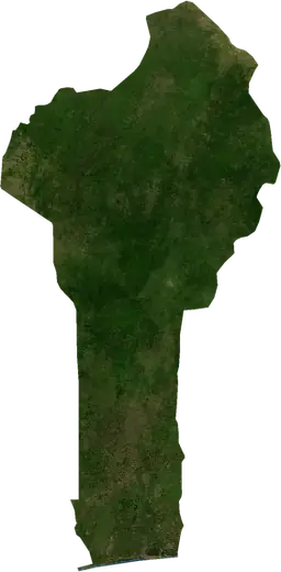
 Benin
Benin: earthquakes and wildfires
Latest earthquakes and active wildfires in Benin on a live map, the strongest earthquakes and largest fires on record, and statistics by year.
Live map – Benin
Key statistics (30 days)
Earthquakes M2.5+ and the wildfire fronts shown on the map.
Fire danger
Forecast for the area around: Malanville. Danger can vary locally; follow official guidance. Source: Copernicus EMS – EFFIS (FWI).
Severe weather (forecast)
- Today: Rain – Heavy rain (10–25 mm) · Cotonou
- Tomorrow: Rain – Heavy rain (10–25 mm) · Cotonou
Forecast for the area around: Benin. It does not replace warnings from the national weather service. Source: ECMWF / Copernicus EMS.
Recent events in Benin
- 12 h agoWildfire near Adjaouere, Benin – active2,105 acres · 11 mi NNE of Adjaouere, Benin
- 12 h agoWildfire near Banikoara, Benin – active1,102 acres · 17 mi NW of Banikoara, Benin
- 12 h agoWildfire near Kandi, Benin – active1,154 acres · 34 mi N of Kandi, Benin
- 12 h agoWildfire near Tanguieta, Benin – active1,060 acres · 34 mi NNE of Tanguieta, Benin
- 13 h agoWildfire near Kandi, Benin – active1,964 acres · 28 mi N of Kandi, Benin
- 24 h agoWildfire near Materi, Benin – active6,682 acres · 28 mi NNE of Materi, Benin
Historical overview
Earthquakes M3.0+ and significant events of other hazards.
About Benin
Benin has recorded 1 earthquakes of magnitude 3.0 or more since 2009. The strongest was M4.4 in 2009.
Satellites have detected 58 significant wildfires here; the largest burned about 79,474 acres.
Know the official emergency number, prepare an emergency kit and follow the instructions of your civil protection authority.
Learn more ›Earthquakes
1 earthquakes of magnitude 3.0 or more since 2009. The strongest was M4.4.
Recent earthquakes
No earthquakes of magnitude 2.5+ in the last 12 months.
Strongest earthquakes on record
| Mag | Location | Time (UTC) | Depth |
|---|---|---|---|
| 4.4 | 8 mi NNE of Abomey-Calavi, Benin | 6.2 mi |
Wildfires
58 major fires since 2025. The largest covered about 79,474 acres.
Recent fires
| Area | Location | Since | Status |
|---|---|---|---|
| 2,105 acres | 11 mi NNE of Adjaouere, Benin | Active | |
| 1,102 acres | 17 mi NW of Banikoara, Benin | Active | |
| 1,154 acres | 34 mi N of Kandi, Benin | Active | |
| 1,060 acres | 34 mi NNE of Tanguieta, Benin | Active | |
| 1,964 acres | 28 mi N of Kandi, Benin | Active | |
| 6,682 acres | 28 mi NNE of Materi, Benin | Active | |
| 9,709 acres | 35 mi NW of Kerou, Benin | Active | |
| 9,783 acres | 32 mi WSW of Malanville, Benin | Active | |
| 1,678 acres | 27 mi NNW of Banikoara, Benin | Active | |
| 11,745 acres | 26 mi NNW of Banikoara, Benin | Active |
Show all (73)
| Area | Location | Since | Status |
|---|---|---|---|
| 2,980 acres | 20 mi NNE of Kandi, Benin | Active | |
| 2,056 acres | 20 mi W of Malanville, Benin | Active | |
| 5,184 acres | 31 mi WSW of Malanville, Benin | Active | |
| 10,593 acres | 27 mi SSE of Gogounou, Benin | Active | |
| 1,021 acres | 9 mi W of Boukoumbe, Benin | Active | |
| 2,271 acres | near Natitingou, Benin | Active | |
| 8,592 acres | 15 mi NNE of Materi, Benin | Active | |
| 4,075 acres | 24 mi NW of Kerou, Benin | Active | |
| 5,765 acres | 17 mi N of Kandi, Benin | Active | |
| 16,914 acres | 24 mi N of Materi, Benin | Active | |
| 8,967 acres | 35 mi NNE of Banikoara, Benin | Active | |
| 1,841 acres | 6 mi SE of Natitingou, Benin | Active | |
| 6,343 acres | 26 mi NNW of Guilmaro, Benin | Active | |
| 1,011 acres | 18 mi N of Materi, Benin | Active | |
| 12,457 acres | 16 mi NE of Materi, Benin | Active | |
| 5,963 acres | 25 mi NNE of Tanguieta, Benin | Active | |
| 4,127 acres | 32 mi NNE of Banikoara, Benin | Active | |
| 5,577 acres | 33 mi N of Guilmaro, Benin | Inactive | |
| 4,655 acres | 24 mi N of Kandi, Benin | Inactive | |
| 9,889 acres | 20 mi NW of Banikoara, Benin | Inactive | |
| 1,777 acres | 12 mi NNE of Tanguieta, Benin | Inactive | |
| 1,245 acres | 33 mi WNW of Malanville, Benin | Inactive | |
| 912 acres | 31 mi W of Malanville, Benin | Inactive | |
| 862 acres | 23 mi WNW of Malanville, Benin | Inactive | |
| 2,642 acres | 26 mi NNW of Kandi, Benin | Inactive | |
| 3,034 acres | 24 mi NNW of Kalale, Benin | Inactive | |
| 3,148 acres | 20 mi SE of Bassila, Benin | Inactive | |
| 3,244 acres | 22 mi ESE of Bassila, Benin | Inactive | |
| 6,425 acres | 37 mi WNW of Parakou, Benin | Inactive | |
| 2,711 acres | 52 mi SW of Parakou, Benin | Inactive | |
| 9,098 acres | 47 mi SW of Parakou, Benin | Inactive | |
| 7,295 acres | 31 mi NE of Banikoara, Benin | Inactive | |
| 3,193 acres | 39 mi WSW of Parakou, Benin | Inactive | |
| 8,004 acres | 36 mi WNW of Malanville, Benin | Inactive | |
| 3,111 acres | 6 mi ENE of Pobe, Benin | Inactive | |
| 4,171 acres | 39 mi W of Malanville, Benin | Inactive | |
| 2,471 acres | 13 mi NNE of Bante, Benin | Inactive | |
| 3,825 acres | 26 mi ESE of Bassila, Benin | Inactive | |
| 7,942 acres | 21 mi N of Bante, Benin | Inactive | |
| 2,876 acres | 42 mi W of Malanville, Benin | Inactive | |
| 3,198 acres | 20 mi WNW of Ouesse, Benin | Inactive | |
| 2,503 acres | 20 mi N of Kalale, Benin | Inactive | |
| 7,675 acres | 39 mi WSW of Malanville, Benin | Inactive | |
| 79,474 acres | 21 mi NNE of Bante, Benin | Inactive | |
| 12,575 acres | 11 mi WSW of Dassa-Zoume, Benin | Inactive | |
| 2,661 acres | 37 mi SW of Parakou, Benin | Inactive | |
| 5,923 acres | 22 mi SE of Save, Benin | Inactive | |
| 3,600 acres | 23 mi N of Kandi, Benin | Inactive | |
| 3,373 acres | 13 mi ESE of Cobly, Benin | Inactive | |
| 3,645 acres | 38 mi NNE of Banikoara, Benin | Inactive | |
| 2,980 acres | 36 mi NNE of Tanguieta, Benin | Inactive | |
| 4,280 acres | 35 mi NNW of Guilmaro, Benin | Inactive | |
| 7,737 acres | 42 mi NNE of Tanguieta, Benin | Inactive | |
| 3,025 acres | 32 mi N of Kandi, Benin | Inactive | |
| 3,413 acres | 34 mi NW of Kerou, Benin | Inactive | |
| 6,971 acres | 39 mi NNE of Tanguieta, Benin | Inactive | |
| 4,473 acres | 30 mi NNE of Tanguieta, Benin | Inactive | |
| 3,027 acres | 40 mi NW of Kerou, Benin | Inactive | |
| 5,291 acres | 25 mi NNE of Tanguieta, Benin | Inactive | |
| 4,569 acres | 21 mi NNE of Materi, Benin | Inactive | |
| 4,856 acres | 25 mi NNW of Kerou, Benin | Inactive | |
| 2,738 acres | 21 mi WNW of Banikoara, Benin | Inactive | |
| 3,509 acres | 28 mi NW of Kerou, Benin | Inactive |
Largest fires on record
| Area | Location | Since | Status |
|---|---|---|---|
| 79,474 acres | 21 mi NNE of Bante, Benin | Inactive | |
| 16,914 acres | 24 mi N of Materi, Benin | Active | |
| 12,575 acres | 11 mi WSW of Dassa-Zoume, Benin | Inactive | |
| 12,457 acres | 16 mi NE of Materi, Benin | Active | |
| 11,745 acres | 26 mi NNW of Banikoara, Benin | Active | |
| 10,593 acres | 27 mi SSE of Gogounou, Benin | Active | |
| 9,889 acres | 20 mi NW of Banikoara, Benin | Inactive | |
| 9,783 acres | 32 mi WSW of Malanville, Benin | Active | |
| 9,709 acres | 35 mi NW of Kerou, Benin | Active | |
| 9,098 acres | 47 mi SW of Parakou, Benin | Inactive | |
| 8,967 acres | 35 mi NNE of Banikoara, Benin | Active | |
| 8,592 acres | 15 mi NNE of Materi, Benin | Active | |
| 8,004 acres | 36 mi WNW of Malanville, Benin | Inactive | |
| 7,942 acres | 21 mi N of Bante, Benin | Inactive | |
| 7,737 acres | 42 mi NNE of Tanguieta, Benin | Inactive |
Major fires per year
Year
| 2026 | 44 | 79,474 acres |
| 2025 | 14 | 7,737 acres |
Regions
Places
- Cotonou
- Abomey-Calavi
- Porto-Novo
- Godome
- Abomey
- Materi
- Tanguieta
- Banikoara
- Kerou
- Cobly
- Malanville
- Natitingou
- Kandi
- Kalale
- Boukoumbe
- Nikki
- Bassila
- Tchaourou
- Segbana
- Save
- Glazoue
- Savalou
- Dassa-Zoume
- Parakou
- Pehonko
- Ketou
- Djougou
- Cove
- Kopargo
- Kpozoun
- Pobe
- Adjaouere
- Bembereke
- Sinende
- Ndali
- Bohicon
- Semi
- Sakete
- Misserete
- Ganvie
- Ekpe
- Djidja
- Banigbe
- Avrankou
- Allada
- Adjarra