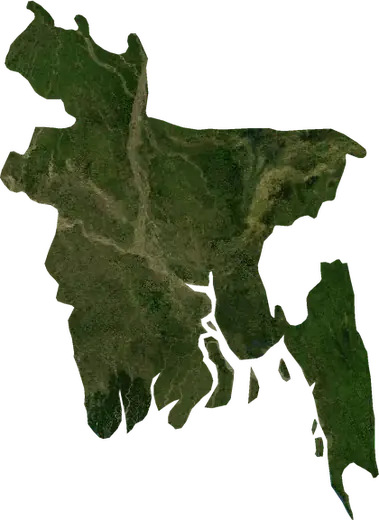
 Bangladesh
: earthquakes and wildfires
Latest earthquakes and active wildfires in Bangladesh on a live map, the strongest earthquakes and largest fires on record, and statistics by year.
Live map – Bangladesh
Key statistics (30 days)
Earthquakes M2.5+ and the wildfire fronts shown on the map.
Fire danger
Forecast for the area around: Dhaka. Danger can vary locally; follow official guidance. Source: Copernicus EMS – EFFIS (FWI).
Severe weather (forecast)
The forecast shows no heavy rain, gales or thunderstorms for today and tomorrow.
Forecast for the area around: Bangladesh. It does not replace warnings from the national weather service. Source: ECMWF / Copernicus EMS.
Recent events in Bangladesh
- 21 h agoWildfire near Hathazari, Bangladesh – active895 acres · 5 mi WSW of Hathazari, Bangladesh
- 44 h agoWildfire near Dhaka, Bangladesh – active1,159 acres · 8 mi E of Dhaka, Bangladesh
- 3 days agoWildfire near Hathazari, Bangladesh902 acres · 26 mi NE of Hathazari, Bangladesh
- 3 days agoWildfire near Chittagong, Bangladesh1,443 acres · 37 mi NNW of Chittagong, Bangladesh
- 4 days agoWildfire near Burhanuddin, Bangladesh848 acres · near Burhanuddin, Bangladesh
- 4.4147 days agoM4.4 earthquake near Dhaka, Bangladesh20 mi NE of Dhaka, Bangladesh
Historical overview
Earthquakes M3.0+ and significant events of other hazards.
About Bangladesh
Bangladesh has recorded 140 earthquakes of magnitude 3.0 or more since 1977. The strongest was M6.0 in 1997.
Satellites have detected 37 significant wildfires here; the largest burned about 74,853 acres.
Know the official emergency number, prepare an emergency kit and follow the instructions of your civil protection authority.
Learn more ›Earthquakes
Earthquakes today: Bangladesh →
140 earthquakes of magnitude 3.0 or more since 1977. The strongest was M6.0.
Recent earthquakes
| Mag | Location | Time (UTC) | Depth |
|---|---|---|---|
| 4.4 | 20 mi NE of Dhaka, Bangladesh | 6.2 mi | |
| 5.0 | 33 mi SW of Khulna, Bangladesh | 22.9 mi | |
| 4.1 | near Dhaka, Bangladesh | 6.2 mi | |
| 4.1 | 8 mi ESE of Gazipur, Bangladesh | 6.2 mi | |
| 4.3 | 5 mi NE of Dhaka, Bangladesh | 6.2 mi | |
| 5.4 | 17 mi ENE of Dhaka, Bangladesh | 16.8 mi |
Strongest earthquakes on record
| Mag | Location | Time (UTC) | Depth |
|---|---|---|---|
| 6.0 | 24 mi E of Sylhet, Bangladesh | 21.7 mi | |
| 5.8 | 55 mi S of Bagerhat, Bangladesh | 3.6 mi | |
| 5.8 | 18 mi NE of Baniachang, Bangladesh | 20.5 mi | |
| 5.7 | 12 mi NNE of Karnaphuli, Bangladesh | 6.2 mi | |
| 5.7 | 66 mi ENE of Cox's Bazar, Bangladesh | 24.9 mi | |
| 5.5 | 27 mi SW of Comilla, Bangladesh | 28.0 mi | |
| 5.5 | 12 mi NE of Karnaphuli, Bangladesh | 6.2 mi | |
| 5.5 | 60 mi ENE of Cox's Bazar, Bangladesh | 20.5 mi | |
| 5.4 | 17 mi ENE of Dhaka, Bangladesh | 16.8 mi | |
| 5.3 | 24 mi ENE of Sylhet, Bangladesh | 22.8 mi | |
| 5.3 | 72 mi S of Natona, Bangladesh | 18.2 mi | |
| 5.3 | 14 mi WNW of Sunamganj, Bangladesh | 10.9 mi | |
| 5.2 | 27 mi SE of Sylhet, Bangladesh | 24.0 mi | |
| 5.2 | 10 mi NW of Cox's Bazar, Bangladesh | 6.2 mi | |
| 5.2 | 140 mi SW of Dakshinpara, Bangladesh | 20.5 mi |
Earthquakes per year (M3.0+)
Year
| 2026 | 2 | M5.0 |
| 2025 | 6 | M5.4 |
| 2024 | 2 | M4.2 |
| 2023 | 7 | M5.5 |
| 2022 | 2 | M4.2 |
| 2021 | 1 | M4.5 |
| 2020 | 5 | M4.9 |
| 2019 | 2 | M4.9 |
| 2018 | 1 | M4.4 |
| 2017 | 2 | M4.5 |
| 2016 | 2 | M4.7 |
| 2015 | 5 | M4.6 |
| 2014 | 3 | M4.3 |
| 2013 | 2 | M5.2 |
| 2012 | 5 | M4.7 |
| 2011 | 4 | M4.4 |
| 2010 | 1 | M4.8 |
| 2009 | 2 | M4.9 |
| 2008 | 10 | M5.0 |
| 2007 | 8 | M5.1 |
| 2006 | 3 | M4.9 |
| 2005 | 6 | M4.6 |
| 2003 | 7 | M5.7 |
| 2002 | 6 | M4.9 |
| 2001 | 5 | M4.5 |
| 2000 | 2 | M5.5 |
| 1999 | 3 | M5.2 |
| 1998 | 1 | M4.0 |
| 1997 | 3 | M6.0 |
| 1996 | 3 | M4.7 |
| 1995 | 2 | M4.3 |
| 1992 | 5 | M5.3 |
| 1991 | 4 | M4.7 |
| 1989 | 3 | M5.8 |
| 1988 | 3 | M5.8 |
| 1986 | 2 | M5.3 |
| 1985 | 1 | M4.9 |
| 1982 | 4 | M5.2 |
| 1981 | 1 | M4.2 |
| 1979 | 2 | M4.9 |
| 1978 | 1 | M4.6 |
| 1977 | 1 | M5.7 |
Wildfires
37 major fires since 2026. The largest covered about 74,853 acres.
Recent fires
| Area | Location | Since | Status |
|---|---|---|---|
| 895 acres | 5 mi WSW of Hathazari, Bangladesh | Active | |
| 1,159 acres | 8 mi E of Dhaka, Bangladesh | Active | |
| 902 acres | 26 mi NE of Hathazari, Bangladesh | Inactive | |
| 1,443 acres | 37 mi NNW of Chittagong, Bangladesh | Inactive | |
| 848 acres | near Burhanuddin, Bangladesh | Inactive | |
| 7,238 acres | 28 mi NE of Khagrachhari, Bangladesh | Inactive | |
| 3,551 acres | 57 mi ENE of Cox's Bazar, Bangladesh | Inactive | |
| 10,255 acres | 28 mi NE of Khagrachhari, Bangladesh | Inactive | |
| 2,651 acres | 33 mi NNE of Khagrachhari, Bangladesh | Inactive | |
| 4,460 acres | 40 mi ENE of Cox's Bazar, Bangladesh | Inactive |
Show all (42)
Largest fires on record
| Area | Location | Since | Status |
|---|---|---|---|
| 74,853 acres | 54 mi E of Cox's Bazar, Bangladesh | Inactive | |
| 28,578 acres | 70 mi E of Cox's Bazar, Bangladesh | Inactive | |
| 21,286 acres | 29 mi E of Cox's Bazar, Bangladesh | Inactive | |
| 20,507 acres | 54 mi ESE of Cox's Bazar, Bangladesh | Inactive | |
| 13,952 acres | 72 mi E of Cox's Bazar, Bangladesh | Inactive | |
| 13,628 acres | 41 mi SE of Chittagong, Bangladesh | Inactive | |
| 10,255 acres | 28 mi NE of Khagrachhari, Bangladesh | Inactive | |
| 10,055 acres | 56 mi ENE of Cox's Bazar, Bangladesh | Inactive | |
| 9,993 acres | 37 mi ESE of Bandarban, Bangladesh | Inactive | |
| 8,710 acres | 44 mi E of Cox's Bazar, Bangladesh | Inactive | |
| 7,655 acres | 39 mi E of Chittagong, Bangladesh | Inactive | |
| 7,596 acres | 34 mi NE of Cox's Bazar, Bangladesh | Inactive | |
| 7,238 acres | 28 mi NE of Khagrachhari, Bangladesh | Inactive | |
| 6,852 acres | 23 mi E of Khagrachhari, Bangladesh | Inactive | |
| 6,143 acres | 63 mi ENE of Cox's Bazar, Bangladesh | Inactive |
Regions
Places
- Dhaka
- Chittagong
- Gazipur
- Khulna
- Rangpur
- Rajshahi
- Comilla
- Pallabi
- Mirpur Model Thana
- Mohammadpur
- Hathazari
- Bogura
- Savar
- Shibganj
- Natore
- Kafrul
- Tungi
- Bhatara
- Narsingdi
- Brahmanbaria
- Demra
- Nagar Naluakot
- Bagerhat
- Cox's Bazar
- Kaliakair
- Jessore
- Nagarpur
- Sylhet
- Mymensingh
- Narayanganj
- Chandpur
- Ashuganj City
- Dinajpur
- Karnaphuli
- Motijheel
- Barishal
- Nawabganj
- Saidpur
- Par Naogaon
- Pabna
- Paltan
- Tangail
- Jamalpur
- Puthia
- Ramna Maidan
- Kushtia
- Maijdi
- Sonargaon
- Satkhira
- Sirajganj
- Tungipara
- Faridpur
- Gulshan
- Sherpur
- Rangamati
- Bhairab Bazar
- Shahzadpur
- Thakurgaon
- Bhola
- Azimpur
- Kishorganj
- Bibir Hat
- Habiganj
- Madaripur
- Feni
- Laksham
- Ishwardi
- Sarishabari
- Netrakona
- Jamirdia
- Sunamganj
- Joypur Hat
- Manikganj
- Palang
- Lalmonirhat
- Habirbari
- Raipur
- Lakshmipur
- Maulavi Bazar
- Ramganj