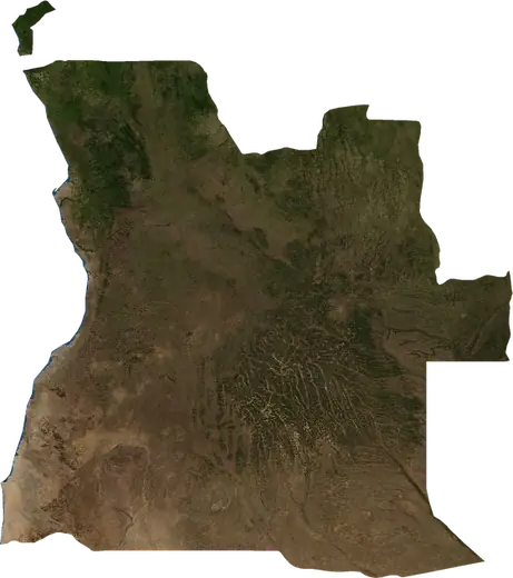
 Caxito
Wildfires near Caxito
Is there a fire near Caxito right now? Active wildfires within 62 mi of Caxito, Angola, from NASA satellites, and the largest fires on record.
Live map – Caxito
Loading live map…
Latest event1,072 acres4 days ago17 mi E of Luanda, Angola
Low
Moderate
High
Very high
Extreme
Very extreme
Forecast: Copernicus EFFIS (FWI index)
Very light rain (0.1–1 mm)
Light rain (1–5 mm)
Moderate rain (5–10 mm)
Heavy rain (10–25 mm)
Very heavy rain (25–50 mm)
Extreme rain (≥ 50 mm)
Forecast: ECMWF via Copernicus EMS – GWIS
Calm (< 7 km/h, 0–1 Bf)
Light breeze (7–18 km/h, 2–3 Bf)
Moderate breeze (18–36 km/h, 4–5 Bf)
Strong breeze (36–54 km/h, 5–7 Bf)
Gale (54–72 km/h, 7–8 Bf)
Storm (≥ 72 km/h, 9+ Bf)
Forecast: ECMWF via Copernicus EMS – GWIS
Very low lightning
Low lightning
Moderate lightning
High lightning
Very high lightning
Extreme lightning
Forecast: ECMWF via Copernicus EMS – GWIS
Earthquakes
Wildfires
Floods
Storms
Volcanoes
Tsunamis
Earthquakes within 62 mi of the city center.
Key statistics (30 days)
Earthquakes M2.5+ and the wildfire fronts shown on the map.
Recent events in Caxito
- 4 days agoWildfire near Luanda, Angola1,072 acres · 17 mi E of Luanda, Angola
- 5 days agoWildfire near Calumbo, Angola19,998 acres · 16 mi ESE of Calumbo, Angola
- 5 days agoWildfire near Luanda, Angola1,950 acres · 6 mi NE of Luanda, Angola
- 6 days agoWildfire near Ucua, Angola55,366 acres · 12 mi W of Ucua, Angola
- 7 days agoWildfire near Muxima, Angola2,908 acres · 27 mi NNE of Muxima, Angola
- 8 days agoWildfire near Kikolo, Angola3,590 acres · 43 mi ENE of Kikolo, Angola
Historical overview
Earthquakes M3.0+ and significant events of other hazards.
About Caxito
Satellites have detected 24 significant wildfires here; the largest burned about 55,366 acres.
Know the official emergency number, prepare an emergency kit and follow the instructions of your civil protection authority.
Learn more ›Wildfires
24 major fires since 2025 within 62 mi. The largest covered about 55,366 acres.
Recent fires
| Area | Location | Since | Status |
|---|---|---|---|
| 1,072 acres | 17 mi E of Luanda, Angola | Inactive | |
| 19,998 acres | 16 mi ESE of Calumbo, Angola | Inactive | |
| 1,950 acres | 6 mi NE of Luanda, Angola | Inactive | |
| 55,366 acres | 12 mi W of Ucua, Angola | Inactive | |
| 2,908 acres | 27 mi NNE of Muxima, Angola | Inactive | |
| 3,590 acres | 43 mi ENE of Kikolo, Angola | Inactive | |
| 13,440 acres | 30 mi NE of Panguila, Angola | Inactive | |
| 2,740 acres | near Tabi, Angola | Inactive | |
| 2,666 acres | 4 mi SSW of Ucua, Angola | Inactive | |
| 6,595 acres | 4 mi WSW of Ucua, Angola | Inactive |
Show all (24)
| Area | Location | Since | Status |
|---|---|---|---|
| 3,296 acres | 9 mi WNW of Pango Aluquem, Angola | Inactive | |
| 3,151 acres | near Pango Aluquem, Angola | Inactive | |
| 25,973 acres | 4 mi SW of Quibaxe, Angola | Inactive | |
| 27,280 acres | 5 mi NNE of Cazuangongo, Angola | Inactive | |
| 3,198 acres | 11 mi W of Ucua, Angola | Inactive | |
| 11,001 acres | 7 mi ENE of Ucua, Angola | Inactive | |
| 9,163 acres | near Cage Mazumbo, Angola | Inactive | |
| 3,788 acres | near Canacassala, Angola | Inactive | |
| 2,575 acres | 9 mi NNE of Quicabo, Angola | Inactive | |
| 10,685 acres | 6 mi S of Zala, Angola | Inactive | |
| 4,853 acres | 6 mi W of Quixico, Angola | Inactive | |
| 5,127 acres | 7 mi WSW of Calumbo, Angola | Inactive | |
| 3,578 acres | 15 mi SSW of Calumbo, Angola | Inactive | |
| 2,755 acres | 11 mi SW of Calumbo, Angola | Inactive |
Largest fires on record
| Area | Location | Since | Status |
|---|---|---|---|
| 55,366 acres | 12 mi W of Ucua, Angola | Inactive | |
| 27,280 acres | 5 mi NNE of Cazuangongo, Angola | Inactive | |
| 25,973 acres | 4 mi SW of Quibaxe, Angola | Inactive | |
| 19,998 acres | 16 mi ESE of Calumbo, Angola | Inactive | |
| 13,440 acres | 30 mi NE of Panguila, Angola | Inactive | |
| 11,001 acres | 7 mi ENE of Ucua, Angola | Inactive | |
| 10,685 acres | 6 mi S of Zala, Angola | Inactive | |
| 9,163 acres | near Cage Mazumbo, Angola | Inactive | |
| 6,595 acres | 4 mi WSW of Ucua, Angola | Inactive | |
| 5,127 acres | 7 mi WSW of Calumbo, Angola | Inactive | |
| 4,853 acres | 6 mi W of Quixico, Angola | Inactive | |
| 3,788 acres | near Canacassala, Angola | Inactive | |
| 3,590 acres | 43 mi ENE of Kikolo, Angola | Inactive | |
| 3,578 acres | 15 mi SSW of Calumbo, Angola | Inactive | |
| 3,296 acres | 9 mi WNW of Pango Aluquem, Angola | Inactive |
Major fires per year
Year
| 2026 | 18 | 55,366 acres |
| 2025 | 6 | 19,998 acres |
Nearby places
- Gama 13 mi
- Panguila 17 mi
- Barra do Dande 21 mi
- Cacuaco 24 mi
- Kikolo 27 mi
- Hoji ya Henda 30 mi
- Viana 30 mi
- Mulenvos 30 mi
- Sambizanga 30 mi
- Kima Kieza 31 mi
- Cazenga 32 mi
- Rangel 32 mi
- Kilamba 32 mi
- Golfe 34 mi
- Ucua 34 mi
- Ingombota 34 mi
- Luanda 34 mi
- Maianga 35 mi
- Zango 36 mi
- Camama 37 mi
- Vila Flor 37 mi
- Nova Vida 38 mi
- Samba 38 mi
- Talatona 40 mi
- Canacassala 42 mi
- Benfica 42 mi