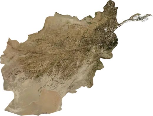
 Afghanistan
: earthquakes and wildfires
Latest earthquakes and active wildfires in Afghanistan on a live map, the strongest earthquakes and largest fires on record, and statistics by year.
Live map – Afghanistan
Key statistics (30 days)
Earthquakes M2.5+ and the wildfire fronts shown on the map.
Fire danger
Forecast for the area around: Herat. Danger can vary locally; follow official guidance. Source: Copernicus EMS – EFFIS (FWI).
Severe weather (forecast)
- Today: Rain – Heavy rain (10–25 mm) · Jalalabad
- Tomorrow: Rain – Heavy rain (10–25 mm) · Jalalabad
Forecast for the area around: Afghanistan. It does not replace warnings from the national weather service. Source: ECMWF / Copernicus EMS.
Recent events in Afghanistan
- 4.915 h agoM4.9 earthquake near Jurm, Afghanistan23 mi S of Jurm, Afghanistan
- 5.018 h agoM5.0 earthquake near Kuran wa Munjan, Afghanistan13 mi ENE of Kuran wa Munjan, Afghanistan
- 4.43 days agoM4.4 earthquake near Baghlan, Afghanistan19 mi WNW of Baghlan, Afghanistan
- 4.13 days agoM4.1 earthquake near Baghlan, Afghanistan86 mi E of Baghlan, Afghanistan
- 4.212 days agoM4.2 earthquake near Jurm, Afghanistan30 mi SSW of Jurm, Afghanistan
- 4.113 days agoM4.1 earthquake near Khandud, Afghanistan61 mi NNE of Khandud, Afghanistan
Historical overview
Earthquakes M3.0+ and significant events of other hazards.
About Afghanistan
Afghanistan has recorded 7,116 earthquakes of magnitude 3.0 or more since 1976. The strongest was M7.5 in 2015.
Satellites have detected 3 significant wildfires here; the largest burned about 9,417 acres.
Know the official emergency number, prepare an emergency kit and follow the instructions of your civil protection authority.
Learn more ›Earthquakes
Earthquakes today: Afghanistan →
7,116 earthquakes of magnitude 3.0 or more since 1976. The strongest was M7.5.
Recent earthquakes
| Mag | Location | Time (UTC) | Depth |
|---|---|---|---|
| 4.9 | 23 mi S of Jurm, Afghanistan | 118.1 mi | |
| 5.0 | 13 mi ENE of Kuran wa Munjan, Afghanistan | 62.6 mi | |
| 4.4 | 19 mi WNW of Baghlan, Afghanistan | 6.2 mi | |
| 4.1 | 86 mi E of Baghlan, Afghanistan | 6.2 mi | |
| 4.2 | 30 mi SSW of Jurm, Afghanistan | 123.8 mi | |
| 4.1 | 61 mi NNE of Khandud, Afghanistan | 6.2 mi | |
| 4.3 | 23 mi SSE of Farkhar, Afghanistan | 83.2 mi | |
| 4.2 | 20 mi WSW of Ashkasham, Afghanistan | 132.7 mi | |
| 4.4 | 20 mi SW of Ashkasham, Afghanistan | 77.0 mi | |
| 4.6 | 26 mi S of Farkhar, Afghanistan | 71.5 mi |
Show all (156)
Strongest earthquakes on record
| Mag | Location | Time (UTC) | Depth |
|---|---|---|---|
| 7.5 | 29 mi E of Farkhar, Afghanistan | 143.5 mi | |
| 7.4 | 32 mi SW of Jurm, Afghanistan | 140.4 mi | |
| 7.4 | 47 mi S of Jurm, Afghanistan | 61.3 mi | |
| 7.2 | 34 mi S of Jurm, Afghanistan | 133.6 mi | |
| 7.0 | 34 mi S of Jurm, Afghanistan | 133.3 mi | |
| 6.7 | 33 mi SW of Ashkasham, Afghanistan | 132.3 mi | |
| 6.6 | 27 mi WSW of Ashkasham, Afghanistan | 131.7 mi | |
| 6.6 | 31 mi S of Jurm, Afghanistan | 127.3 mi | |
| 6.6 | 15 mi E of Rustaq, Afghanistan | 20.5 mi | |
| 6.6 | 47 mi S of Jurm, Afghanistan | 61.5 mi | |
| 6.6 | 9 mi NW of Nahrin, Afghanistan | 22.4 mi | |
| 6.5 | 25 mi SSE of Jurm, Afghanistan | 116.2 mi | |
| 6.5 | 33 mi SW of Ashkasham, Afghanistan | 139.8 mi | |
| 6.5 | 27 mi SSE of Jurm, Afghanistan | 116.2 mi | |
| 6.5 | 20 mi SW of Ashkasham, Afghanistan | 141.9 mi |
Earthquakes per year (M3.0+)
Year
| 2026 | 139 | M6.1 |
| 2025 | 197 | M6.3 |
| 2024 | 175 | M6.4 |
| 2023 | 227 | M6.5 |
| 2022 | 185 | M6.0 |
| 2021 | 159 | M5.5 |
| 2020 | 164 | M5.0 |
| 2019 | 151 | M6.1 |
| 2018 | 152 | M6.2 |
| 2017 | 168 | M5.2 |
| 2016 | 196 | M6.6 |
| 2015 | 219 | M7.5 |
| 2014 | 153 | M5.6 |
| 2013 | 155 | M5.5 |
| 2012 | 120 | M5.8 |
| 2011 | 90 | M5.9 |
| 2010 | 75 | M6.3 |
| 2009 | 54 | M6.6 |
| 2008 | 345 | M6.0 |
| 2007 | 287 | M6.2 |
| 2006 | 237 | M5.6 |
| 2005 | 219 | M6.5 |
| 2004 | 173 | M6.5 |
| 2003 | 137 | M5.9 |
| 2002 | 245 | M7.4 |
| 2001 | 184 | M6.2 |
| 2000 | 152 | M6.3 |
| 1999 | 149 | M6.5 |
| 1998 | 217 | M6.6 |
| 1997 | 106 | M6.4 |
| 1996 | 126 | M5.9 |
| 1995 | 122 | M6.3 |
| 1994 | 83 | M6.3 |
| 1993 | 89 | M7.0 |
| 1992 | 81 | M5.8 |
| 1991 | 100 | M6.7 |
| 1990 | 124 | M6.4 |
| 1989 | 81 | M4.9 |
| 1988 | 85 | M6.3 |
| 1987 | 68 | M6.2 |
| 1986 | 112 | M5.9 |
| 1985 | 145 | M7.4 |
| 1984 | 105 | M6.1 |
| 1983 | 76 | M7.2 |
| 1982 | 60 | M6.6 |
| 1981 | 46 | M6.3 |
| 1980 | 58 | M5.4 |
| 1979 | 71 | M6.1 |
| 1978 | 79 | M5.9 |
| 1977 | 74 | M5.5 |
| 1976 | 100 | M6.1 |
Wildfires
3 major fires since 2026. The largest covered about 9,417 acres.
Recent fires
| Area | Location | Since | Status |
|---|---|---|---|
| 2,642 acres | 45 mi NW of Maymana, Afghanistan | Inactive | |
| 9,417 acres | 41 mi NNW of Maymana, Afghanistan | Inactive | |
| 5,276 acres | 54 mi N of Ghormach, Afghanistan | Inactive |
Largest fires on record
| Area | Location | Since | Status |
|---|---|---|---|
| 9,417 acres | 41 mi NNW of Maymana, Afghanistan | Inactive | |
| 5,276 acres | 54 mi N of Ghormach, Afghanistan | Inactive | |
| 2,642 acres | 45 mi NW of Maymana, Afghanistan | Inactive |
Regions
Places
- Kabul
- Herat
- Mazar-e Sharif
- Kandahar
- Jalalabad
- Kunduz
- Ghazni
- Balkh
- Bagram
- Baghlan
- Gardez
- Khost
- Maymana
- Khanabad
- Bazar-e Yakawlang
- Bazarak
- Khulm
- Taloqan
- Bamyan
- Pul-e Khumri
- Shibirghan
- Charikar
- Sar-e Pul
- Paghman
- Asadabad
- Aibak
- Fayzabad
- Dasht-e Qal'ah
- Istalif
- Andkhoy
- Baharak
- Ghormach
- Rustaq
- Qarawul
- Jurm
- Nahrin
- Baraki Barak