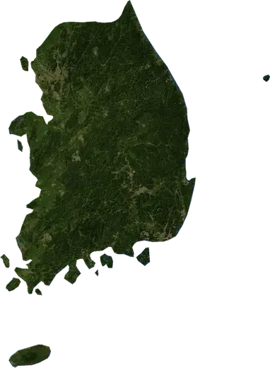
 Daegu
Daegu: earthquakes and wildfires
Was there an earthquake or a fire near Daegu just now? Live map within 100 km, the strongest earthquakes, the largest fires and statistics for Daegu, South Korea.
Live map – Daegu
Earthquakes within 100 km of the city centre.
Key statistics (30 days)
Earthquakes M2.5+ and the wildfire fronts shown on the map.
Recent events in Daegu
- 3.633 h agoM3.6 earthquake near Sangju, South Korea21 km WNW of Sangju, South Korea
- 6 days agoWildfire near Ulsan, South Korea11 km² · 6 km SE of Ulsan, South Korea
- 6 days agoWildfire near Pohang, South Korea57 km² · near Pohang, South Korea
- 6 days agoWildfire near Ulsan, South Korea9.2 km² · 11 km SSE of Ulsan, South Korea
- 6 days agoWildfire near Changwon, South Korea4.2 km² · 8 km WSW of Changwon, South Korea
- 6 days agoWildfire near Gimhae, South Korea14 km² · 15 km S of Gimhae, South Korea
Historical overview
Earthquakes M3.0+ and significant events of other hazards.
About Daegu
Daegu has recorded 11 earthquakes of magnitude 3.0 or more since 1978. The strongest was M5.5 in 2017.
Satellites have detected 2 significant wildfires here; the largest burned about 57 km².
Know the official emergency number, prepare an emergency kit and follow the instructions of your civil protection authority.
Learn more ›Did you feel an earthquake in Daegu?
No reports yet.
Earthquakes
11 earthquakes of magnitude 3.0 or more since 1978 within 100 km. The strongest was M5.5.
Recent earthquakes
| Mag | Location | Time (UTC) | Depth |
|---|---|---|---|
| 3.6 | 21 km WNW of Sangju, South Korea | 20.0 km |
Strongest earthquakes on record
| Mag | Location | Time (UTC) | Depth |
|---|---|---|---|
| 5.5 | 9 km WNW of Pohang, South Korea | 10.0 km | |
| 5.4 | 7 km S of Gyeongju, South Korea | 13.0 km | |
| 4.9 | 15 km SW of Gyeongju, South Korea | 10.0 km | |
| 4.7 | 8 km NW of Pohang, South Korea | 5.4 km | |
| 4.7 | near Pohang, South Korea | 10.0 km | |
| 4.7 | near Gyeongju, South Korea | 10.0 km | |
| 4.6 | 10 km SSW of Gyeongju, South Korea | 8.8 km | |
| 4.6 | 47 km ENE of Daejeon, South Korea | 33.0 km |
Earthquakes per year (M3.0+)
Year
| 2026 | 1 | M3.6 |
| 2023 | 1 | M3.8 |
| 2018 | 1 | M4.7 |
| 2017 | 2 | M5.5 |
| 2016 | 4 | M5.4 |
| 1997 | 1 | M4.7 |
| 1978 | 1 | M4.6 |
Wildfires
2 major fires since 2026 within 100 km. The largest covered about 57 km².
Recent fires
| Area | Location | Since | Status |
|---|---|---|---|
| 11 km² | 6 km SE of Ulsan, South Korea | Inactive | |
| 57 km² | near Pohang, South Korea | Inactive | |
| 9.2 km² | 11 km SSE of Ulsan, South Korea | Inactive | |
| 4.2 km² | 8 km WSW of Changwon, South Korea | Inactive | |
| 14 km² | 15 km S of Gimhae, South Korea | Inactive |
Largest fires on record
| Area | Location | Since | Status |
|---|---|---|---|
| 57 km² | near Pohang, South Korea | Inactive | |
| 11 km² | 6 km SE of Ulsan, South Korea | Inactive |
Nearby places
- Hwawon 12 km
- Gyeongsan-si 13 km
- Hayang 20 km
- Waegwan 23 km
- Eisen 32 km
- Gumi 36 km
- Changnyeong 38 km
- Kunwi 41 km
- Miryang 44 km
- Jenzan 49 km
- Gimcheon 52 km
- Gyeongju 55 km
- Yeonil 66 km
- Naeso 69 km
- Yangsan 71 km
- Pohang 71 km
- Changwon 72 km
- Heunghae 72 km
- Sangju 72 km
- Ungsang 73 km
- Ulsan 74 km
- Cheongsong gun 75 km
- Gimhae 75 km
- Andong 78 km
- Yeongdong 82 km
- Mungyeong 88 km
- Yecheon 88 km
- Chinju 89 km
- Gijang 89 km