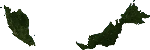
 Malaysia
: earthquakes and wildfires
Latest earthquakes and active wildfires in Malaysia on a live map, the strongest earthquakes and largest fires on record, and statistics by year.
Live map – Malaysia
Key statistics (30 days)
Earthquakes M2.5+ and the wildfire fronts shown on the map.
Fire danger
Forecast for the area around: Kuala Lumpur. Danger can vary locally; follow official guidance. Source: Copernicus EMS – EFFIS (FWI).
Severe weather (forecast)
- Today: Rain – Extreme rain (≥ 50 mm) · Kuala Lumpur
- Today: Lightning – High lightning · Kuala Lumpur
- Tomorrow: Rain – Extreme rain (≥ 50 mm) · Kuala Lumpur
Forecast for the area around: Malaysia. It does not replace warnings from the national weather service. Source: ECMWF / Copernicus EMS.
Recent events in Malaysia
- 2.53 h agoM2.5 earthquake near Ranau, Malaysia – now29 km ENE of Ranau, Malaysia
- 5 h agoWildfire near Dungun, Malaysia – active13 km² · 198 km ENE of Dungun, Malaysia
- 6 h agoWildfire near Kota Kinabalu, Malaysia – active6.2 km² · 62 km NW of Kota Kinabalu, Malaysia
- 6 h agoWildfire near Miri, Malaysia – active22 km² · 129 km WNW of Miri, Malaysia
- 6 h agoWildfire near Bintulu, Malaysia – active12 km² · 84 km NW of Bintulu, Malaysia
- 17 h agoWildfire near Bintulu, Malaysia – active51 km² · 14 km NNE of Bintulu, Malaysia
Historical overview
Earthquakes M3.0+ and significant events of other hazards.
About Malaysia
Malaysia has recorded 74 earthquakes of magnitude 3.0 or more since 1976. The strongest was M7.1 in 2026.
Satellites have detected 22 significant wildfires here; the largest burned about 107 km².
Know the official emergency number, prepare an emergency kit and follow the instructions of your civil protection authority.
Learn more ›Earthquakes
74 earthquakes of magnitude 3.0 or more since 1976. The strongest was M7.1.
Recent earthquakes
| Mag | Location | Time (UTC) | Depth |
|---|---|---|---|
| 2.5 | 29 km ENE of Ranau, Malaysia | 10.0 km | |
| 5.0 | 44 km NNE of Semporna, Malaysia | 10.0 km | |
| 7.1 | 101 km NNE of Kota Kinabalu, Malaysia | 629.0 km |
Strongest earthquakes on record
| Mag | Location | Time (UTC) | Depth |
|---|---|---|---|
| 7.1 | 101 km NNE of Kota Kinabalu, Malaysia | 629.0 km | |
| 6.2 | 7 km SSW of Lahad Datu, Malaysia | 33.0 km | |
| 6.0 | near Kampung Kundassang, Malaysia | 10.0 km | |
| 5.7 | 36 km ENE of Lahad Datu, Malaysia | 55.2 km | |
| 5.7 | 21 km NNE of Lahad Datu, Malaysia | 50.3 km | |
| 5.5 | 57 km NNW of Kota Kinabalu, Malaysia | 618.7 km | |
| 5.4 | 19 km ESE of Ranau, Malaysia | 18.0 km | |
| 5.4 | 27 km ENE of Kampung Kunak, Malaysia | 39.1 km | |
| 5.3 | 72 km ENE of Kota Kinabalu, Malaysia | 7.3 km | |
| 5.3 | 188 km SE of Lidung Jelo, Malaysia | 11.0 km | |
| 5.3 | 65 km NW of Sandakan, Malaysia | 19.0 km | |
| 5.3 | 45 km SSW of Tatau, Malaysia | 28.9 km | |
| 5.3 | 14 km S of Lahad Datu, Malaysia | 33.0 km | |
| 5.3 | 75 km NNE of Tawau, Malaysia | 33.0 km | |
| 5.3 | 8 km NE of Lahad Datu, Malaysia | 33.0 km |
Earthquakes per year (M3.0+)
Year
| 2026 | 2 | M7.1 |
| 2025 | 2 | M4.3 |
| 2023 | 1 | M5.5 |
| 2022 | 1 | M4.2 |
| 2020 | 2 | M4.9 |
| 2019 | 1 | M4.5 |
| 2018 | 2 | M5.2 |
| 2017 | 1 | M4.6 |
| 2016 | 1 | M4.1 |
| 2015 | 10 | M6.0 |
| 2014 | 3 | M4.6 |
| 2012 | 1 | M4.6 |
| 2010 | 1 | M4.2 |
| 2009 | 1 | M4.5 |
| 2008 | 3 | M5.0 |
| 2007 | 1 | M5.3 |
| 2006 | 2 | M4.5 |
| 2005 | 3 | M5.3 |
| 2004 | 2 | M5.2 |
| 2003 | 1 | M4.9 |
| 2002 | 1 | M5.1 |
| 1996 | 1 | M4.4 |
| 1995 | 1 | M4.1 |
| 1994 | 3 | M5.7 |
| 1992 | 2 | M4.6 |
| 1991 | 5 | M5.4 |
| 1989 | 2 | M4.4 |
| 1988 | 1 | M5.2 |
| 1984 | 2 | M5.7 |
| 1983 | 1 | M5.0 |
| 1982 | 1 | M4.5 |
| 1981 | 1 | M5.4 |
| 1980 | 1 | M5.1 |
| 1979 | 1 | M4.5 |
| 1976 | 10 | M6.2 |
Wildfires
22 major fires since 2025. The largest covered about 107 km².
Recent fires
| Area | Location | Since | Status |
|---|---|---|---|
| 13 km² | 198 km ENE of Dungun, Malaysia | Active | |
| 6.2 km² | 62 km NW of Kota Kinabalu, Malaysia | Active | |
| 22 km² | 129 km WNW of Miri, Malaysia | Active | |
| 12 km² | 84 km NW of Bintulu, Malaysia | Active | |
| 51 km² | 14 km NNE of Bintulu, Malaysia | Active | |
| 9.8 km² | 46 km N of Sebauh, Malaysia | Active | |
| 11 km² | 48 km N of Sebauh, Malaysia | Active | |
| 4.0 km² | 207 km NE of Kuala Terengganu, Malaysia | Inactive | |
| 5.2 km² | 176 km NNE of Pengkalan Chepa, Malaysia | Inactive | |
| 6.6 km² | 51 km E of Seremban, Malaysia | Inactive |
Show all (31)
| Area | Location | Since | Status |
|---|---|---|---|
| 6.5 km² | near Labuan, Malaysia | Inactive | |
| 5.5 km² | 55 km NW of Labuan, Malaysia | Inactive | |
| 4.9 km² | 149 km NE of Kota Bharu, Malaysia | Inactive | |
| 4.6 km² | 34 km NNW of Miri, Malaysia | Inactive | |
| 18 km² | 53 km W of Iskandar Puteri, Malaysia | Inactive | |
| 11 km² | 28 km SSE of Batu Pahat, Malaysia | Inactive | |
| 107 km² | 27 km SW of Iskandar Puteri, Malaysia | Inactive | |
| 18 km² | 59 km W of Iskandar Puteri, Malaysia | Inactive | |
| 11 km² | 62 km SE of Muar, Malaysia | Inactive | |
| 65 km² | 41 km S of Lubok Antu, Malaysia | Inactive | |
| 13 km² | 65 km SSE of Lubok Antu, Malaysia | Inactive | |
| 14 km² | 66 km SSW of Tebedu, Malaysia | Inactive | |
| 11 km² | 61 km SSW of Tebedu, Malaysia | Inactive | |
| 11 km² | 31 km SE of Sebauh, Malaysia | Inactive | |
| 44 km² | 62 km SSE of Tebedu, Malaysia | Inactive | |
| 17 km² | 13 km SW of Tebedu, Malaysia | Inactive | |
| 32 km² | 53 km S of Tebedu, Malaysia | Inactive | |
| 55 km² | 50 km SSW of Tebedu, Malaysia | Inactive | |
| 35 km² | 76 km SSW of Muar, Malaysia | Inactive | |
| 29 km² | 77 km SW of Batu Pahat, Malaysia | Inactive | |
| 14 km² | 80 km S of Muar, Malaysia | Inactive |
Largest fires on record
| Area | Location | Since | Status |
|---|---|---|---|
| 107 km² | 27 km SW of Iskandar Puteri, Malaysia | Inactive | |
| 65 km² | 41 km S of Lubok Antu, Malaysia | Inactive | |
| 55 km² | 50 km SSW of Tebedu, Malaysia | Inactive | |
| 51 km² | 14 km NNE of Bintulu, Malaysia | Active | |
| 44 km² | 62 km SSE of Tebedu, Malaysia | Inactive | |
| 35 km² | 76 km SSW of Muar, Malaysia | Inactive | |
| 32 km² | 53 km S of Tebedu, Malaysia | Inactive | |
| 29 km² | 77 km SW of Batu Pahat, Malaysia | Inactive | |
| 22 km² | 129 km WNW of Miri, Malaysia | Active | |
| 18 km² | 59 km W of Iskandar Puteri, Malaysia | Inactive | |
| 18 km² | 53 km W of Iskandar Puteri, Malaysia | Inactive | |
| 17 km² | 13 km SW of Tebedu, Malaysia | Inactive | |
| 14 km² | 80 km S of Muar, Malaysia | Inactive | |
| 14 km² | 66 km SSW of Tebedu, Malaysia | Inactive | |
| 13 km² | 65 km SSE of Lubok Antu, Malaysia | Inactive |
Major fires per year
Year
| 2026 | 19 | 107 km² |
| 2025 | 3 | 13 km² |
Regions
Places
- Malacca
- Kota Kinabalu
- Sandakan
- Tawau
- Kluang
- Muar
- Miri
- Kapar
- Klang
- Batu Pahat
- Bintulu
- Bandar Bukit Raja
- Lahad Datu
- Putatan
- Donggongon
- Keningau
- Semporna
- Petagas
- Kudat
- Tambunan
- Iskandar Puteri
- Tebedu
- Bukit Indah
- Perling
- Mukim Pulai
- Setia Tropika
- Parit Sulung
- Pekan Nenas
- Pontian Besar
- Kampung Larkin Lama
- Kampung Sedenak
- Taman Senai
- Kulai
- Skudai
- Kempas
- Johor Bahru
- Gelang Patah
- Bakri
- Kampung Kangkar Teberau
- Taman Universiti
- Kampung Jelutong Tengah
- Bandar Seri Alam
- Kampung Pasir Gudang Baru
- Pelentong
- Masai
- Pagoh
- Ulu Tiram
- Serian
- Kampung Batu Empat
- Johor Jaya
- Taman Permas Jaya
- Kawasan Penempatan Ulu Sungai Benut
- Kawasan Penempatan Ulu Benut Tiga
- Kawasan Penempatan Ulu Benut Lima
- Taman Scientex
- Simpang Renggam
- Pasir Gudang
- Yong Peng
- Siburan
- Kampung Bukit Baharu
- Bukit Gambir
- Kota Tinggi
- Gerisek
- Bau
- Tatau
- Tangkak
- Sebauh
- Klebang Besar
- Labis
- Kampung Ayer Keroh
- Simunjan
- Lundu
- Niah
- Kampung Selang
- Batu Berendam
- Taman Pelangi
- Port Dickson
- Sepang
- Kuching