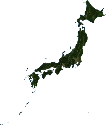
 Japan
Japan: earthquakes and wildfires
Latest earthquakes and active wildfires in Japan on a live map, the strongest earthquakes and largest fires on record, and statistics by year.
Live map – Japan
Key statistics (30 days)
Earthquakes M2.5+ and the wildfire fronts shown on the map.
Fire danger
Forecast for the area around: Yokohama. Danger can vary locally; follow official guidance. Source: Copernicus EMS – EFFIS (FWI).
Severe weather (forecast)
- Today: Rain – Very heavy rain (25–50 mm) · Tokyo
- Tomorrow: Rain – Very heavy rain (25–50 mm) · Tokyo
Forecast for the area around: Japan. It does not replace warnings from the national weather service. Source: ECMWF / Copernicus EMS.
Recent events in Japan
- 3.42 h agoM3.4 earthquake near Hamamatsu, Japan – now34 km N of Hamamatsu, Japan
- 5 h agoWildfire near Kitakyushu, Japan – active60 km² · 7 km N of Kitakyushu, Japan
- 5 h agoWildfire near Himeji, Japan – active30 km² · 16 km SE of Himeji, Japan
- 5 h agoWildfire near Fukuyama, Japan – active36 km² · 6 km ESE of Fukuyama, Japan
- 5 h agoWildfire near Nagoya, Japan – active50 km² · 17 km S of Nagoya, Japan
- 5 h agoWildfire near Inabe, Japan – active7.4 km² · 8 km NW of Inabe, Japan
Historical overview
Earthquakes M3.0+ and significant events of other hazards.
About Japan
Japan has recorded 43,312 earthquakes of magnitude 3.0 or more since 1976. The strongest was M9.1 in 2011.
Satellites have detected 17 significant wildfires here; the largest burned about 67 km².
The area has also been affected by 4 tropical cyclones, floods, volcanic events or tsunami messages.
Know the official emergency number, prepare an emergency kit and follow the instructions of your civil protection authority.
Learn more ›Earthquakes
43,312 earthquakes of magnitude 3.0 or more since 1976. The strongest was M9.1.
Recent earthquakes
| Mag | Location | Time (UTC) | Depth |
|---|---|---|---|
| 3.4 | 34 km N of Hamamatsu, Japan | 40.0 km | |
| 3.1 | near Honmachi, Japan | 10.0 km | |
| 3.6 | 54 km SSE of Iwaki, Japan | 40.0 km | |
| 3.8 | 48 km SSW of Koto, Japan | 10.0 km | |
| 3.7 | 40 km S of Iwaki, Japan | 90.0 km | |
| 3.9 | near Honmachi, Japan | 10.0 km | |
| 4.2 | 69 km ESE of Nemuro, Japan | 30.0 km | |
| 4.6 | 75 km S of Yudomari, Japan | 40.9 km | |
| 3.5 | 8 km E of Odacho-oda, Japan | 10.0 km | |
| 4.3 | 183 km WSW of Ogasawara, Japan | 483.9 km |
Show all (200)
Strongest earthquakes on record
| Mag | Location | Time (UTC) | Depth |
|---|---|---|---|
| 9.1 | 95 km E of Ishinomaki, Japan | 29.0 km | |
| 8.3 | 67 km ESE of Erimo, Japan | 27.0 km | |
| 7.9 | 54 km SE of Hitachi, Japan | 43.0 km | |
| 7.8 | 188 km WNW of Ogasawara, Japan | 664.0 km | |
| 7.8 | 145 km ENE of Kuji, Japan | 27.0 km | |
| 7.7 | 70 km NW of Setana, Japan | 17.0 km | |
| 7.7 | 117 km W of Hirosaki, Japan | 24.0 km | |
| 7.7 | 68 km ESE of Ishinomaki, Japan | 44.0 km | |
| 7.6 | 80 km NE of Hachinohe, Japan | 45.0 km | |
| 7.6 | 272 km ESE of Kamaishi, Japan | 19.0 km | |
| 7.6 | 58 km NE of Obihiro, Japan | 102.0 km | |
| 7.5 | 6 km N of Suzu, Japan | 10.0 km | |
| 7.5 | 255 km SSE of Ishigaki, Japan | 33.0 km | |
| 7.4 | 100 km ENE of Miyako, Japan | 35.0 km | |
| 7.4 | 150 km E of Ogasawara, Japan | 14.0 km |
Earthquakes per year (M3.0+)
Year
| 2026 | 1,059 | M7.4 |
| 2025 | 1,176 | M7.6 |
| 2024 | 1,078 | M7.5 |
| 2023 | 914 | M6.3 |
| 2022 | 1,266 | M7.3 |
| 2021 | 952 | M7.1 |
| 2020 | 829 | M6.6 |
| 2019 | 754 | M6.4 |
| 2018 | 850 | M6.6 |
| 2017 | 784 | M6.2 |
| 2016 | 1,137 | M7.0 |
| 2015 | 1,026 | M7.8 |
| 2014 | 1,105 | M6.5 |
| 2013 | 933 | M6.9 |
| 2012 | 1,307 | M7.2 |
| 2011 | 5,533 | M9.1 |
| 2010 | 1,170 | M7.4 |
| 2009 | 461 | M7.1 |
| 2008 | 1,384 | M6.9 |
| 2007 | 1,043 | M6.8 |
| 2006 | 896 | M6.3 |
| 2005 | 1,146 | M7.2 |
| 2004 | 1,123 | M7.4 |
| 2003 | 884 | M8.3 |
| 2002 | 733 | M6.4 |
| 2001 | 624 | M6.8 |
| 2000 | 1,339 | M6.8 |
| 1999 | 549 | M6.4 |
| 1998 | 675 | M7.5 |
| 1997 | 685 | M6.3 |
| 1996 | 875 | M6.7 |
| 1995 | 828 | M7.1 |
| 1994 | 538 | M7.8 |
| 1993 | 575 | M7.7 |
| 1992 | 561 | M7.0 |
| 1991 | 363 | M6.7 |
| 1990 | 417 | M6.5 |
| 1989 | 594 | M7.4 |
| 1988 | 334 | M6.3 |
| 1987 | 369 | M6.8 |
| 1986 | 562 | M6.6 |
| 1985 | 668 | M6.5 |
| 1984 | 392 | M7.2 |
| 1983 | 481 | M7.7 |
| 1982 | 468 | M6.8 |
| 1981 | 322 | M6.9 |
| 1980 | 358 | M6.3 |
| 1979 | 288 | M6.4 |
| 1978 | 369 | M7.7 |
| 1977 | 258 | M6.8 |
| 1976 | 275 | M6.3 |
Wildfires
17 major fires since 2026. The largest covered about 67 km².
Recent fires
| Area | Location | Since | Status |
|---|---|---|---|
| 60 km² | 7 km N of Kitakyushu, Japan | Active | |
| 30 km² | 16 km SE of Himeji, Japan | Active | |
| 36 km² | 6 km ESE of Fukuyama, Japan | Active | |
| 50 km² | 17 km S of Nagoya, Japan | Active | |
| 7.4 km² | 8 km NW of Inabe, Japan | Active | |
| 12 km² | 32 km WSW of Himeji, Japan | Active | |
| 12 km² | 38 km W of Hamamatsu, Japan | Active | |
| 6.8 km² | 10 km E of Kagoshima, Japan | Active | |
| 6.9 km² | 29 km SW of Utsunomiya, Japan | Active | |
| 5.1 km² | near Kawasaki, Japan | Active |
Show all (31)
| Area | Location | Since | Status |
|---|---|---|---|
| 43 km² | 21 km ESE of Yokohama, Japan | Active | |
| 20 km² | near Chiba, Japan | Active | |
| 4.3 km² | 5 km SSE of Fukayacho, Japan | Active | |
| 34 km² | near Kashima-shi, Japan | Active | |
| 3.3 km² | near Hokuto, Japan | Active | |
| 20 km² | near Muroran, Japan | Active | |
| 12 km² | near Hachinohe, Japan | Active | |
| 33 km² | near Minato, Japan | Inactive | |
| 4.4 km² | near Ofunato, Japan | Inactive | |
| 4.6 km² | near Fujioka, Japan | Inactive | |
| 3.8 km² | 275 km SSW of Ogasawara, Japan | Inactive | |
| 18 km² | 5 km NE of Oita, Japan | Inactive | |
| 18 km² | near Tokuyama, Japan | Inactive | |
| 3.1 km² | 33 km NNE of Okinawa, Japan | Inactive | |
| 7.5 km² | near Sakai, Japan | Inactive | |
| 67 km² | 9 km SSW of Kurashiki, Japan | Inactive | |
| 4.9 km² | 35 km SSW of Okayama, Japan | Inactive | |
| 3.7 km² | 25 km ESE of Oita, Japan | Inactive | |
| 5.9 km² | near Itoigawa, Japan | Inactive | |
| 12 km² | 33 km ENE of Koto, Japan | Inactive | |
| 12 km² | 10 km WSW of Gotemba, Japan | Inactive |
Largest fires on record
| Area | Location | Since | Status |
|---|---|---|---|
| 67 km² | 9 km SSW of Kurashiki, Japan | Inactive | |
| 58 km² | 7 km N of Kitakyushu, Japan | Inactive | |
| 49 km² | 17 km S of Nagoya, Japan | Active | |
| 41 km² | 21 km ESE of Yokohama, Japan | Active | |
| 34 km² | 6 km ESE of Fukuyama, Japan | Active | |
| 34 km² | near Kashima-shi, Japan | Active | |
| 33 km² | near Minato, Japan | Active | |
| 28 km² | 16 km SE of Himeji, Japan | Active | |
| 20 km² | near Muroran, Japan | Active | |
| 20 km² | near Chiba, Japan | Active | |
| 18 km² | near Tokuyama, Japan | Inactive | |
| 18 km² | 5 km NE of Oita, Japan | Inactive | |
| 12 km² | 32 km WSW of Himeji, Japan | Active | |
| 12 km² | 38 km W of Hamamatsu, Japan | Active | |
| 12 km² | 33 km ENE of Koto, Japan | Inactive |
Storms
Last 12 months
| Level | Location | Time | Status |
|---|---|---|---|
| Green | Tropical cyclone CEMPAKA-26 – Japan | Inactive | |
| Green | Tropical cyclone IN-FA-26 – Japan | Inactive | |
| Red | Tropical cyclone CHAMPI-26 – Japan | Inactive | |
| Green | Tropical cyclone TWENTYEIGHT-26 – Japan | Inactive |
Significant events on record
| Level | Location | Time | Status |
|---|---|---|---|
| Green | Tropical cyclone CEMPAKA-26 – Japan | Inactive | |
| Green | Tropical cyclone IN-FA-26 – Japan | Inactive | |
| Red | Tropical cyclone CHAMPI-26 – Japan | Inactive | |
| Green | Tropical cyclone TWENTYEIGHT-26 – Japan | Inactive |
Regions
- Tokyo
- Hokkaido
- Okinawa
- Iwate
- Chiba
- Fukushima
- Kagoshima
- Miyagi
- Ibaraki
- Aomori
- Shizuoka
- Miyazaki
- Ishikawa
- Mie
- Wakayama
- Niigata
- Kanagawa
- Akita
- Kumamoto
- Saitama
- Nagano
- Tochigi
- Shimane
- Oita
- Fukui
- Gifu
- Kyoto
- Aichi
- Ehime
- Toyama
- Yamagata
- Gunma
- Hyōgo
- Nagasaki
- Kochi
- Tokushima
- Tottori
- Nara
- Osaka
- Fukuoka
- Shiga
- Yamaguchi
- Yamanashi
- Hiroshima
- Okayama
Places
- Tokyo
- Yokohama
- Osaka
- Nagoya
- Sapporo
- Fukuoka
- Kawasaki
- Kobe
- Kyoto
- Saitama
- Hiroshima
- Sendai
- Chiba
- Kitakyushu
- Setagaya
- Sakai
- Niigata
- Hamamatsu
- Ōta-ku
- Kumamoto
- Aihara
- Okayama
- Sagamihara
- Edogawe
- Adachi
- Shizuoka
- Honcho
- Kawaguchi
- Kagoshima
- Suginami
- Itabashi
- Hachioji
- Koto
- Himeji
- Utsunomiya
- Matsuyama
- Matsudo
- Ichikawa
- Higashiosaka
- Nishinomiya
- Kurashiki
- Oita
- Fukuyama
- Kanazawa
- Amagasaki
- Katsushika-ku
- Fujisawa
- Kashiwa
- Machida
- Toyota
- Shinagawa
- Takamatsu
- Toyama
- Yokosuka
- Nagasaki
- Hirakata
- Gifu
- Toyonaka
- Miyazaki
- Suita
- Okazaki
- Ichinomiya
- Toyohashi
- Minato
- Takasaki
- Nagano
- Nara-shi
- Iwaki
- Wakayama
- Kawagoe
- Takatsuki
- Shinjuku
- Koshigaya
- Otsu
- Nakano
- Tokorozawa
- Asahikawa
- Maebashi
- Kita-ku
- Kochi