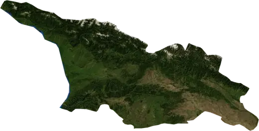
 Georgia
: earthquakes and wildfires
Latest earthquakes and active wildfires in Georgia on a live map, the strongest earthquakes and largest fires on record, and statistics by year.
Live map – Georgia
Key statistics (30 days)
Earthquakes M2.5+ and the wildfire fronts shown on the map.
Fire danger
Forecast for the area around: Tbilisi. Danger can vary locally; follow official guidance. Source: Copernicus EMS – EFFIS (FWI).
Severe weather (forecast)
- Today: Rain – Very heavy rain (25–50 mm) · Batumi
- Tomorrow: Rain – Very heavy rain (25–50 mm) · Batumi
Forecast for the area around: Georgia. It does not replace warnings from the national weather service. Source: ECMWF / Copernicus EMS.
Recent events in Georgia
- 4.069 days agoM4.0 earthquake near Khashuri, Georgia38 km S of Khashuri, Georgia
- 98 days agoWildfire near Dedoplistsqaro, Georgia58 km² · 18 km ESE of Dedoplistsqaro, Georgia
- 4.1146 days agoM4.1 earthquake near Kutaisi, Georgia40 km NE of Kutaisi, Georgia
- 352 days agoWildfire near Ts'khinvali, Georgia11 km² · 31 km NNW of Ts'khinvali, Georgia
- 357 days agoWildfire near Ts'khinvali, Georgia11 km² · 33 km NNW of Ts'khinvali, Georgia
Historical overview
Earthquakes M3.0+ and significant events of other hazards.
About Georgia
Georgia has recorded 228 earthquakes of magnitude 3.0 or more since 1977. The strongest was M7.0 in 1991.
Satellites have detected 3 significant wildfires here; the largest burned about 58 km².
Know the official emergency number, prepare an emergency kit and follow the instructions of your civil protection authority.
Learn more ›Earthquakes
228 earthquakes of magnitude 3.0 or more since 1977. The strongest was M7.0.
Recent earthquakes
| Mag | Location | Time (UTC) | Depth |
|---|---|---|---|
| 4.0 | 38 km S of Khashuri, Georgia | 10.5 km | |
| 4.1 | 40 km NE of Kutaisi, Georgia | 14.3 km |
Strongest earthquakes on record
| Mag | Location | Time (UTC) | Depth |
|---|---|---|---|
| 7.0 | 35 km NW of Ts'khinvali, Georgia | 17.0 km | |
| 6.1 | 26 km N of Ts'khinvali, Georgia | 9.0 km | |
| 6.1 | 31 km N of Ts'khinvali, Georgia | 14.3 km | |
| 6.0 | 8 km N of Oni, Georgia | 15.0 km | |
| 6.0 | 8 km N of Oni, Georgia | 15.0 km | |
| 5.7 | 58 km WNW of Poti, Georgia | 15.2 km | |
| 5.7 | 64 km S of Khashuri, Georgia | 10.0 km | |
| 5.6 | 65 km NE of Kutaisi, Georgia | 10.0 km | |
| 5.5 | 11 km E of Lagodekhi, Georgia | 10.0 km | |
| 5.5 | 43 km NNW of Ts'khinvali, Georgia | 10.0 km | |
| 5.5 | 10 km NNE of Satkhe, Georgia | 33.0 km | |
| 5.4 | 22 km NE of Ts'khinvali, Georgia | 20.4 km | |
| 5.4 | 10 km WSW of Oni, Georgia | 10.0 km | |
| 5.4 | 32 km N of Ts'khinvali, Georgia | 10.0 km | |
| 5.4 | 20 km N of Kvareli, Georgia | 33.0 km |
Earthquakes per year (M3.0+)
Year
| 2026 | 2 | M4.1 |
| 2025 | 1 | M3.0 |
| 2024 | 10 | M4.9 |
| 2023 | 5 | M4.4 |
| 2022 | 5 | M4.7 |
| 2021 | 2 | M4.1 |
| 2020 | 1 | M4.3 |
| 2019 | 1 | M4.4 |
| 2018 | 3 | M5.0 |
| 2017 | 3 | M4.7 |
| 2016 | 4 | M4.8 |
| 2015 | 3 | M4.4 |
| 2014 | 2 | M4.1 |
| 2013 | 5 | M5.3 |
| 2012 | 7 | M5.7 |
| 2011 | 5 | M5.2 |
| 2010 | 2 | M4.2 |
| 2009 | 7 | M6.0 |
| 2008 | 1 | M3.7 |
| 2007 | 2 | M3.7 |
| 2006 | 10 | M5.3 |
| 2005 | 4 | M4.5 |
| 2004 | 1 | M3.7 |
| 2002 | 3 | M4.4 |
| 2001 | 3 | M3.9 |
| 2000 | 2 | M4.6 |
| 1999 | 3 | M4.4 |
| 1998 | 3 | M4.6 |
| 1997 | 2 | M5.3 |
| 1996 | 3 | M4.5 |
| 1995 | 1 | M4.0 |
| 1994 | 10 | M5.0 |
| 1993 | 3 | M5.0 |
| 1992 | 10 | M4.8 |
| 1991 | 70 | M7.0 |
| 1990 | 3 | M5.5 |
| 1989 | 2 | M4.8 |
| 1988 | 2 | M5.0 |
| 1987 | 1 | M4.4 |
| 1986 | 2 | M5.7 |
| 1985 | 1 | M5.4 |
| 1984 | 3 | M4.8 |
| 1983 | 1 | M4.4 |
| 1982 | 5 | M4.7 |
| 1981 | 1 | M5.1 |
| 1979 | 3 | M4.4 |
| 1978 | 3 | M5.3 |
| 1977 | 2 | M4.5 |
Wildfires
3 major fires since 2025. The largest covered about 58 km².
Recent fires
| Area | Location | Since | Status |
|---|---|---|---|
| 58 km² | 18 km ESE of Dedoplistsqaro, Georgia | Inactive | |
| 11 km² | 31 km NNW of Ts'khinvali, Georgia | Inactive | |
| 11 km² | 33 km NNW of Ts'khinvali, Georgia | Inactive |
Largest fires on record
| Area | Location | Since | Status |
|---|---|---|---|
| 58 km² | 18 km ESE of Dedoplistsqaro, Georgia | Inactive | |
| 11 km² | 31 km NNW of Ts'khinvali, Georgia | Inactive | |
| 11 km² | 33 km NNW of Ts'khinvali, Georgia | Inactive |
Major fires per year
Year
| 2026 | 1 | 58 km² |
| 2025 | 2 | 11 km² |