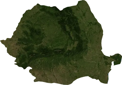
 Romania
: earthquakes and wildfires
Latest earthquakes and active wildfires in Romania on a live map, the strongest earthquakes and largest fires on record, and statistics by year.
Live map – Romania
Key statistics (30 days)
Earthquakes M2.5+ and the wildfire fronts shown on the map.
Fire danger
Forecast for the area around: Bucharest. Danger can vary locally; follow official guidance. Source: Copernicus EMS – EFFIS (FWI).
Severe weather (forecast)
- Today: Rain – Extreme rain (≥ 50 mm) · Baia Mare
- Tomorrow: Rain – Extreme rain (≥ 50 mm) · Baia Mare
Forecast for the area around: Romania. It does not replace warnings from the national weather service. Source: ECMWF / Copernicus EMS.
Recent events in Romania
- 4.627 days agoM4.6 earthquake near Lunca Jaristei, Romanianear Lunca Jaristei, Romania
- 36 days agoWildfire near Baile Herculane, Romania17 km² · near Baile Herculane, Romania
- 38 days agoWildfire near Orsova, Romania18 km² · near Orsova, Romania
- 4.170 days agoM4.1 earthquake near Tudor Vladimirescu, Romanianear Tudor Vladimirescu, Romania
- 4.382 days agoM4.3 earthquake near Gura Teghii, Romania14 km N of Gura Teghii, Romania
- 4.293 days agoM4.2 earthquake near Crisan, Romania164 km SE of Crisan, Romania
Historical overview
Earthquakes M3.0+ and significant events of other hazards.
About Romania
Romania has recorded 752 earthquakes of magnitude 3.0 or more since 1976. The strongest was M7.5 in 1977.
Satellites have detected 2 significant wildfires here; the largest burned about 18 km².
Know the official emergency number, prepare an emergency kit and follow the instructions of your civil protection authority.
Learn more ›Earthquakes
752 earthquakes of magnitude 3.0 or more since 1976. The strongest was M7.5.
Recent earthquakes
| Mag | Location | Time (UTC) | Depth |
|---|---|---|---|
| 4.6 | near Lunca Jaristei, Romania | 130.0 km | |
| 4.1 | near Tudor Vladimirescu, Romania | 10.0 km | |
| 4.3 | 14 km N of Gura Teghii, Romania | 149.2 km | |
| 4.2 | 164 km SE of Crisan, Romania | 11.0 km | |
| 4.6 | 9 km SSE of Sita Buzaului, Romania | 139.9 km | |
| 4.5 | near Paltin, Romania | 115.8 km |
Strongest earthquakes on record
| Mag | Location | Time (UTC) | Depth |
|---|---|---|---|
| 7.5 | near Paltin, Romania | 89.0 km | |
| 6.9 | 15 km N of Nehoiu, Romania | 132.0 km | |
| 6.7 | 5 km W of Nistoresti, Romania | 89.0 km | |
| 6.1 | near Naruja, Romania | 88.0 km | |
| 5.8 | 7 km W of Paltin, Romania | 96.0 km | |
| 5.6 | 9 km NW of Targu Jiu, Romania | 10.0 km | |
| 5.6 | 13 km W of Nereju Mic, Romania | 97.0 km | |
| 5.6 | 7 km WNW of Nereju Mic, Romania | 92.0 km | |
| 5.6 | 5 km E of Panciu, Romania | 32.0 km | |
| 5.6 | 35 km NW of Drobeta-Turnu Severin, Romania | 12.0 km | |
| 5.6 | near Livezile, Romania | 11.0 km | |
| 5.5 | 27 km SE of Covasna, Romania | 151.0 km | |
| 5.5 | 30 km SSW of Timisoara, Romania | 9.0 km | |
| 5.4 | 6 km WSW of Lunca Jaristei, Romania | 155.9 km | |
| 5.3 | 9 km W of Nereju Mic, Romania | 127.0 km |
Earthquakes per year (M3.0+)
Year
| 2026 | 6 | M4.6 |
| 2025 | 6 | M4.4 |
| 2024 | 7 | M5.2 |
| 2023 | 19 | M5.6 |
| 2022 | 7 | M5.1 |
| 2021 | 7 | M4.5 |
| 2020 | 9 | M4.9 |
| 2019 | 6 | M4.6 |
| 2018 | 6 | M5.5 |
| 2017 | 12 | M4.7 |
| 2016 | 5 | M5.6 |
| 2015 | 18 | M4.5 |
| 2014 | 16 | M5.6 |
| 2013 | 11 | M5.3 |
| 2012 | 7 | M4.7 |
| 2011 | 4 | M4.7 |
| 2010 | 2 | M4.5 |
| 2009 | 5 | M5.2 |
| 2008 | 40 | M4.5 |
| 2007 | 41 | M4.4 |
| 2006 | 51 | M4.6 |
| 2005 | 84 | M5.2 |
| 2004 | 22 | M5.8 |
| 2003 | 6 | M4.5 |
| 2002 | 13 | M5.0 |
| 2001 | 7 | M5.3 |
| 2000 | 8 | M5.2 |
| 1999 | 12 | M5.4 |
| 1998 | 7 | M5.2 |
| 1997 | 9 | M4.7 |
| 1996 | 10 | M4.8 |
| 1995 | 13 | M4.9 |
| 1994 | 18 | M4.7 |
| 1993 | 16 | M5.0 |
| 1992 | 20 | M5.2 |
| 1991 | 64 | M5.6 |
| 1990 | 21 | M6.7 |
| 1989 | 11 | M4.7 |
| 1988 | 7 | M4.7 |
| 1987 | 14 | M4.7 |
| 1986 | 17 | M6.9 |
| 1985 | 9 | M5.2 |
| 1984 | 10 | M4.7 |
| 1983 | 13 | M4.8 |
| 1982 | 9 | M4.3 |
| 1981 | 6 | M5.0 |
| 1980 | 6 | M4.7 |
| 1979 | 16 | M5.1 |
| 1978 | 9 | M5.0 |
| 1977 | 6 | M7.5 |
| 1976 | 4 | M5.2 |
Wildfires
2 major fires since 2026. The largest covered about 18 km².
Recent fires
| Area | Location | Since | Status |
|---|---|---|---|
| 17 km² | near Baile Herculane, Romania | Inactive | |
| 18 km² | near Orsova, Romania | Inactive |
Largest fires on record
| Area | Location | Since | Status |
|---|---|---|---|
| 18 km² | near Orsova, Romania | Inactive | |
| 17 km² | near Baile Herculane, Romania | Inactive |
Regions
Places
- Bucharest
- Sector 3
- Iași
- Sector 6
- Constanta
- Sector 2
- Sector 4
- Cluj-Napoca
- Sector 5
- Brasov
- Timisoara
- Craiova
- Sector 1
- Galati
- Targu Mures
- Oradea
- Ploiesti
- Arad
- Braila
- Pitesti
- Bacau
- Sibiu
- Satu Mare
- Baia Mare
- Buzau
- Piatra Neamt
- Ramnicu Valcea
- Resita
- Drobeta-Turnu Severin
- Targu Jiu
- Hunedoara
- Roman
- Barlad
- Deva
- Targoviste
- Focsani
- Tulcea
- Alba Iulia
- Slatina
- Vaslui
- Giurgiu
- Zalau
- Sfantu Gheorghe
- Pascani
- Petrosani
- Medgidia
- Lugoj
- Campina
- Slobozia
- Tecuci
- Sighetu Marmatiei
- Alexandria
- Mangalia
- Ramnicu Sarat
- Dej
- Odorheiu Secuiesc
- Sighisoara
- Miercurea-Ciuc
- Navodari
- Fetesti
- Curtea de Arges
- Fagaras
- Lupeni
- Voluntari
- Sacele
- Falticeni
- Husi
- Mioveni
- Turnu Magurele
- Caransebes
- Rosiorii de Vede
- Sebes
- Borsa
- Petrila
- Zarnesti
- Cugir
- Moinesti
- Fetesti-Gara
- Comanesti
- Oltenita