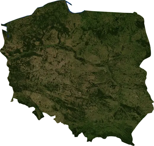
 Poland
: earthquakes and wildfires
Latest earthquakes and active wildfires in Poland on a live map, the strongest earthquakes and largest fires on record, and statistics by year.
Live map – Poland
Key statistics (30 days)
Earthquakes M2.5+ and the wildfire fronts shown on the map.
Fire danger
Forecast for the area around: Warsaw. Danger can vary locally; follow official guidance. Source: Copernicus EMS – EFFIS (FWI).
Severe weather (forecast)
- Today: Rain – Heavy rain (10–25 mm) · Krakow
- Tomorrow: Rain – Heavy rain (10–25 mm) · Krakow
Forecast for the area around: Poland. It does not replace warnings from the national weather service. Source: ECMWF / Copernicus EMS.
Recent events in Poland
- 10 h agoWildfire near Glogow, Poland – active8.1 km² · 8 km WNW of Glogow, Poland
- 10 h agoWildfire near Legnica, Poland – active12 km² · near Legnica, Poland
- 11 h agoWildfire near Dabrowa Gornicza, Poland – active20 km² · 6 km E of Dabrowa Gornicza, Poland
- 12 h agoWildfire near Zdzieszowice, Poland – active15 km² · near Zdzieszowice, Poland
- 12 h agoWildfire near Krapkowice, Poland – active5.9 km² · 7 km N of Krapkowice, Poland
- 36 h agoWildfire near Czestochowa, Poland – active11 km² · near Czestochowa, Poland
Historical overview
Earthquakes M3.0+ and significant events of other hazards.
About Poland
Poland has recorded 2,829 earthquakes of magnitude 3.0 or more since 1977. The strongest was M5.8 in 1983.
Satellites have detected 5 significant wildfires here; the largest burned about 20 km².
Know the official emergency number, prepare an emergency kit and follow the instructions of your civil protection authority.
Learn more ›Earthquakes
2,829 earthquakes of magnitude 3.0 or more since 1977. The strongest was M5.8.
Recent earthquakes
| Mag | Location | Time (UTC) | Depth |
|---|---|---|---|
| 4.7 | 11 km NW of Polkowice, Poland | 5.0 km | |
| 4.4 | near Polkowice, Poland | 5.0 km | |
| 4.3 | 6 km N of Polkowice, Poland | 5.0 km | |
| 4.0 | near Polkowice, Poland | 5.0 km | |
| 4.9 | near Polkowice, Poland | 5.0 km | |
| 4.2 | 9 km NNW of Polkowice, Poland | 5.0 km | |
| 4.2 | 5 km E of Polkowice, Poland | 5.0 km | |
| 4.1 | near Polkowice, Poland | 5.0 km |
Strongest earthquakes on record
| Mag | Location | Time (UTC) | Depth |
|---|---|---|---|
| 5.8 | 7 km WSW of Glogow, Poland | 10.0 km | |
| 5.4 | 9 km NNW of Polkowice, Poland | 5.0 km | |
| 5.3 | near Glogow, Poland | 10.0 km | |
| 5.1 | near Radlin, Poland | 10.0 km | |
| 5.0 | 14 km ENE of Polkowice, Poland | 5.0 km | |
| 5.0 | near Polkowice, Poland | 5.0 km | |
| 5.0 | 16 km ENE of Boleslawiec, Poland | 33.0 km | |
| 4.9 | near Polkowice, Poland | 5.0 km | |
| 4.9 | 10 km NE of Polkowice, Poland | 10.0 km | |
| 4.9 | 11 km NE of Polkowice, Poland | 10.0 km | |
| 4.9 | 11 km WSW of Lubin, Poland | 5.0 km | |
| 4.9 | 6 km N of Polkowice, Poland | 1.0 km | |
| 4.9 | 26 km NNW of Legnica, Poland | 5.0 km | |
| 4.9 | 20 km WSW of Legnica, Poland | 10.0 km | |
| 4.9 | 5 km SE of Polkowice, Poland | 13.0 km |
Earthquakes per year (M3.0+)
Year
| 2026 | 8 | M4.9 |
| 2025 | 12 | M4.7 |
| 2024 | 4 | M4.4 |
| 2023 | 6 | M4.6 |
| 2022 | 7 | M4.7 |
| 2021 | 4 | M4.4 |
| 2020 | 4 | M5.0 |
| 2019 | 7 | M4.9 |
| 2018 | 6 | M4.9 |
| 2017 | 5 | M4.6 |
| 2016 | 6 | M4.7 |
| 2015 | 5 | M4.7 |
| 2014 | 5 | M4.5 |
| 2012 | 4 | M4.4 |
| 2011 | 6 | M4.5 |
| 2010 | 13 | M5.0 |
| 2009 | 6 | M4.7 |
| 2008 | 59 | M4.6 |
| 2007 | 65 | M4.6 |
| 2006 | 107 | M4.8 |
| 2005 | 126 | M4.4 |
| 2004 | 139 | M4.8 |
| 2003 | 123 | M4.8 |
| 2002 | 146 | M4.9 |
| 2001 | 159 | M4.8 |
| 2000 | 151 | M4.9 |
| 1999 | 158 | M5.4 |
| 1998 | 192 | M4.6 |
| 1997 | 181 | M4.4 |
| 1996 | 109 | M4.3 |
| 1995 | 71 | M4.6 |
| 1994 | 62 | M4.5 |
| 1993 | 117 | M4.5 |
| 1992 | 104 | M4.4 |
| 1991 | 57 | M4.5 |
| 1990 | 76 | M4.5 |
| 1989 | 68 | M5.3 |
| 1988 | 77 | M4.4 |
| 1987 | 73 | M4.9 |
| 1986 | 81 | M4.9 |
| 1985 | 58 | M4.7 |
| 1984 | 49 | M4.4 |
| 1983 | 36 | M5.8 |
| 1982 | 26 | M4.9 |
| 1981 | 14 | M4.8 |
| 1980 | 24 | M4.8 |
| 1979 | 10 | M4.3 |
| 1978 | 2 | M4.0 |
| 1977 | 1 | M5.0 |
Wildfires
5 major fires since 2025. The largest covered about 20 km².
Recent fires
| Area | Location | Since | Status |
|---|---|---|---|
| 8.1 km² | 8 km WNW of Glogow, Poland | Active | |
| 12 km² | near Legnica, Poland | Active | |
| 20 km² | 6 km E of Dabrowa Gornicza, Poland | Active | |
| 15 km² | near Zdzieszowice, Poland | Active | |
| 5.9 km² | 7 km N of Krapkowice, Poland | Active | |
| 11 km² | near Czestochowa, Poland | Active | |
| 18 km² | near Plock, Poland | Active |
Largest fires on record
| Area | Location | Since | Status |
|---|---|---|---|
| 20 km² | 6 km E of Dabrowa Gornicza, Poland | Active | |
| 18 km² | near Plock, Poland | Active | |
| 15 km² | near Zdzieszowice, Poland | Active | |
| 12 km² | near Legnica, Poland | Active | |
| 11 km² | near Czestochowa, Poland | Active |
Major fires per year
Year
| 2026 | 3 | 18 km² |
| 2025 | 2 | 20 km² |
Regions
Places
- Warsaw
- Krakow
- Wroclaw
- Lodz
- Poznan
- Gdansk
- Bydgoszcz
- Katowice
- Gdynia
- Czestochowa
- Sosnowiec
- Radom
- Mokotow
- Gliwice
- Rzeszow
- Torun
- Kielce
- Zabrze
- Bytom
- Praga Poludnie
- Bielsko-Biala
- Ursynow
- Ruda Slaska
- Rybnik
- Wola
- Bielany
- Tychy
- Bialoleka
- Opole
- Elblag
- Plock
- Walbrzych
- Targowek
- Bemowo
- Wloclawek
- Zielona Gora
- Tarnow
- Dabrowa Gornicza
- Gorzow Wielkopolski
- Chorzow
- Kalisz
- Legnica
- Srodmiescie
- Srodmiescie
- Jaworzno
- Jastrzebie Zdroj
- Psie Pole
- Praga Polnoc
- Nowy Sacz
- Ochota
- Konin
- Piotrkow Trybunalski
- Lubin
- Jelenia Gora
- Wawer
- Ostrowiec Swietokrzyski
- Siemianowice Slaskie
- Ostrow Wielkopolski
- Myslowice
- Pabianice
- Gniezno
- Tomaszow Mazowiecki
- Kedzierzyn-Kozle
- Glogow
- Leszno
- Zory
- Belchatow
- Tarnowskie Gory
- Swidnica
- Piekary Slaskie
- Mielec
- Raciborz
- Bedzin
- Zgierz
- Swietochlowice
- Pruszkow
- Starachowice
- Zawiercie
- Zoliborz
- Legionowo