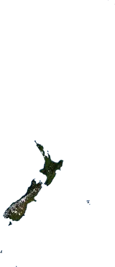
 New Zealand
: earthquakes and wildfires
Latest earthquakes and active wildfires in New Zealand on a live map, the strongest earthquakes and largest fires on record, and statistics by year.
Live map – New Zealand
Key statistics (30 days)
Earthquakes M2.5+ and the wildfire fronts shown on the map.
Fire danger
Forecast for the area around: Auckland. Danger can vary locally; follow official guidance. Source: Copernicus EMS – EFFIS (FWI).
Severe weather (forecast)
- Today: Rain – Very heavy rain (25–50 mm) · Auckland
- Tomorrow: Rain – Very heavy rain (25–50 mm) · Auckland
Forecast for the area around: New Zealand. It does not replace warnings from the national weather service. Source: ECMWF / Copernicus EMS.
Recent events in New Zealand
- 3.14 h agoM3.1 earthquake near Te Anau, New Zealand – now58 km N of Te Anau, New Zealand
- 3.07 h agoM3.0 earthquake near Whakatane, New Zealand130 km NE of Whakatane, New Zealand
- 9 h agoWildfire near Manukau City, New Zealand – active13 km² · 27 km SSW of Manukau City, New Zealand
- 3.217 h agoM3.2 earthquake near Waikowhai, New Zealand158 km W of Waikowhai, New Zealand
- 3.219 h agoM3.2 earthquake near Nelson, New Zealand97 km N of Nelson, New Zealand
- 3.620 h agoM3.6 earthquake near Colville, New Zealand13 km NNW of Colville, New Zealand
Historical overview
Earthquakes M3.0+ and significant events of other hazards.
About New Zealand
New Zealand has recorded 9,997 earthquakes of magnitude 3.0 or more since 1976. The strongest was M7.8 in 2016.
Satellites have detected 2 significant wildfires here; the largest burned about 22 km².
Know the official emergency number, prepare an emergency kit and follow the instructions of your civil protection authority.
Learn more ›Earthquakes
Earthquakes today: New Zealand →
9,997 earthquakes of magnitude 3.0 or more since 1976. The strongest was M7.8.
Recent earthquakes
| Mag | Location | Time (UTC) | Depth |
|---|---|---|---|
| 3.1 | 58 km N of Te Anau, New Zealand | 62.4 km | |
| 3.0 | 130 km NE of Whakatane, New Zealand | 75.0 km | |
| 3.2 | 158 km W of Waikowhai, New Zealand | 389.0 km | |
| 3.2 | 97 km N of Nelson, New Zealand | 10.0 km | |
| 3.6 | 13 km NNW of Colville, New Zealand | 623.5 km | |
| 3.2 | 206 km N of Hicks Bay, New Zealand | 172.8 km | |
| 3.2 | 78 km NW of Rolleston, New Zealand | 5.0 km | |
| 4.9 | 78 km NW of Rolleston, New Zealand | 14.4 km | |
| 3.1 | 86 km N of Whakatane, New Zealand | 229.3 km | |
| 3.1 | 90 km NNW of Ashburton, New Zealand | 10.0 km |
Show all (145)
Strongest earthquakes on record
| Mag | Location | Time (UTC) | Depth |
|---|---|---|---|
| 7.8 | 74 km NNE of Rangiora, New Zealand | 15.0 km | |
| 7.8 | 98 km WSW of Te Anau, New Zealand | 12.0 km | |
| 7.5 | 180 km WSW of Riverton, New Zealand | 33.0 km | |
| 7.3 | 101 km E of Hicks Bay, New Zealand | 20.0 km | |
| 7.2 | 57 km NW of Te Anau, New Zealand | 28.0 km | |
| 7.1 | 255 km W of Riverton, New Zealand | 10.0 km | |
| 7.1 | 208 km ENE of Hicks Bay, New Zealand | 33.0 km | |
| 7.1 | 44 km ESE of Hicks Bay, New Zealand | 21.0 km | |
| 7.0 | 79 km ENE of Hicks Bay, New Zealand | 19.0 km | |
| 7.0 | 43 km N of Ashburton, New Zealand | 12.0 km | |
| 7.0 | 64 km WNW of Te Anau, New Zealand | 28.1 km | |
| 6.8 | 71 km N of Te Anau, New Zealand | 26.0 km | |
| 6.8 | 91 km NW of Rolleston, New Zealand | 14.0 km | |
| 6.8 | 125 km NW of Hicks Bay, New Zealand | 39.3 km | |
| 6.7 | 164 km WSW of Riverton, New Zealand | 21.0 km |
Earthquakes per year (M3.0+)
Year
| 2026 | 142 | M5.9 |
| 2025 | 125 | M6.7 |
| 2024 | 96 | M5.8 |
| 2023 | 90 | M5.7 |
| 2022 | 89 | M5.7 |
| 2021 | 381 | M7.3 |
| 2020 | 136 | M5.8 |
| 2019 | 105 | M5.8 |
| 2018 | 102 | M6.1 |
| 2017 | 160 | M5.5 |
| 2016 | 627 | M7.8 |
| 2015 | 112 | M6.1 |
| 2014 | 143 | M6.7 |
| 2013 | 223 | M6.5 |
| 2012 | 365 | M6.3 |
| 2011 | 620 | M6.1 |
| 2010 | 478 | M7.0 |
| 2009 | 353 | M7.8 |
| 2008 | 451 | M5.5 |
| 2007 | 648 | M6.8 |
| 2006 | 626 | M5.3 |
| 2005 | 552 | M5.4 |
| 2004 | 273 | M7.1 |
| 2003 | 393 | M7.2 |
| 2002 | 283 | M5.6 |
| 2001 | 613 | M7.1 |
| 2000 | 327 | M6.1 |
| 1999 | 147 | M6.2 |
| 1998 | 150 | M5.9 |
| 1997 | 100 | M5.3 |
| 1996 | 30 | M5.4 |
| 1995 | 141 | M7.1 |
| 1994 | 86 | M6.8 |
| 1993 | 200 | M7.0 |
| 1992 | 240 | M6.2 |
| 1991 | 34 | M6.1 |
| 1990 | 36 | M6.3 |
| 1989 | 21 | M6.4 |
| 1988 | 32 | M6.7 |
| 1987 | 38 | M6.6 |
| 1986 | 24 | M5.6 |
| 1985 | 48 | M6.3 |
| 1984 | 33 | M6.8 |
| 1983 | 11 | M5.3 |
| 1982 | 14 | M5.6 |
| 1981 | 14 | M5.7 |
| 1980 | 17 | M5.7 |
| 1979 | 20 | M7.5 |
| 1978 | 8 | M5.4 |
| 1977 | 26 | M6.0 |
| 1976 | 14 | M6.6 |
Wildfires
2 major fires since 2026. The largest covered about 22 km².
Recent fires
| Area | Location | Since | Status |
|---|---|---|---|
| 13 km² | 27 km SSW of Manukau City, New Zealand | Active | |
| 22 km² | 26 km N of Taihape, New Zealand | Inactive |
Largest fires on record
| Area | Location | Since | Status |
|---|---|---|---|
| 22 km² | 26 km N of Taihape, New Zealand | Inactive | |
| 13 km² | 27 km SSW of Manukau City, New Zealand | Active |
Regions
Places
- Auckland
- Christchurch
- Wellington
- Manukau City
- North Shore
- Hamilton
- Tauranga
- Dunedin
- Lower Hutt
- Palmerston North
- New Plymouth
- Hastings
- Napier
- Rotorua
- Porirua
- Invercargill
- Papatoetoe
- Nelson
- Whanganui
- Upper Hutt
- Manurewa
- Gisborne
- Papakura
- Rolleston
- Paraparaumu
- Blenheim
- Timaru
- Masterton
- Mangere East
- Remuera
- Taupo
- Avondale
- Otara
- New Lynn
- Mangere
- Massey East
- Massey
- Ashburton
- Pukekohe East
- Wainuiomata
- Stoke
- Epsom