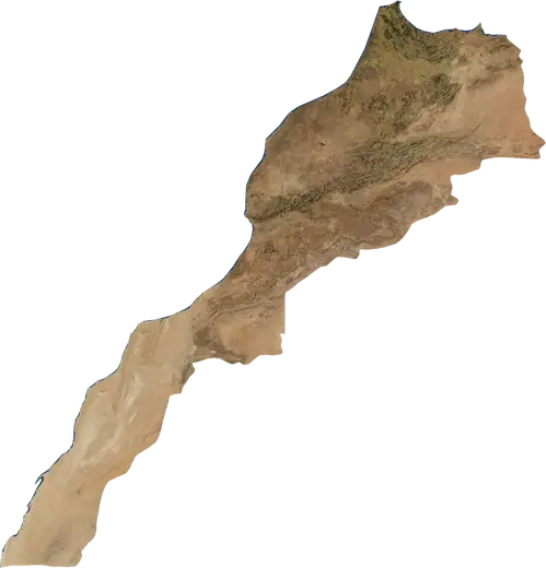
 Morocco
: earthquakes and wildfires
Latest earthquakes and active wildfires in Morocco on a live map, the strongest earthquakes and largest fires on record, and statistics by year.
Live map – Morocco
Key statistics (30 days)
Earthquakes M2.5+ and the wildfire fronts shown on the map.
Fire danger
Forecast for the area around: Oujda. Danger can vary locally; follow official guidance. Source: Copernicus EMS – EFFIS (FWI).
Severe weather (forecast)
- Today: Rain – Heavy rain (10–25 mm) · Tangier
- Tomorrow: Rain – Heavy rain (10–25 mm) · Tangier
Forecast for the area around: Morocco. It does not replace warnings from the national weather service. Source: ECMWF / Copernicus EMS.
Recent events in Morocco
- 10 h agoWildfire near Beni Mellal, Morocco – active3.0 km² · 32 km NE of Beni Mellal, Morocco
- 10 h agoWildfire near Settat, Morocco – active3.7 km² · 10 km NE of Settat, Morocco
- 35 h agoWildfire near Casablanca, Morocco – active4.4 km² · 14 km SSE of Casablanca, Morocco
- 3 days agoWildfire near Casablanca, Morocco4.7 km² · 28 km SSW of Casablanca, Morocco
- 4.7104 days agoM4.7 earthquake near Errachidia, Morocco75 km WNW of Errachidia, Morocco
- 114 days agoWildfire near Oujda, Morocco62 km² · 42 km E of Oujda, Morocco
Historical overview
Earthquakes M3.0+ and significant events of other hazards.
About Morocco
Morocco has recorded 1,765 earthquakes of magnitude 3.0 or more since 1977. The strongest was M6.8 in 2023.
Satellites have detected 2 significant wildfires here; the largest burned about 62 km².
Know the official emergency number, prepare an emergency kit and follow the instructions of your civil protection authority.
Learn more ›Earthquakes
1,765 earthquakes of magnitude 3.0 or more since 1977. The strongest was M6.8.
Recent earthquakes
| Mag | Location | Time (UTC) | Depth |
|---|---|---|---|
| 4.7 | 75 km WNW of Errachidia, Morocco | 10.0 km | |
| 4.0 | 5 km ESE of Ouezzane, Morocco | 3.9 km | |
| 4.4 | 73 km ENE of Tetouan, Morocco | 94.7 km | |
| 4.1 | 20 km N of Meknes, Morocco | 10.0 km |
Strongest earthquakes on record
| Mag | Location | Time (UTC) | Depth |
|---|---|---|---|
| 6.8 | 73 km SSW of Marrakesh, Morocco | 18.0 km | |
| 6.4 | 11 km SSW of Tirhanimine, Morocco | 0.0 km | |
| 6.3 | 50 km NNE of Al Hoceima, Morocco | 12.0 km | |
| 6.0 | 16 km WNW of Tirhanimine, Morocco | 9.7 km | |
| 5.6 | 10 km W of Recani, Morocco | 25.6 km | |
| 5.6 | 9 km NNW of Recani, Morocco | 28.6 km | |
| 5.5 | 51 km NE of Al Hoceima, Morocco | 10.0 km | |
| 5.3 | 44 km NE of Al Hoceima, Morocco | 10.0 km | |
| 5.3 | 52 km NNE of Al Hoceima, Morocco | 10.0 km | |
| 5.3 | 15 km WNW of Tirhanimine, Morocco | 10.1 km | |
| 5.2 | 56 km NNE of Al Hoceima, Morocco | 10.0 km | |
| 5.2 | 29 km N of Al Hoceima, Morocco | 10.0 km | |
| 5.2 | 104 km ESE of Beni Mellal, Morocco | 22.2 km | |
| 5.1 | 25 km N of Ouezzane, Morocco | 29.5 km | |
| 5.1 | 66 km NE of Al Hoceima, Morocco | 10.0 km |
Earthquakes per year (M3.0+)
Year
| 2026 | 3 | M4.7 |
| 2025 | 4 | M5.1 |
| 2024 | 6 | M4.5 |
| 2023 | 13 | M6.8 |
| 2022 | 22 | M5.5 |
| 2021 | 22 | M5.3 |
| 2020 | 4 | M4.8 |
| 2019 | 4 | M5.0 |
| 2018 | 2 | M4.3 |
| 2017 | 2 | M4.4 |
| 2016 | 48 | M6.3 |
| 2015 | 2 | M4.3 |
| 2014 | 11 | M4.8 |
| 2013 | 5 | M4.8 |
| 2012 | 1 | M4.2 |
| 2011 | 2 | M4.5 |
| 2010 | 5 | M4.8 |
| 2009 | 3 | M4.5 |
| 2008 | 18 | M4.0 |
| 2007 | 41 | M4.8 |
| 2006 | 61 | M4.5 |
| 2005 | 182 | M4.5 |
| 2004 | 895 | M6.4 |
| 2003 | 15 | M4.7 |
| 2002 | 4 | M4.4 |
| 2001 | 4 | M4.6 |
| 2000 | 8 | M4.6 |
| 1999 | 7 | M4.7 |
| 1998 | 9 | M4.7 |
| 1997 | 7 | M4.3 |
| 1996 | 19 | M4.3 |
| 1995 | 36 | M4.1 |
| 1994 | 159 | M6.0 |
| 1993 | 27 | M4.4 |
| 1992 | 36 | M5.6 |
| 1991 | 10 | M4.3 |
| 1990 | 11 | M4.4 |
| 1989 | 18 | M3.8 |
| 1988 | 13 | M4.7 |
| 1987 | 11 | M4.6 |
| 1986 | 8 | M5.2 |
| 1983 | 2 | M4.6 |
| 1980 | 1 | M4.7 |
| 1979 | 3 | M4.6 |
| 1977 | 1 | M4.4 |
Wildfires
2 major fires since 2026. The largest covered about 62 km².
Recent fires
| Area | Location | Since | Status |
|---|---|---|---|
| 3.0 km² | 32 km NE of Beni Mellal, Morocco | Active | |
| 3.7 km² | 10 km NE of Settat, Morocco | Active | |
| 4.4 km² | 14 km SSE of Casablanca, Morocco | Active | |
| 4.7 km² | 28 km SSW of Casablanca, Morocco | Inactive | |
| 62 km² | 42 km E of Oujda, Morocco | Inactive | |
| 20 km² | 34 km ESE of Oujda, Morocco | Inactive |
Largest fires on record
| Area | Location | Since | Status |
|---|---|---|---|
| 62 km² | 42 km E of Oujda, Morocco | Inactive | |
| 20 km² | 34 km ESE of Oujda, Morocco | Inactive |
Regions
Places
- Casablanca
- Rabat
- Fes
- Tangier
- Marrakesh
- Sale
- Agadir
- Meknes
- Oujda
- Kenitra
- Tetouan
- Al Hoceima
- Temara
- Safi
- Mohammedia
- Khouribga
- El Jadida
- Beni Mellal
- Sale Al Jadida
- Ait Melloul
- Nador
- Dar Bouazza
- Taza
- Fes al Bali
- Settat
- Berrechid
- Khemisset
- Inezgane
- Ksar El Kebir
- Larache
- Guelmim
- Khenifra
- Berkane
- Taourirt
- Bouskoura
- Al Fqih Ben Calah
- Dchira El Jihadia
- Oued Zem
- El Kelaa des Srarhna
- Sidi Slimane
- Errachidia
- Guercif
- Oulad Teima
- Ouislane
- Tiflet
- Lqoliaa
- Taroudant
- Sefrou
- Essaouira
- Fnidek
- Sidi Kacem
- Tiznit
- Ouarzazate
- Souk El Arbaa
- Ifrane
- Martil
- Souq Sebt Oulad Nemma
- Skhirate
- Ouezzane
- Benslimane
- Beni Enzar
- Mdiq
- Midelt
- Azrou
- Tirhanimine
- My Drarga
- Dakhla
- Ain El Aouda
- Ben Jerrar
- Al Aaroui
- Kasba Tadla
- Bejaad
- Sidi Taibi
- Jerada
- Chefchaouen
- Mrirt
- Tinghir
- El Aioun
- Souq Larb'a al Gharb
- Ait Ourir