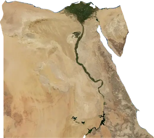
 Egypt
Egypt: earthquakes and wildfires
Latest earthquakes and active wildfires in Egypt on a live map, the strongest earthquakes and largest fires on record, and statistics by year.
Live map – Egypt
Key statistics (30 days)
Earthquakes M2.5+ and the wildfire fronts shown on the map.
Fire danger
Forecast for the area around: Asyut. Danger can vary locally; follow official guidance. Source: Copernicus EMS – EFFIS (FWI).
Severe weather (forecast)
The forecast shows no heavy rain, gales or thunderstorms for today and tomorrow.
Forecast for the area around: Egypt. It does not replace warnings from the national weather service. Source: ECMWF / Copernicus EMS.
Recent events in Egypt
- 4 h agoWildfire near Marsá Maţrūḩ, Egypt – active19 km² · 66 km S of Marsá Maţrūḩ, Egypt
- 4 h agoWildfire near Abu Kabir, Egypt – active3.1 km² · near Abu Kabir, Egypt
- 4 h agoWildfire near Al Fayyum, Egypt – active5.8 km² · 48 km SE of Al Fayyum, Egypt
- 5 h agoWildfire near Marsá Maţrūḩ, Egypt – active7.0 km² · 64 km SSE of Marsá Maţrūḩ, Egypt
- 15 h agoWildfire near An-Najaylah, Egypt – active6.6 km² · 66 km S of An-Najaylah, Egypt
- 15 h agoWildfire near An-Najaylah, Egypt – active7.3 km² · 85 km SSW of An-Najaylah, Egypt
Historical overview
Earthquakes M3.0+ and significant events of other hazards.
About Egypt
Egypt has recorded 300 earthquakes of magnitude 3.0 or more since 1981. The strongest was M6.1 in 1993.
Satellites have detected 14 significant wildfires here; the largest burned about 19 km².
Know the official emergency number, prepare an emergency kit and follow the instructions of your civil protection authority.
Learn more ›Earthquakes
300 earthquakes of magnitude 3.0 or more since 1981. The strongest was M6.1.
Recent earthquakes
| Mag | Location | Time (UTC) | Depth |
|---|---|---|---|
| 5.0 | 42 km NNE of Suez, Egypt | 10.0 km |
Strongest earthquakes on record
| Mag | Location | Time (UTC) | Depth |
|---|---|---|---|
| 6.1 | 28 km NNE of Dahab, Egypt | 10.0 km | |
| 5.7 | 30 km S of Nuweiba, Egypt | 10.0 km | |
| 5.5 | 74 km SSE of Sharm el Sheikh, Egypt | 10.0 km | |
| 5.5 | near Nuweiba, Egypt | 22.0 km | |
| 5.5 | 41 km E of Marsá Maţrūḩ, Egypt | 10.0 km | |
| 5.4 | 21 km ENE of Dahab, Egypt | 10.0 km | |
| 5.3 | 20 km SSE of Nuweiba, Egypt | 22.5 km | |
| 5.3 | 18 km E of Dahab, Egypt | 10.0 km | |
| 5.3 | 27 km SSW of Giza, Egypt | 22.0 km | |
| 5.3 | 54 km SW of Aswān, Egypt | 10.0 km | |
| 5.1 | 108 km N of Al Burj, Egypt | 13.4 km | |
| 5.1 | 20 km NE of Dahab, Egypt | 10.0 km | |
| 5.1 | 31 km ENE of Dahab, Egypt | 10.0 km | |
| 5.1 | 39 km WNW of Marsa Alam, Egypt | 10.0 km | |
| 5.0 | 42 km NNE of Suez, Egypt | 10.0 km |
Earthquakes per year (M3.0+)
Year
| 2026 | 1 | M5.0 |
| 2024 | 3 | M4.4 |
| 2023 | 2 | M4.2 |
| 2022 | 2 | M4.7 |
| 2021 | 1 | M4.3 |
| 2020 | 5 | M5.5 |
| 2019 | 3 | M4.8 |
| 2018 | 2 | M4.5 |
| 2017 | 3 | M4.4 |
| 2016 | 3 | M5.0 |
| 2015 | 6 | M5.5 |
| 2014 | 5 | M4.2 |
| 2013 | 4 | M4.9 |
| 2012 | 4 | M5.1 |
| 2011 | 3 | M4.5 |
| 2008 | 6 | M4.3 |
| 2007 | 3 | M4.6 |
| 2006 | 4 | M4.5 |
| 2005 | 3 | M4.4 |
| 2004 | 5 | M4.8 |
| 2003 | 1 | M4.7 |
| 2002 | 1 | M4.4 |
| 2001 | 5 | M4.4 |
| 2000 | 4 | M4.9 |
| 1999 | 5 | M4.5 |
| 1998 | 2 | M5.5 |
| 1997 | 2 | M4.8 |
| 1996 | 34 | M5.3 |
| 1995 | 32 | M5.4 |
| 1994 | 31 | M4.6 |
| 1993 | 36 | M6.1 |
| 1992 | 34 | M5.3 |
| 1991 | 4 | M4.2 |
| 1990 | 8 | M4.1 |
| 1989 | 6 | M4.4 |
| 1988 | 3 | M4.8 |
| 1987 | 9 | M5.0 |
| 1986 | 3 | M4.3 |
| 1985 | 1 | M4.6 |
| 1984 | 3 | M5.1 |
| 1983 | 1 | M5.0 |
| 1982 | 6 | M4.8 |
| 1981 | 1 | M5.3 |
Wildfires
14 major fires since 2025. The largest covered about 19 km².
Recent fires
| Area | Location | Since | Status |
|---|---|---|---|
| 19 km² | 66 km S of Marsá Maţrūḩ, Egypt | Active | |
| 3.1 km² | near Abu Kabir, Egypt | Active | |
| 5.8 km² | 48 km SE of Al Fayyum, Egypt | Active | |
| 7.0 km² | 64 km SSE of Marsá Maţrūḩ, Egypt | Active | |
| 6.6 km² | 66 km S of An-Najaylah, Egypt | Active | |
| 7.3 km² | 85 km SSW of An-Najaylah, Egypt | Active | |
| 7.1 km² | 60 km S of Marsá Maţrūḩ, Egypt | Active | |
| 8.8 km² | 110 km S of Marsá Maţrūḩ, Egypt | Active | |
| 7.8 km² | 17 km SSE of Manfalut, Egypt | Active | |
| 11 km² | 39 km SW of Suez, Egypt | Active |
Show all (63)
| Area | Location | Since | Status |
|---|---|---|---|
| 6.5 km² | 23 km SSE of Giza, Egypt | Active | |
| 8.2 km² | 139 km SSW of El Dabaa, Egypt | Active | |
| 7.0 km² | 143 km SSW of El Alamein, Egypt | Active | |
| 6.2 km² | 9 km E of Biba, Egypt | Active | |
| 6.0 km² | 86 km ESE of Cairo, Egypt | Active | |
| 15 km² | 13 km SW of Alexandria, Egypt | Active | |
| 18 km² | 9 km SW of Alexandria, Egypt | Active | |
| 4.3 km² | 26 km SE of Qina, Egypt | Active | |
| 10 km² | 61 km SSW of Marsá Maţrūḩ, Egypt | Active | |
| 3.1 km² | 147 km WNW of Ibshaway, Egypt | Active | |
| 9.0 km² | 42 km ENE of Alexandria, Egypt | Active | |
| 4.3 km² | 8 km SW of Suez, Egypt | Active | |
| 3.1 km² | 26 km ENE of Qina, Egypt | Active | |
| 4.4 km² | 61 km S of An-Najaylah, Egypt | Active | |
| 7.1 km² | 76 km SSW of Marsá Maţrūḩ, Egypt | Active | |
| 3.4 km² | 119 km SSW of An-Najaylah, Egypt | Active | |
| 5.1 km² | 69 km SSW of Marsá Maţrūḩ, Egypt | Active | |
| 16 km² | 25 km SW of Alexandria, Egypt | Active | |
| 5.6 km² | 8 km ENE of Al Hammam, Egypt | Active | |
| 8.0 km² | 78 km WSW of El Dabaa, Egypt | Active | |
| 5.1 km² | 55 km S of El Dabaa, Egypt | Active | |
| 16 km² | 108 km SSW of An-Najaylah, Egypt | Active | |
| 5.0 km² | 48 km NNW of Hurghada, Egypt | Active | |
| 3.0 km² | 31 km NW of Hurghada, Egypt | Active | |
| 5.3 km² | 42 km WSW of Suez, Egypt | Active | |
| 12 km² | 13 km SSW of Alexandria, Egypt | Active | |
| 4.6 km² | 32 km ESE of Cairo, Egypt | Active | |
| 7.1 km² | 48 km S of Al ‘Arīsh, Egypt | Active | |
| 9.4 km² | 7 km ESE of Bilbeis, Egypt | Active | |
| 11 km² | 55 km SSE of Marsá Maţrūḩ, Egypt | Active | |
| 5.6 km² | 19 km WSW of Abu Tij, Egypt | Active | |
| 3.9 km² | 45 km S of Al ‘Arīsh, Egypt | Active | |
| 13 km² | 8 km ENE of Madinat as Sadat, Egypt | Active | |
| 11 km² | 37 km SSW of Suez, Egypt | Active | |
| 9.4 km² | 45 km SSW of Suez, Egypt | Active | |
| 3.6 km² | 116 km SSW of El Alamein, Egypt | Active | |
| 5.5 km² | 18 km ESE of Bani Mazar, Egypt | Active | |
| 7.5 km² | 9 km NNE of Abu Qurqas, Egypt | Active | |
| 9.3 km² | 14 km S of Manfalut, Egypt | Active | |
| 11 km² | 8 km WSW of Al Balyana, Egypt | Active | |
| 9.6 km² | 31 km SSE of Giza, Egypt | Active | |
| 5.3 km² | 57 km ESE of Zaafarana, Egypt | Active | |
| 6.0 km² | near Abnub, Egypt | Active | |
| 10.0 km² | 37 km WSW of Giza, Egypt | Inactive | |
| 3.9 km² | 6 km NW of Abu Tij, Egypt | Inactive | |
| 7.7 km² | 19 km NE of Shubra al Khaymah, Egypt | Inactive | |
| 7.2 km² | 15 km E of Bush, Egypt | Inactive | |
| 16 km² | 11 km WNW of Az-Zuhur, Egypt | Inactive | |
| 6.0 km² | 54 km ESE of Zaafarana, Egypt | Inactive | |
| 14 km² | 24 km SSW of Alexandria, Egypt | Inactive | |
| 5.3 km² | 65 km NNW of Hurghada, Egypt | Inactive | |
| 5.3 km² | 52 km S of Marsá Maţrūḩ, Egypt | Inactive | |
| 4.1 km² | 133 km SSW of El Dabaa, Egypt | Inactive |
Largest fires on record
| Area | Location | Since | Status |
|---|---|---|---|
| 19 km² | 66 km S of Marsá Maţrūḩ, Egypt | Active | |
| 18 km² | 9 km SW of Alexandria, Egypt | Active | |
| 16 km² | 11 km WNW of Az-Zuhur, Egypt | Inactive | |
| 16 km² | 25 km SW of Alexandria, Egypt | Active | |
| 16 km² | 108 km SSW of An-Najaylah, Egypt | Active | |
| 15 km² | 13 km SW of Alexandria, Egypt | Active | |
| 14 km² | 24 km SSW of Alexandria, Egypt | Inactive | |
| 13 km² | 8 km ENE of Madinat as Sadat, Egypt | Active | |
| 12 km² | 13 km SSW of Alexandria, Egypt | Active | |
| 11 km² | 37 km SSW of Suez, Egypt | Active | |
| 11 km² | 39 km SW of Suez, Egypt | Active | |
| 11 km² | 55 km SSE of Marsá Maţrūḩ, Egypt | Active | |
| 11 km² | 8 km WSW of Al Balyana, Egypt | Active | |
| 10 km² | 61 km SSW of Marsá Maţrūḩ, Egypt | Active |
Major fires per year
Year
| 2026 | 10 | 19 km² |
| 2025 | 4 | 14 km² |
Regions
Places
- Cairo
- Alexandria
- Giza
- Shubra al Khaymah
- Port Said
- Suez
- Madinat an Nasr
- Al Mansurah
- Al Mahallah al Kubra
- Tanta
- Asyut
- Al Fayyum
- Al Khusus
- Zagazig
- Ismailia
- Kom Ombo
- Aswān
- 6th of October City
- Hada'iq al Qubbah
- Damanhur
- New Cairo
- Damietta
- Rosetta
- Minya
- Bani Suwayf
- Shibin al Kawm
- Sohag
- Az-Zuhur
- Qina
- Al 'Ashir min Ramadan
- Halwan
- Mallawi
- Hurghada
- Kafr ash Shaykh
- Bilbeis
- Banha
- Idku
- Marsá Maţrūḩ
- Al Matariyah
- Qalyub
- Al Hawamidiyah
- Abu Kabir
- Mit Ghamr
- Akhmim
- Girga
- Disuq
- Ad-Dawahy
- Samalut
- Al-'Ubur
- Kerdasa
- Bilqas
- Bush
- Tahta
- Sinnuris
- Kafr ad Dawwar
- Al Manzalah
- Munuf
- Ashmun
- As Sinbillawayn
- Maghaghah
- Manfalut
- Faqus
- Bani Mazar
- Al Fashn
- Talkha
- Abnub
- Zefta
- Abu Tij
- Dayrut
- Tima
- Dikirnis
- Minya al Qamh
- Ash-Shaykh Zayid
- Biba
- Al Qurayn
- Awsim
- Fuwwah
- El Shorouk
- Al Badrashayn