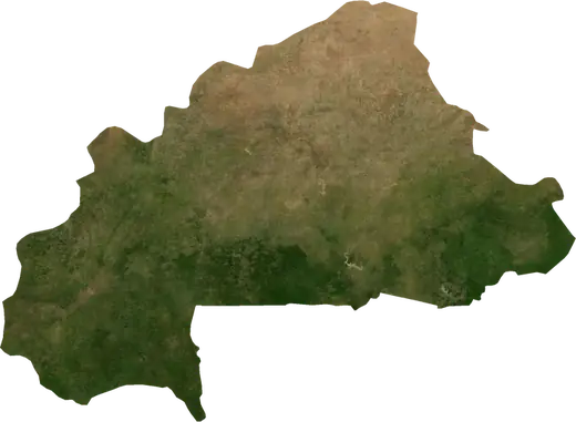
 Burkina Faso
Wildfires in Burkina Faso
Active wildfires in Burkina Faso on a live satellite map, the largest fires on record and major fires per year.
Live map – Burkina Faso
Key statistics (30 days)
Earthquakes M2.5+ and the wildfire fronts shown on the map.
Fire danger
Forecast for the area around: Ouagadougou. Danger can vary locally; follow official guidance. Source: Copernicus EMS – EFFIS (FWI).
Severe weather (forecast)
The forecast shows no heavy rain, gales or thunderstorms for today and tomorrow.
Forecast for the area around: Burkina Faso. It does not replace warnings from the national weather service. Source: ECMWF / Copernicus EMS.
Recent events in Burkina Faso
- 13 h agoWildfire near Djibo, Burkina Faso – active4.2 km² · 21 km SW of Djibo, Burkina Faso
- 13 h agoWildfire near Djibo, Burkina Faso – active20 km² · 40 km WNW of Djibo, Burkina Faso
- 13 h agoWildfire near Kouka, Burkina Faso – active7.9 km² · 12 km NNE of Kouka, Burkina Faso
- 13 h agoWildfire near Po, Burkina Faso – active10 km² · 38 km SW of Po, Burkina Faso
- 13 h agoWildfire near Tougan, Burkina Faso – active7.7 km² · 7 km NW of Tougan, Burkina Faso
- 13 h agoWildfire near Dedougou, Burkina Faso – active3.7 km² · 33 km WSW of Dedougou, Burkina Faso
Historical overview
Earthquakes M3.0+ and significant events of other hazards.
About Burkina Faso
Satellites have detected 265 significant wildfires here; the largest burned about 838 km².
Know the official emergency number, prepare an emergency kit and follow the instructions of your civil protection authority.
Learn more ›Wildfires
265 major fires since 2025. The largest covered about 838 km².
Recent fires
| Area | Location | Since | Status |
|---|---|---|---|
| 4.2 km² | 21 km SW of Djibo, Burkina Faso | Active | |
| 20 km² | 40 km WNW of Djibo, Burkina Faso | Active | |
| 7.9 km² | 12 km NNE of Kouka, Burkina Faso | Active | |
| 10 km² | 38 km SW of Po, Burkina Faso | Active | |
| 7.7 km² | 7 km NW of Tougan, Burkina Faso | Active | |
| 3.7 km² | 33 km WSW of Dedougou, Burkina Faso | Active | |
| 39 km² | 20 km WNW of Po, Burkina Faso | Active | |
| 6.2 km² | 81 km NNW of Koudougou, Burkina Faso | Active | |
| 14 km² | 25 km WSW of Po, Burkina Faso | Active | |
| 22 km² | 51 km E of Pama, Burkina Faso | Active |
Show all (200)
| Area | Location | Since | Status |
|---|---|---|---|
| 5.2 km² | 33 km SE of Dori, Burkina Faso | Active | |
| 4.3 km² | 19 km WSW of Pama, Burkina Faso | Active | |
| 14 km² | 14 km N of Fada N'gourma, Burkina Faso | Active | |
| 37 km² | 34 km NE of Pama, Burkina Faso | Active | |
| 45 km² | 53 km SSW of Namponkore, Burkina Faso | Active | |
| 101 km² | 10 km E of Kongoussi, Burkina Faso | Active | |
| 3.9 km² | 43 km E of Fada N'gourma, Burkina Faso | Active | |
| 7.0 km² | 50 km W of Po, Burkina Faso | Active | |
| 122 km² | 36 km ESE of Tenkodogo, Burkina Faso | Active | |
| 11 km² | 56 km W of Namponkore, Burkina Faso | Active | |
| 838 km² | 54 km E of Namponkore, Burkina Faso | Active | |
| 26 km² | 18 km ESE of Fada N'gourma, Burkina Faso | Active | |
| 92 km² | 35 km W of Pama, Burkina Faso | Active | |
| 17 km² | near Bilanga, Burkina Faso | Active | |
| 4.1 km² | 19 km W of Kompienga, Burkina Faso | Active | |
| 19 km² | 57 km E of Diapaga, Burkina Faso | Active | |
| 8.0 km² | near Kompienga, Burkina Faso | Active | |
| 21 km² | 17 km WNW of Natiaboani, Burkina Faso | Active | |
| 38 km² | 21 km SE of Ouargaye, Burkina Faso | Active | |
| 7.6 km² | 42 km WSW of Namponkore, Burkina Faso | Active | |
| 4.3 km² | 21 km NE of Bittou, Burkina Faso | Active | |
| 400 km² | 33 km NNE of Pama, Burkina Faso | Active | |
| 5.8 km² | 34 km WNW of Po, Burkina Faso | Active | |
| 12 km² | 17 km SSW of Bama, Burkina Faso | Active | |
| 6.6 km² | 30 km W of Kompienga, Burkina Faso | Active | |
| 7.4 km² | 48 km SSW of Namponkore, Burkina Faso | Active | |
| 35 km² | 13 km SSW of Fada N'gourma, Burkina Faso | Active | |
| 4.9 km² | 29 km SSW of Namponkore, Burkina Faso | Active | |
| 7.8 km² | 36 km ENE of Pama, Burkina Faso | Active | |
| 6.0 km² | 11 km WSW of Fada N'gourma, Burkina Faso | Active | |
| 4.5 km² | 30 km E of Tenkodogo, Burkina Faso | Active | |
| 22 km² | 43 km ENE of Pama, Burkina Faso | Active | |
| 4.1 km² | 29 km WSW of Fada N'gourma, Burkina Faso | Active | |
| 5.2 km² | 44 km E of Natiaboani, Burkina Faso | Active | |
| 9.5 km² | 39 km SE of Dano, Burkina Faso | Active | |
| 6.8 km² | 23 km ENE of Pama, Burkina Faso | Active | |
| 3.3 km² | 30 km SSE of Namponkore, Burkina Faso | Active | |
| 10 km² | 21 km ENE of Kompienga, Burkina Faso | Active | |
| 4.1 km² | 18 km ENE of Boulsa, Burkina Faso | Active | |
| 116 km² | 28 km ENE of Kompienga, Burkina Faso | Active | |
| 42 km² | 52 km ENE of Natiaboani, Burkina Faso | Active | |
| 35 km² | 31 km NE of Toma, Burkina Faso | Active | |
| 4.7 km² | 50 km ESE of Tenkodogo, Burkina Faso | Active | |
| 52 km² | 40 km NW of Gorom-Gorom, Burkina Faso | Active | |
| 3.3 km² | 28 km WNW of Pama, Burkina Faso | Active | |
| 20 km² | 25 km SW of Fada N'gourma, Burkina Faso | Active | |
| 4.1 km² | 26 km SSE of Natiaboani, Burkina Faso | Active | |
| 5.6 km² | 34 km SSW of Gayeri, Burkina Faso | Active | |
| 6.2 km² | 30 km SSE of Namponkore, Burkina Faso | Active | |
| 18 km² | 43 km W of Po, Burkina Faso | Active | |
| 5.4 km² | 17 km NE of Kompienga, Burkina Faso | Active | |
| 11 km² | 15 km N of Pama, Burkina Faso | Active | |
| 8.9 km² | 34 km WNW of Pa, Burkina Faso | Active | |
| 57 km² | 42 km WSW of Tougan, Burkina Faso | Active | |
| 9.3 km² | 20 km WNW of Ouahigouya, Burkina Faso | Active | |
| 6.2 km² | 20 km N of Ouahigouya, Burkina Faso | Active | |
| 3.9 km² | 53 km ENE of Natiaboani, Burkina Faso | Inactive | |
| 11 km² | 17 km W of Fada N'gourma, Burkina Faso | Inactive | |
| 45 km² | near Kompienga, Burkina Faso | Inactive | |
| 167 km² | 16 km NNE of Cinkanse, Burkina Faso | Inactive | |
| 47 km² | 54 km ENE of Pama, Burkina Faso | Inactive | |
| 6.2 km² | 47 km NE of Pama, Burkina Faso | Inactive | |
| 9.6 km² | 36 km WNW of Tougan, Burkina Faso | Inactive | |
| 3.9 km² | 29 km SSW of Dori, Burkina Faso | Inactive | |
| 337 km² | 35 km SE of Dori, Burkina Faso | Inactive | |
| 28 km² | 10 km ENE of Titao, Burkina Faso | Inactive | |
| 22 km² | 32 km SSE of Titao, Burkina Faso | Inactive | |
| 41 km² | 16 km SE of Bourzanga, Burkina Faso | Inactive | |
| 22 km² | 48 km N of Pissila, Burkina Faso | Inactive | |
| 204 km² | 18 km SSE of Bogande, Burkina Faso | Inactive | |
| 5.4 km² | 31 km ENE of Tougan, Burkina Faso | Inactive | |
| 7.2 km² | 32 km W of Tougan, Burkina Faso | Inactive | |
| 7.3 km² | 20 km ENE of Gorom-Gorom, Burkina Faso | Inactive | |
| 14 km² | 35 km SSE of Namponkore, Burkina Faso | Inactive | |
| 4.3 km² | 36 km W of Reo, Burkina Faso | Inactive | |
| 3.1 km² | 47 km NE of Koupela, Burkina Faso | Inactive | |
| 8.3 km² | 44 km ENE of Namponkore, Burkina Faso | Inactive | |
| 7.2 km² | 33 km WSW of Manga, Burkina Faso | Inactive | |
| 11 km² | 41 km ENE of Natiaboani, Burkina Faso | Inactive | |
| 95 km² | 39 km ENE of Tenkodogo, Burkina Faso | Inactive | |
| 37 km² | 30 km S of Namponkore, Burkina Faso | Inactive | |
| 5.8 km² | 55 km ENE of Fada N'gourma, Burkina Faso | Inactive | |
| 5.2 km² | 53 km SW of Namponkore, Burkina Faso | Inactive | |
| 270 km² | 54 km E of Natiaboani, Burkina Faso | Inactive | |
| 6.2 km² | 13 km ENE of Bittou, Burkina Faso | Inactive | |
| 16 km² | 74 km S of Ouagadougou, Burkina Faso | Inactive | |
| 18 km² | 25 km N of Pissila, Burkina Faso | Inactive | |
| 13 km² | 45 km ENE of Nouna, Burkina Faso | Inactive | |
| 3.3 km² | 13 km NE of Titao, Burkina Faso | Inactive | |
| 26 km² | 20 km NNE of Pama, Burkina Faso | Inactive | |
| 59 km² | 15 km ESE of Natiaboani, Burkina Faso | Inactive | |
| 46 km² | 30 km E of Cinkanse, Burkina Faso | Inactive | |
| 7.2 km² | 25 km SW of Gomboussougou, Burkina Faso | Inactive | |
| 4.5 km² | 59 km NE of Pama, Burkina Faso | Inactive | |
| 30 km² | 25 km E of Pama, Burkina Faso | Inactive | |
| 18 km² | 33 km E of Namponkore, Burkina Faso | Inactive | |
| 26 km² | 10 km NNE of Bittou, Burkina Faso | Inactive | |
| 10 km² | 24 km ENE of Yalgo, Burkina Faso | Inactive | |
| 3.1 km² | 32 km NNE of Pissila, Burkina Faso | Inactive | |
| 7.5 km² | 12 km SSE of Yalgo, Burkina Faso | Inactive | |
| 11 km² | 22 km SW of Diapaga, Burkina Faso | Inactive | |
| 7.0 km² | 20 km SW of Kompienga, Burkina Faso | Inactive | |
| 3.5 km² | 56 km NW of Diapaga, Burkina Faso | Inactive | |
| 3.1 km² | 16 km SSE of Toma, Burkina Faso | Inactive | |
| 14 km² | 13 km SE of Ouargaye, Burkina Faso | Inactive | |
| 8.7 km² | 11 km WSW of Bama, Burkina Faso | Inactive | |
| 7.6 km² | 33 km WSW of Namponkore, Burkina Faso | Inactive | |
| 43 km² | 12 km E of Ouargaye, Burkina Faso | Inactive | |
| 20 km² | 23 km NE of Dedougou, Burkina Faso | Inactive | |
| 11 km² | 33 km N of Dedougou, Burkina Faso | Inactive | |
| 58 km² | 41 km E of Natiaboani, Burkina Faso | Inactive | |
| 4.5 km² | 45 km W of Po, Burkina Faso | Inactive | |
| 44 km² | 63 km S of Leo, Burkina Faso | Inactive | |
| 14 km² | 22 km WSW of Tougan, Burkina Faso | Inactive | |
| 8.0 km² | 19 km NE of Bittou, Burkina Faso | Inactive | |
| 26 km² | near Pama, Burkina Faso | Inactive | |
| 4.5 km² | 30 km W of Gourcy, Burkina Faso | Inactive | |
| 50 km² | 50 km SW of Namponkore, Burkina Faso | Inactive | |
| 96 km² | 36 km W of Po, Burkina Faso | Inactive | |
| 4.1 km² | 19 km SE of Pissila, Burkina Faso | Inactive | |
| 5.4 km² | 20 km E of Cinkanse, Burkina Faso | Inactive | |
| 3.3 km² | 38 km WNW of Ouahigouya, Burkina Faso | Inactive | |
| 17 km² | 14 km N of Bittou, Burkina Faso | Inactive | |
| 3.7 km² | 45 km NE of Diapaga, Burkina Faso | Inactive | |
| 6.0 km² | near Bama, Burkina Faso | Inactive | |
| 6.2 km² | 20 km NE of Djibo, Burkina Faso | Inactive | |
| 62 km² | 16 km WNW of Kompienga, Burkina Faso | Inactive | |
| 3.5 km² | 19 km ESE of Kompienga, Burkina Faso | Inactive | |
| 9.7 km² | 16 km E of Pissila, Burkina Faso | Inactive | |
| 15 km² | 45 km WNW of Gorom-Gorom, Burkina Faso | Inactive | |
| 7.9 km² | 20 km NNE of Dori, Burkina Faso | Inactive | |
| 7.9 km² | 13 km NNW of Ouargaye, Burkina Faso | Inactive | |
| 31 km² | 25 km WNW of Po, Burkina Faso | Inactive | |
| 71 km² | 9 km NW of Bourzanga, Burkina Faso | Inactive | |
| 15 km² | 13 km SSW of Natiaboani, Burkina Faso | Inactive | |
| 30 km² | 9 km N of Ouargaye, Burkina Faso | Inactive | |
| 4.3 km² | 10 km WSW of Tougan, Burkina Faso | Inactive | |
| 5.8 km² | 60 km N of Dedougou, Burkina Faso | Inactive | |
| 5.6 km² | 26 km NNW of Fada N'gourma, Burkina Faso | Inactive | |
| 3.3 km² | 39 km NW of Fada N'gourma, Burkina Faso | Inactive | |
| 46 km² | 58 km SW of Namponkore, Burkina Faso | Inactive | |
| 3.7 km² | 36 km ENE of Natiaboani, Burkina Faso | Inactive | |
| 40 km² | 18 km W of Solenzo, Burkina Faso | Inactive | |
| 48 km² | 21 km W of Ouahigouya, Burkina Faso | Inactive | |
| 5.2 km² | 26 km ESE of Dano, Burkina Faso | Inactive | |
| 4.6 km² | 63 km WNW of Koudougou, Burkina Faso | Inactive | |
| 17 km² | 24 km WNW of Natiaboani, Burkina Faso | Inactive | |
| 26 km² | 33 km ENE of Dedougou, Burkina Faso | Inactive | |
| 20 km² | 9 km SSW of Titao, Burkina Faso | Inactive | |
| 3.5 km² | 24 km SSE of Tenkodogo, Burkina Faso | Inactive | |
| 5.4 km² | 6 km N of Bogande, Burkina Faso | Inactive | |
| 9.7 km² | 36 km NNW of Po, Burkina Faso | Inactive | |
| 28 km² | 19 km NNE of Po, Burkina Faso | Inactive | |
| 4.3 km² | 59 km E of Pama, Burkina Faso | Inactive | |
| 10 km² | 35 km SW of Namponkore, Burkina Faso | Inactive | |
| 5.0 km² | 8 km SW of Diebougou, Burkina Faso | Inactive | |
| 49 km² | 61 km ESE of Diapaga, Burkina Faso | Inactive | |
| 5.0 km² | 32 km SW of Reo, Burkina Faso | Inactive | |
| 3.3 km² | 29 km ESE of Namponkore, Burkina Faso | Inactive | |
| 3.3 km² | 20 km NNW of Pama, Burkina Faso | Inactive | |
| 4.6 km² | 58 km ENE of Fada N'gourma, Burkina Faso | Inactive | |
| 35 km² | 39 km WSW of Namponkore, Burkina Faso | Inactive | |
| 4.7 km² | 30 km E of Gaoua, Burkina Faso | Inactive | |
| 11 km² | 53 km W of Namponkore, Burkina Faso | Inactive | |
| 7.2 km² | 23 km W of Ouargaye, Burkina Faso | Inactive | |
| 3.1 km² | 23 km SSE of Natiaboani, Burkina Faso | Inactive | |
| 13 km² | 60 km ENE of Pama, Burkina Faso | Inactive | |
| 9.9 km² | 31 km SE of Pa, Burkina Faso | Inactive | |
| 3.5 km² | 59 km NE of Diapaga, Burkina Faso | Inactive | |
| 114 km² | 14 km NNW of Aribinda, Burkina Faso | Inactive | |
| 21 km² | 59 km ENE of Natiaboani, Burkina Faso | Inactive | |
| 3.9 km² | 5 km NE of Titao, Burkina Faso | Inactive | |
| 90 km² | 47 km SSW of Namponkore, Burkina Faso | Inactive | |
| 4.3 km² | 33 km W of Kompienga, Burkina Faso | Inactive | |
| 8.1 km² | 7 km NE of Sebba, Burkina Faso | Inactive | |
| 46 km² | 38 km SE of Namponkore, Burkina Faso | Inactive | |
| 24 km² | 13 km S of Fada N'gourma, Burkina Faso | Inactive | |
| 16 km² | 9 km NNW of Natiaboani, Burkina Faso | Inactive | |
| 13 km² | 39 km W of Reo, Burkina Faso | Inactive | |
| 15 km² | 24 km E of Yalgo, Burkina Faso | Inactive | |
| 22 km² | 23 km SE of Natiaboani, Burkina Faso | Inactive | |
| 7.6 km² | 34 km SE of Namponkore, Burkina Faso | Inactive | |
| 7.0 km² | 30 km ENE of Cinkanse, Burkina Faso | Inactive | |
| 103 km² | 16 km WNW of Kouka, Burkina Faso | Inactive | |
| 4.1 km² | 30 km W of Tougan, Burkina Faso | Inactive | |
| 21 km² | 35 km W of Tougan, Burkina Faso | Inactive | |
| 3.5 km² | 17 km NNW of Djibo, Burkina Faso | Inactive | |
| 28 km² | 14 km SW of Sebba, Burkina Faso | Inactive | |
| 28 km² | 34 km W of Pa, Burkina Faso | Inactive | |
| 6.8 km² | 23 km ENE of Dedougou, Burkina Faso | Inactive |
Largest fires on record
| Area | Location | Since | Status |
|---|---|---|---|
| 838 km² | 54 km E of Namponkore, Burkina Faso | Active | |
| 400 km² | 33 km NNE of Pama, Burkina Faso | Active | |
| 337 km² | 35 km SE of Dori, Burkina Faso | Inactive | |
| 270 km² | 54 km E of Natiaboani, Burkina Faso | Inactive | |
| 204 km² | 18 km SSE of Bogande, Burkina Faso | Inactive | |
| 167 km² | 16 km NNE of Cinkanse, Burkina Faso | Inactive | |
| 122 km² | 36 km ESE of Tenkodogo, Burkina Faso | Active | |
| 116 km² | 28 km ENE of Kompienga, Burkina Faso | Active | |
| 114 km² | 14 km NNW of Aribinda, Burkina Faso | Inactive | |
| 103 km² | 16 km WNW of Kouka, Burkina Faso | Inactive | |
| 101 km² | 10 km E of Kongoussi, Burkina Faso | Active | |
| 96 km² | 36 km W of Po, Burkina Faso | Inactive | |
| 95 km² | 39 km ENE of Tenkodogo, Burkina Faso | Inactive | |
| 92 km² | 35 km W of Pama, Burkina Faso | Active | |
| 90 km² | 47 km SSW of Namponkore, Burkina Faso | Inactive |
Major fires per year
Year
| 2026 | 190 | 838 km² |
| 2025 | 75 | 41 km² |
Regions
Places
- Leo
- Po
- Fada N'gourma
- Bourzanga
- Zabre
- Bittou
- Kongoussi
- Djibo
- Aribinda
- Tenkodogo
- Sapouy
- Pissila
- Koupela
- Titao
- Pouytenga
- Kaya
- Yalgo
- Garango
- Dori
- Nouna
- Tougan
- Ouahigouya
- Dedougou
- Zorgo
- Yako
- Gourcy
- Manga
- Boulsa
- Bogande
- Barogo
- Gao
- Beguedo
- Niangoloko
- Ziniare
- Solenzo
- Mogtedo
- Dano
- Bousse
- Banfora
- Kombissiri
- Gaoua
- Fara Department
- Bama
- Diebougou
- Reo
- Saaba
- Nioko I
- Bobo-Dioulasso
- Ouagadougou
- Saonre
- Koudougou
- Kokologo
- Orodara
- Hounde
- Boromo