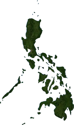
 Philippines
: earthquakes and wildfires
Latest earthquakes and active wildfires in Philippines on a live map, the strongest earthquakes and largest fires on record, and statistics by year.
Live map – Philippines
Key statistics (30 days)
Earthquakes M2.5+ and the wildfire fronts shown on the map.
Fire danger
Forecast for the area around: Iloilo City. Danger can vary locally; follow official guidance. Source: Copernicus EMS – EFFIS (FWI).
Severe weather (forecast)
- Today: Rain – Very heavy rain (25–50 mm) · Davao City
- Today: Lightning – High lightning · Manila
- Tomorrow: Rain – Very heavy rain (25–50 mm) · Davao City
- Tomorrow: Lightning – High lightning · Budta
Forecast for the area around: Philippines. It does not replace warnings from the national weather service. Source: ECMWF / Copernicus EMS.
Recent events in Philippines
- 4.72 h agoM4.7 earthquake near Tandag, Philippines – now86 km NNE of Tandag, Philippines
- 5.52 h agoM5.5 earthquake near Union, Philippines – now10 km E of Union, Philippines
- 11 h agoWildfire near Malilipot, Philippines – active119 km² · 9 km SW of Malilipot, Philippines
- 11 h agoWildfire near Batangas, Philippines – active6.1 km² · 15 km S of Batangas, Philippines
- 3.219 h agoM3.2 earthquake near Calatagan, Philippines20 km SSW of Calatagan, Philippines
- 3.519 h agoM3.5 earthquake near Sarangani, Philippines69 km ESE of Sarangani, Philippines
Historical overview
Earthquakes M3.0+ and significant events of other hazards.
About Philippines
Philippines has recorded 22,936 earthquakes of magnitude 3.0 or more since 1976. The strongest was M8.0 in 1976.
Satellites have detected 11 significant wildfires here; the largest burned about 119 km².
The area has also been affected by 1 tropical cyclones, floods, volcanic events or tsunami messages.
Know the official emergency number, prepare an emergency kit and follow the instructions of your civil protection authority.
Learn more ›Earthquakes
Earthquakes today: Philippines →
22,936 earthquakes of magnitude 3.0 or more since 1976. The strongest was M8.0.
Recent earthquakes
| Mag | Location | Time (UTC) | Depth |
|---|---|---|---|
| 4.7 | 86 km NNE of Tandag, Philippines | 10.0 km | |
| 5.5 | 10 km E of Union, Philippines | 10.0 km | |
| 3.2 | 20 km SSW of Calatagan, Philippines | 95.0 km | |
| 3.5 | 69 km ESE of Sarangani, Philippines | 11.0 km | |
| 3.1 | 10 km E of Socorro, Philippines | 18.0 km | |
| 4.6 | 97 km SSE of Pondaguitan, Philippines | 65.4 km | |
| 4.9 | 7 km SE of Tagbina, Philippines | 154.1 km | |
| 3.2 | near Pinamopoan, Philippines | 4.0 km | |
| 3.3 | 17 km NNW of Claveria, Philippines | 2.0 km | |
| 3.3 | 36 km WNW of Mamburao, Philippines | 15.0 km |
Show all (200)
Strongest earthquakes on record
| Mag | Location | Time (UTC) | Depth |
|---|---|---|---|
| 8.0 | 29 km S of Kalamansig, Philippines | 33.0 km | |
| 7.8 | 50 km SSW of Malapatan, Philippines | 55.0 km | |
| 7.8 | 6 km NNE of Bongabon, Philippines | 25.0 km | |
| 7.6 | 21 km NE of Hinatuan, Philippines | 32.0 km | |
| 7.6 | 90 km E of Sulangan, Philippines | 28.0 km | |
| 7.6 | 112 km SW of Dinaig, Philippines | 586.0 km | |
| 7.5 | 91 km WNW of Kalamansig, Philippines | 640.6 km | |
| 7.5 | 62 km SSE of Kalamansig, Philippines | 31.0 km | |
| 7.5 | 41 km E of Mati, Philippines | 33.0 km | |
| 7.5 | 66 km ENE of Mati, Philippines | 33.0 km | |
| 7.5 | 44 km E of Hinatuan, Philippines | 24.0 km | |
| 7.5 | 91 km SSW of Malapatan, Philippines | 202.2 km | |
| 7.4 | 13 km E of Santiago, Philippines | 59.0 km | |
| 7.3 | 190 km SSE of Tabiauan, Philippines | 627.2 km | |
| 7.3 | 73 km WNW of Kalamansig, Philippines | 607.1 km |
Earthquakes per year (M3.0+)
Year
| 2026 | 1,073 | M7.8 |
| 2025 | 755 | M7.4 |
| 2024 | 729 | M7.1 |
| 2023 | 1,276 | M7.6 |
| 2022 | 739 | M7.0 |
| 2021 | 644 | M7.1 |
| 2020 | 636 | M6.6 |
| 2019 | 794 | M6.8 |
| 2018 | 403 | M7.0 |
| 2017 | 452 | M7.3 |
| 2016 | 489 | M6.3 |
| 2015 | 415 | M6.1 |
| 2014 | 689 | M6.6 |
| 2013 | 510 | M7.1 |
| 2012 | 703 | M7.6 |
| 2011 | 371 | M6.6 |
| 2010 | 359 | M7.6 |
| 2009 | 318 | M6.8 |
| 2008 | 783 | M6.9 |
| 2007 | 489 | M6.4 |
| 2006 | 531 | M6.1 |
| 2005 | 364 | M7.1 |
| 2004 | 434 | M6.5 |
| 2003 | 432 | M6.9 |
| 2002 | 452 | M7.5 |
| 2001 | 340 | M7.5 |
| 2000 | 330 | M6.4 |
| 1999 | 365 | M7.3 |
| 1998 | 413 | M6.8 |
| 1997 | 409 | M6.9 |
| 1996 | 872 | M7.1 |
| 1995 | 694 | M7.2 |
| 1994 | 245 | M7.1 |
| 1993 | 274 | M7.0 |
| 1992 | 286 | M7.5 |
| 1991 | 356 | M7.0 |
| 1990 | 483 | M7.8 |
| 1989 | 274 | M7.5 |
| 1988 | 229 | M7.3 |
| 1987 | 233 | M6.9 |
| 1986 | 191 | M6.6 |
| 1985 | 185 | M7.0 |
| 1984 | 213 | M7.5 |
| 1983 | 213 | M6.7 |
| 1982 | 206 | M7.1 |
| 1981 | 209 | M6.5 |
| 1980 | 309 | M6.8 |
| 1979 | 188 | M7.1 |
| 1978 | 147 | M6.9 |
| 1977 | 203 | M7.3 |
| 1976 | 229 | M8.0 |
Wildfires
11 major fires since 2025. The largest covered about 119 km².
Recent fires
| Area | Location | Since | Status |
|---|---|---|---|
| 119 km² | 9 km SW of Malilipot, Philippines | Active | |
| 6.1 km² | 15 km S of Batangas, Philippines | Active | |
| 3.4 km² | near Valenzuela, Philippines | Active | |
| 15 km² | 43 km SE of San Jose, Philippines | Active | |
| 5.1 km² | 16 km NNE of Manaoag, Philippines | Active | |
| 3.6 km² | 14 km SE of San Miguel, Philippines | Active | |
| 4.9 km² | near Norzagaray, Philippines | Active | |
| 3.8 km² | 7 km SE of Vigan, Philippines | Active | |
| 3.6 km² | 24 km NNE of San Narciso, Philippines | Active | |
| 8.3 km² | 26 km NNE of Pitogo, Philippines | Active |
Show all (35)
| Area | Location | Since | Status |
|---|---|---|---|
| 4.9 km² | 33 km WSW of Budta, Philippines | Active | |
| 5.9 km² | 32 km W of Sultan sa Barongis, Philippines | Active | |
| 3.2 km² | 29 km S of Pagalungan, Philippines | Active | |
| 3.6 km² | 30 km SSW of Malingao, Philippines | Active | |
| 4.2 km² | 88 km N of El Nido, Philippines | Active | |
| 3.4 km² | near San Fernando, Philippines | Active | |
| 3.2 km² | near Limay, Philippines | Active | |
| 5.4 km² | 12 km SE of Tagaytay, Philippines | Active | |
| 5.2 km² | 23 km ENE of Sablayan, Philippines | Inactive | |
| 4.2 km² | 13 km NE of Urdaneta, Philippines | Inactive | |
| 5.2 km² | 26 km ENE of Sablayan, Philippines | Inactive | |
| 4.0 km² | 9 km SSE of La Paz, Philippines | Inactive | |
| 6.0 km² | 15 km ENE of Santa Cruz, Philippines | Inactive | |
| 17 km² | 10 km SSE of Itogon, Philippines | Inactive | |
| 4.4 km² | 7 km SSE of Botolan, Philippines | Inactive | |
| 3.7 km² | 10 km E of La Carlota, Philippines | Inactive | |
| 12 km² | 38 km E of Sablayan, Philippines | Inactive | |
| 7.2 km² | 37 km ESE of Sablayan, Philippines | Inactive | |
| 14 km² | 11 km E of Itogon, Philippines | Inactive | |
| 19 km² | 8 km NNE of Sagada, Philippines | Inactive | |
| 13 km² | 21 km NW of Bontoc, Philippines | Inactive | |
| 12 km² | 24 km WNW of Bamban, Philippines | Inactive | |
| 16 km² | 33 km NNE of Catbalogan, Philippines | Inactive | |
| 16 km² | 12 km NNW of Bontoc, Philippines | Inactive | |
| 15 km² | 19 km SSE of Itogon, Philippines | Inactive |
Largest fires on record
| Area | Location | Since | Status |
|---|---|---|---|
| 119 km² | 9 km SW of Malilipot, Philippines | Active | |
| 19 km² | 8 km NNE of Sagada, Philippines | Inactive | |
| 17 km² | 10 km SSE of Itogon, Philippines | Inactive | |
| 16 km² | 12 km NNW of Bontoc, Philippines | Inactive | |
| 16 km² | 33 km NNE of Catbalogan, Philippines | Inactive | |
| 15 km² | 19 km SSE of Itogon, Philippines | Inactive | |
| 15 km² | 43 km SE of San Jose, Philippines | Active | |
| 14 km² | 11 km E of Itogon, Philippines | Inactive | |
| 13 km² | 21 km NW of Bontoc, Philippines | Inactive | |
| 12 km² | 24 km WNW of Bamban, Philippines | Inactive | |
| 12 km² | 38 km E of Sablayan, Philippines | Inactive |
Major fires per year
Year
| 2026 | 10 | 119 km² |
| 2025 | 1 | 15 km² |
Volcanoes
Last 12 months
| Level | Location | Time | Status |
|---|---|---|---|
| Green | Volcano Mayon – Philippines | Inactive |
Significant events on record
| Level | Location | Time | Status |
|---|---|---|---|
| Green | Volcano Mayon – Philippines | Inactive |
Regions
Places
- Quezon City
- Davao City
- Caloocan
- Manila
- City of Taguig
- Budta
- Malingao
- Zamboanga
- Cebu City
- Antipolo City
- Pasig City
- Cagayan de Oro
- Valenzuela
- General Santos
- Paranaque City
- Las Pinas
- Calamba
- City of Muntinlupa
- Makati City
- Lapu-Lapu City
- Angeles City
- Imus
- Iloilo City
- Marikina City
- Mandaluyong City
- Bacolod City
- Mansilingan
- Dasmarinas
- Mandaluyong
- Pasay
- Tarlac City
- Cotabato
- Malabon
- San Jose del Monte
- Bacoor
- San Pedro
- Cabanatuan City
- Iligan
- Mandaue City
- Iligan City
- Butuan
- Cabuyao
- San Pablo
- Binan
- Santol
- Cainta
- Baguio
- Malolos
- Mantampay
- Bagong Silang
- Marawi City
- Tacloban
- San Fernando
- Libertad
- Navotas
- Ormoc
- Batangas
- Magugpo Poblacion
- Taytay
- Lucena
- Meycauayan
- NIA Valencia
- Puerto Princesa
- Olongapo
- Binangonan
- Santa Rosa
- Commonwealth
- Lipa City
- Panabo
- Kabankalan
- Toledo
- Pagadian
- Koronadal
- Bago City
- Panalanoy
- Mabalacat City
- Sorsogon
- Roxas City
- Legaspi
- Concepcion