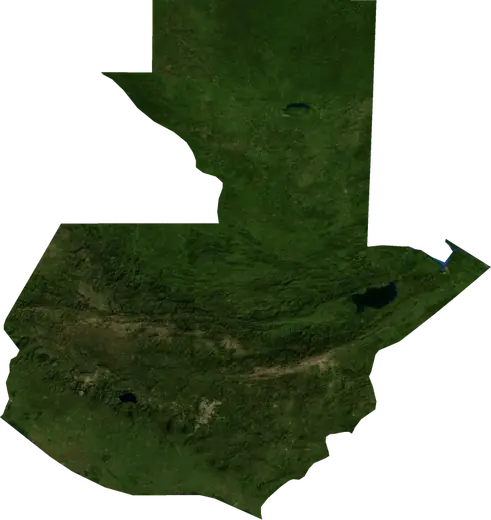
 Guatemala
: earthquakes and wildfires
Latest earthquakes and active wildfires in Guatemala on a live map, the strongest earthquakes and largest fires on record, and statistics by year.
Live map – Guatemala
Key statistics (30 days)
Earthquakes M2.5+ and the wildfire fronts shown on the map.
Fire danger
Forecast for the area around: Chiquimula. Danger can vary locally; follow official guidance. Source: Copernicus EMS – EFFIS (FWI).
Severe weather (forecast)
- Today: Rain – Very heavy rain (25–50 mm) · Coban
- Tomorrow: Rain – Very heavy rain (25–50 mm) · Coban
Forecast for the area around: Guatemala. It does not replace warnings from the national weather service. Source: ECMWF / Copernicus EMS.
Recent events in Guatemala
- 4 h agoWildfire near Quetzaltenango, Guatemala – active28 km² · 13 km SSW of Quetzaltenango, Guatemala
- 4 h agoWildfire near La Gomera, Guatemala – active16 km² · 18 km SW of La Gomera, Guatemala
- 16 h agoWildfire near La Gomera, Guatemala – active7.1 km² · near La Gomera, Guatemala
- 16 h agoWildfire near Villa Nueva, Guatemala – active4.0 km² · 41 km SW of Villa Nueva, Guatemala
- 16 h agoWildfire near Villa Nueva, Guatemala – active111 km² · 33 km W of Villa Nueva, Guatemala
- 3.526 h agoM3.5 earthquake near Puerto San Jose, Guatemala54 km SSW of Puerto San Jose, Guatemala
Historical overview
Earthquakes M3.0+ and significant events of other hazards.
About Guatemala
Guatemala has recorded 3,394 earthquakes of magnitude 3.0 or more since 1976. The strongest was M7.5 in 1976.
Satellites have detected 6 significant wildfires here; the largest burned about 111 km².
Know the official emergency number, prepare an emergency kit and follow the instructions of your civil protection authority.
Learn more ›Earthquakes
Earthquakes today: Guatemala →
3,394 earthquakes of magnitude 3.0 or more since 1976. The strongest was M7.5.
Recent earthquakes
| Mag | Location | Time (UTC) | Depth |
|---|---|---|---|
| 3.5 | 54 km SSW of Puerto San Jose, Guatemala | 30.0 km | |
| 2.9 | 28 km WNW of Jutiapa, Guatemala | 9.0 km | |
| 3.6 | near Zacapa, Guatemala | 6.0 km | |
| 2.5 | 51 km SSW of Puerto San Jose, Guatemala | 5.0 km | |
| 4.8 | 33 km S of Puerto San Jose, Guatemala | 58.3 km | |
| 5.5 | 40 km S of Puerto San Jose, Guatemala | 59.7 km | |
| 4.5 | 77 km SW of La Gomera, Guatemala | 34.2 km | |
| 4.2 | 13 km ENE of Totonicapan, Guatemala | 181.7 km | |
| 4.6 | 11 km SSW of Chicacao, Guatemala | 98.8 km | |
| 4.2 | 64 km SSW of La Gomera, Guatemala | 29.6 km |
Show all (88)
Strongest earthquakes on record
| Mag | Location | Time (UTC) | Depth |
|---|---|---|---|
| 7.5 | 8 km N of Los Amates, Guatemala | 5.0 km | |
| 7.3 | 80 km S of Coatepeque, Guatemala | 24.0 km | |
| 7.0 | 71 km S of Coatepeque, Guatemala | 67.1 km | |
| 6.8 | 28 km SW of Puerto San Jose, Guatemala | 38.0 km | |
| 6.8 | 12 km SW of Puerto San Jose, Guatemala | 58.0 km | |
| 6.7 | 76 km SSE of Masagua, Guatemala | 23.0 km | |
| 6.7 | 29 km ENE of Puerto Barrios, Guatemala | 10.0 km | |
| 6.6 | 18 km S of Mazatenango, Guatemala | 33.0 km | |
| 6.6 | 49 km SSE of Masagua, Guatemala | 65.0 km | |
| 6.5 | 72 km SSW of Coatepeque, Guatemala | 20.0 km | |
| 6.5 | 33 km S of Puerto San Jose, Guatemala | 24.0 km | |
| 6.5 | 49 km SSW of Coatepeque, Guatemala | 64.8 km | |
| 6.4 | 38 km ENE of Chichicastenango, Guatemala | 252.0 km | |
| 6.4 | 30 km WSW of Coatepeque, Guatemala | 66.0 km | |
| 6.4 | 20 km NNE of Puerto Barrios, Guatemala | 22.0 km |
Earthquakes per year (M3.0+)
Year
| 2026 | 80 | M5.5 |
| 2025 | 91 | M5.9 |
| 2024 | 76 | M6.2 |
| 2023 | 82 | M6.4 |
| 2022 | 80 | M6.2 |
| 2021 | 89 | M5.8 |
| 2020 | 62 | M5.8 |
| 2019 | 78 | M5.9 |
| 2018 | 85 | M5.7 |
| 2017 | 86 | M6.8 |
| 2016 | 87 | M6.1 |
| 2015 | 89 | M5.7 |
| 2014 | 150 | M6.1 |
| 2013 | 149 | M6.4 |
| 2012 | 205 | M7.3 |
| 2011 | 86 | M5.8 |
| 2010 | 67 | M5.6 |
| 2009 | 53 | M6.3 |
| 2008 | 130 | M6.1 |
| 2007 | 111 | M6.7 |
| 2006 | 50 | M6.0 |
| 2005 | 75 | M6.1 |
| 2004 | 72 | M5.9 |
| 2003 | 85 | M6.5 |
| 2002 | 63 | M6.0 |
| 2001 | 73 | M5.9 |
| 2000 | 64 | M5.5 |
| 1999 | 76 | M6.7 |
| 1998 | 86 | M6.6 |
| 1997 | 56 | M6.1 |
| 1996 | 50 | M5.9 |
| 1995 | 53 | M5.7 |
| 1994 | 33 | M6.0 |
| 1993 | 51 | M6.0 |
| 1992 | 41 | M6.0 |
| 1991 | 32 | M6.2 |
| 1990 | 23 | M5.8 |
| 1989 | 28 | M5.4 |
| 1988 | 60 | M6.0 |
| 1987 | 20 | M5.8 |
| 1986 | 29 | M5.9 |
| 1985 | 31 | M5.6 |
| 1984 | 31 | M5.9 |
| 1983 | 40 | M7.0 |
| 1982 | 41 | M6.5 |
| 1981 | 17 | M5.3 |
| 1980 | 32 | M6.4 |
| 1979 | 38 | M6.8 |
| 1978 | 35 | M5.7 |
| 1977 | 24 | M5.6 |
| 1976 | 49 | M7.5 |
Wildfires
6 major fires since 2025. The largest covered about 111 km².
Recent fires
| Area | Location | Since | Status |
|---|---|---|---|
| 28 km² | 13 km SSW of Quetzaltenango, Guatemala | Active | |
| 16 km² | 18 km SW of La Gomera, Guatemala | Active | |
| 7.1 km² | near La Gomera, Guatemala | Active | |
| 4.0 km² | 41 km SW of Villa Nueva, Guatemala | Active | |
| 111 km² | 33 km W of Villa Nueva, Guatemala | Active | |
| 3.8 km² | 12 km SSE of Escuintla, Guatemala | Inactive | |
| 8.6 km² | 5 km W of Santa Lucia Cotzumalguapa, Guatemala | Inactive | |
| 11 km² | 38 km SSW of Panzos, Guatemala | Inactive | |
| 19 km² | 11 km N of Jacaltenango, Guatemala | Inactive | |
| 15 km² | 38 km SE of Escuintla, Guatemala | Inactive |
Largest fires on record
| Area | Location | Since | Status |
|---|---|---|---|
| 111 km² | 33 km W of Villa Nueva, Guatemala | Active | |
| 28 km² | 13 km SSW of Quetzaltenango, Guatemala | Active | |
| 19 km² | 11 km N of Jacaltenango, Guatemala | Inactive | |
| 15 km² | 18 km SW of La Gomera, Guatemala | Active | |
| 15 km² | 38 km SE of Escuintla, Guatemala | Inactive | |
| 11 km² | 38 km SSW of Panzos, Guatemala | Inactive |
Major fires per year
Year
| 2026 | 5 | 111 km² |
| 2025 | 1 | 15 km² |
Regions
Places
- Guatemala City
- Villa Nueva
- Mixco
- Coban
- Quetzaltenango
- Jalapa
- Escuintla
- Villa Canales
- Jutiapa
- Chichicastenango
- San Juan Sacatepequez
- Petapa
- Santa Lucia Cotzumalguapa
- Chiquimula
- Coatepeque
- Chinautla
- Totonicapan
- Puerto Barrios
- Chimaltenango
- Malacatan
- Retalhuleu
- Santa Catarina Pinula
- San Jose Pinula
- Huehuetenango
- Santa Cruz del Quiche
- Mazatenango
- Panzos
- Amatitlan
- Palin
- Salama
- Chicacao
- Zacapa
- Comitancillo
- Fraijanes
- San Pedro Ayampuc
- Patzun
- San Francisco El Alto
- Ostuncalco
- Soloma
- Asuncion Mita
- Colomba
- Barberena
- San Marcos
- Antigua Guatemala
- Solola
- Masagua
- Cantel
- Cuilapa
- Patulul
- San Pedro Sacatepequez
- Nuevo San Carlos
- Jacaltenango
- Yepocapa
- Tecpan Guatemala
- Ciudad Vieja
- Santiago Atitlan
- Comalapa
- Momostenango
- San Benito
- Santiago Sacatepequez
- San Sebastian
- Jalpatagua
- Sumpango
- Nahuala
- San Andres Itzapa
- Guastatoya
- San Luis Jilotepeque
- San Felipe
- Zaragoza
- La Gomera
- Alotenango
- Puerto San Jose
- Nebaj
- Cabrican
- San Francisco Zapotitlan
- Santa Maria de Jesus
- Patzicia
- San Lucas Sacatepequez
- Esquipulas
- El Estor