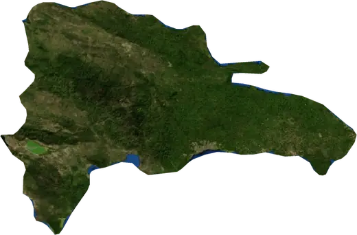
 Constanza
Earthquakes near Constanza
Was there an earthquake in Constanza just now? Live earthquakes within 100 km of Constanza, Dominican Republic, the strongest in history and statistics.
Live map – Constanza
Earthquakes within 100 km of the city centre.
Key statistics (30 days)
Earthquakes M2.5+ and the wildfire fronts shown on the map.
Recent events in Constanza
No significant events in the last few days.
Historical overview
Earthquakes M3.0+ and significant events of other hazards.
About Constanza
Constanza has recorded 176 earthquakes of magnitude 3.0 or more since 1977. The strongest was M6.4 in 2003.
Know the official emergency number, prepare an emergency kit and follow the instructions of your civil protection authority.
Learn more ›Did you feel an earthquake in Constanza?
No reports yet.
Earthquakes
176 earthquakes of magnitude 3.0 or more since 1977 within 100 km. The strongest was M6.4.
Recent earthquakes
No earthquakes of magnitude 2.5+ in the last 12 months.
Strongest earthquakes on record
| Mag | Location | Time (UTC) | Depth |
|---|---|---|---|
| 6.4 | near Puerto Plata, Dominican Republic | 10.0 km | |
| 5.6 | 42 km NW of Santiago de los Caballeros, Dominican Republic | 33.0 km | |
| 5.6 | 41 km WSW of Santo Domingo Oeste, Dominican Republic | 27.7 km | |
| 5.5 | 43 km WSW of Santo Domingo Oeste, Dominican Republic | 39.8 km | |
| 5.3 | 36 km WSW of Santo Domingo Oeste, Dominican Republic | 22.6 km | |
| 5.2 | 20 km NNE of San Ignacio de Sabaneta, Dominican Republic | 19.8 km | |
| 5.2 | 12 km NNW of San Jose de Ocoa, Dominican Republic | 58.0 km | |
| 5.2 | near Santa Cruz de Barahona, Dominican Republic | 12.8 km | |
| 5.1 | 5 km NW of Santa Cruz de Barahona, Dominican Republic | 26.7 km | |
| 5.1 | 33 km NE of San Francisco de Macoris, Dominican Republic | 8.8 km | |
| 5.1 | 44 km SSE of La Vega, Dominican Republic | 82.9 km | |
| 5.0 | near Piedra Blanca, Dominican Republic | 112.4 km | |
| 5.0 | 42 km SSE of La Vega, Dominican Republic | 91.1 km | |
| 5.0 | 37 km NNE of San Francisco de Macoris, Dominican Republic | 33.0 km | |
| 4.9 | 51 km W of Santo Domingo Oeste, Dominican Republic | 23.1 km |
Earthquakes per year (M3.0+)
Year
| 2025 | 5 | M4.7 |
| 2024 | 5 | M4.3 |
| 2023 | 8 | M4.8 |
| 2022 | 6 | M4.3 |
| 2021 | 3 | M4.5 |
| 2020 | 6 | M4.5 |
| 2019 | 4 | M4.3 |
| 2018 | 4 | M5.2 |
| 2017 | 4 | M4.9 |
| 2016 | 6 | M4.6 |
| 2015 | 14 | M4.8 |
| 2014 | 5 | M4.3 |
| 2013 | 9 | M4.9 |
| 2012 | 8 | M5.5 |
| 2011 | 2 | M4.5 |
| 2010 | 4 | M4.6 |
| 2009 | 4 | M4.5 |
| 2008 | 12 | M4.6 |
| 2007 | 11 | M5.0 |
| 2006 | 3 | M4.5 |
| 2005 | 4 | M4.7 |
| 2004 | 1 | M4.2 |
| 2003 | 13 | M6.4 |
| 2002 | 1 | M4.1 |
| 2001 | 1 | M4.5 |
| 1999 | 1 | M4.6 |
| 1998 | 4 | M5.2 |
| 1997 | 1 | M4.7 |
| 1996 | 4 | M5.1 |
| 1995 | 2 | M5.0 |
| 1994 | 2 | M5.6 |
| 1993 | 5 | M5.3 |
| 1992 | 1 | M3.9 |
| 1991 | 2 | M4.5 |
| 1990 | 2 | M4.3 |
| 1988 | 2 | M5.6 |
| 1987 | 1 | M4.9 |
| 1986 | 1 | M4.7 |
| 1984 | 1 | M4.4 |
| 1979 | 1 | M4.2 |
| 1977 | 3 | M5.0 |
Nearby places
- Jarabacoa 26 km
- Bonao 35 km
- La Vega 41 km
- San Jose de Ocoa 47 km
- Azua 51 km
- San Juan de la Maguana 52 km
- Moca 59 km
- Santiago de los Caballeros 60 km
- Salcedo 62 km
- Cotui 64 km
- Tamboril 66 km
- Villa Altagracia 66 km
- San Francisco de Macoris 67 km