 Colombia
: earthquakes and wildfires
Latest earthquakes and active wildfires in Colombia on a live map, the strongest earthquakes and largest fires on record, and statistics by year.
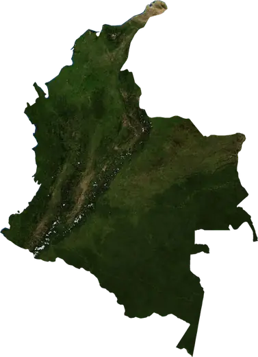
Live map – Colombia
Key statistics (30 days)
Earthquakes M2.5+ and the wildfire fronts shown on the map.
Fire danger
Forecast for the area around: Cucuta. Danger can vary locally; follow official guidance. Source: Copernicus EMS – EFFIS (FWI).
Severe weather (forecast)
- Today: Rain – Extreme rain (≥ 50 mm) · Manizales
- Today: Lightning – High lightning · Buenaventura
- Tomorrow: Rain – Extreme rain (≥ 50 mm) · Cali
- Tomorrow: Lightning – High lightning · Valledupar
Forecast for the area around: Colombia. It does not replace warnings from the national weather service. Source: ECMWF / Copernicus EMS.
Recent events in Colombia
- 4 h agoWildfire near Cali, Colombia – active3.6 km² · 15 km NNE of Cali, Colombia
- 4 h agoWildfire near Cucuta, Colombia – active13 km² · 17 km NE of Cucuta, Colombia
- 4 h agoWildfire near Cucuta, Colombia – active29 km² · 10 km W of Cucuta, Colombia
- 4 h agoWildfire near Albania, Colombia – active13 km² · near Albania, Colombia
- 4 h agoWildfire near Cucuta, Colombia – active6.2 km² · 5 km NNE of Cucuta, Colombia
- 4 h agoWildfire near Hatonuevo, Colombia – active4.6 km² · 12 km ESE of Hatonuevo, Colombia
Historical overview
Earthquakes M3.0+ and significant events of other hazards.
About Colombia
Colombia has recorded 4,539 earthquakes of magnitude 3.0 or more since 1976. The strongest was M7.4 in 2026.
Satellites have detected 92 significant wildfires here; the largest burned about 80 km².
Know the official emergency number, prepare an emergency kit and follow the instructions of your civil protection authority.
Learn more ›Earthquakes
4,539 earthquakes of magnitude 3.0 or more since 1976. The strongest was M7.4.
Recent earthquakes
| Mag | Location | Time (UTC) | Depth |
|---|---|---|---|
| 4.4 | 60 km ESE of Tulua, Colombia | 9.7 km | |
| 4.5 | 10 km WSW of Chaparral, Colombia | 10.0 km | |
| 5.4 | 65 km SE of Tulua, Colombia | 10.0 km | |
| 4.3 | 65 km ENE of Palmira, Colombia | 10.0 km | |
| 4.3 | 52 km NNE of Buenaventura, Colombia | 84.3 km | |
| 4.7 | 24 km WNW of Sevilla, Colombia | 166.2 km | |
| 4.2 | 15 km WNW of Ituango, Colombia | 58.9 km | |
| 4.0 | 31 km W of Nuqui, Colombia | 20.1 km | |
| 4.4 | 29 km NE of Cali, Colombia | 155.2 km | |
| 4.1 | 44 km ESE of Jurado, Colombia | 37.7 km |
Show all (139)
Strongest earthquakes on record
| Mag | Location | Time (UTC) | Depth |
|---|---|---|---|
| 7.4 | 38 km NNW of La Union, Colombia | 110.0 km | |
| 7.4 | 11 km NNW of Murindo, Colombia | 10.0 km | |
| 7.3 | 36 km WNW of Pitalito, Colombia | 170.0 km | |
| 7.2 | 33 km SSW of Pizarro, Colombia | 15.0 km | |
| 7.2 | 88 km NNW of Buenaventura, Colombia | 21.3 km | |
| 7.0 | 15 km S of Murindo, Colombia | 14.0 km | |
| 6.9 | 16 km SW of Pasto, Colombia | 145.0 km | |
| 6.8 | 41 km NW of Timbiqui, Colombia | 31.0 km | |
| 6.8 | 56 km ESE of Tulua, Colombia | 198.7 km | |
| 6.8 | 42 km SSE of Miranda, Colombia | 12.0 km | |
| 6.7 | 101 km WSW of Bahia Solano, Colombia | 12.0 km | |
| 6.6 | 11 km NW of Manizales, Colombia | 119.6 km | |
| 6.5 | 64 km WNW of San Juan de Uraba, Colombia | 13.0 km | |
| 6.5 | 10 km SW of Jurado, Colombia | 17.0 km | |
| 6.5 | 19 km W of Tauramena, Colombia | 17.0 km |
Earthquakes per year (M3.0+)
Year
| 2026 | 132 | M7.4 |
| 2025 | 85 | M6.3 |
| 2024 | 106 | M5.6 |
| 2023 | 125 | M6.5 |
| 2022 | 97 | M5.5 |
| 2021 | 113 | M5.1 |
| 2020 | 102 | M5.7 |
| 2019 | 85 | M6.1 |
| 2018 | 116 | M6.0 |
| 2017 | 84 | M5.5 |
| 2016 | 106 | M6.0 |
| 2015 | 76 | M6.2 |
| 2014 | 107 | M5.5 |
| 2013 | 65 | M6.9 |
| 2012 | 49 | M7.3 |
| 2011 | 55 | M5.7 |
| 2010 | 40 | M5.4 |
| 2009 | 44 | M5.2 |
| 2008 | 102 | M5.7 |
| 2007 | 119 | M6.8 |
| 2006 | 128 | M6.2 |
| 2005 | 131 | M5.3 |
| 2004 | 110 | M7.2 |
| 2003 | 67 | M6.0 |
| 2002 | 62 | M5.9 |
| 2001 | 78 | M5.9 |
| 2000 | 107 | M6.5 |
| 1999 | 112 | M6.2 |
| 1998 | 97 | M5.7 |
| 1997 | 84 | M6.8 |
| 1996 | 97 | M6.3 |
| 1995 | 99 | M6.6 |
| 1994 | 75 | M6.8 |
| 1993 | 118 | M6.1 |
| 1992 | 158 | M7.4 |
| 1991 | 247 | M7.2 |
| 1990 | 45 | M6.1 |
| 1989 | 58 | M5.9 |
| 1988 | 55 | M5.8 |
| 1987 | 59 | M6.0 |
| 1986 | 60 | M5.7 |
| 1985 | 56 | M5.6 |
| 1984 | 57 | M5.5 |
| 1983 | 47 | M5.3 |
| 1982 | 60 | M5.3 |
| 1981 | 79 | M5.7 |
| 1980 | 92 | M5.8 |
| 1979 | 130 | M6.4 |
| 1978 | 45 | M5.5 |
| 1977 | 43 | M6.5 |
| 1976 | 75 | M5.9 |
Wildfires
92 major fires since 2025. The largest covered about 80 km².
Recent fires
| Area | Location | Since | Status |
|---|---|---|---|
| 3.6 km² | 15 km NNE of Cali, Colombia | Active | |
| 13 km² | 17 km NE of Cucuta, Colombia | Active | |
| 29 km² | 10 km W of Cucuta, Colombia | Active | |
| 13 km² | near Albania, Colombia | Active | |
| 6.2 km² | 5 km NNE of Cucuta, Colombia | Active | |
| 4.6 km² | 12 km ESE of Hatonuevo, Colombia | Active | |
| 6.1 km² | 58 km ENE of Cumaribo, Colombia | Active | |
| 8.8 km² | 109 km S of Orocue, Colombia | Active | |
| 17 km² | 8 km ENE of Barrancas, Colombia | Active | |
| 4.2 km² | 9 km NE of Sogamoso, Colombia | Active |
Show all (139)
| Area | Location | Since | Status |
|---|---|---|---|
| 3.4 km² | 6 km N of Sogamoso, Colombia | Active | |
| 19 km² | 23 km WSW of Tunja, Colombia | Active | |
| 14 km² | 24 km ENE of La Mesa, Colombia | Active | |
| 3.6 km² | 14 km SSW of Bogota, Colombia | Active | |
| 3.4 km² | 107 km SSE of Orocue, Colombia | Active | |
| 6.5 km² | 34 km SE of La Primavera, Colombia | Active | |
| 7.5 km² | 57 km SSW of Orocue, Colombia | Active | |
| 4.7 km² | 36 km ESE of Agustin Codazzi, Colombia | Active | |
| 14 km² | 29 km SSE of Mani, Colombia | Active | |
| 3.3 km² | 32 km E of La Primavera, Colombia | Active | |
| 4.1 km² | 63 km ENE of La Primavera, Colombia | Active | |
| 5.1 km² | 40 km NNW of Cucuta, Colombia | Active | |
| 5.7 km² | 54 km NW of Cumaribo, Colombia | Active | |
| 8.7 km² | 22 km ESE of La Primavera, Colombia | Active | |
| 5.9 km² | 100 km SE of Orocue, Colombia | Active | |
| 5.4 km² | 67 km ESE of Puerto Gaitan, Colombia | Active | |
| 4.8 km² | 71 km SE of Orocue, Colombia | Active | |
| 5.3 km² | 20 km NE of Simiti, Colombia | Active | |
| 3.9 km² | 36 km ESE of Agustin Codazzi, Colombia | Active | |
| 6.6 km² | 15 km WNW of Mapiripan, Colombia | Active | |
| 4.0 km² | 104 km NE of Mapiripan, Colombia | Active | |
| 13 km² | 74 km WSW of San Jose del Guaviare, Colombia | Active | |
| 4.6 km² | 108 km NE of Mapiripan, Colombia | Active | |
| 3.2 km² | 61 km WSW of Cumaribo, Colombia | Active | |
| 3.4 km² | 18 km ESE of Puerto Carreno, Colombia | Active | |
| 5.4 km² | 95 km NE of Mapiripan, Colombia | Active | |
| 6.7 km² | 103 km SSE of Orocue, Colombia | Active | |
| 15 km² | 56 km SSW of Puerto Gaitan, Colombia | Active | |
| 6.3 km² | 23 km SSE of Cravo Norte, Colombia | Active | |
| 3.4 km² | 54 km W of Puerto Carreno, Colombia | Active | |
| 3.2 km² | 40 km N of San Jose del Guaviare, Colombia | Active | |
| 5.0 km² | 28 km SE of Manizales, Colombia | Inactive | |
| 10 km² | 22 km WNW of Becerril, Colombia | Inactive | |
| 17 km² | 25 km W of Becerril, Colombia | Inactive | |
| 16 km² | 9 km S of Cartagena, Colombia | Inactive | |
| 3.4 km² | 12 km W of San Antonio, Colombia | Inactive | |
| 8.7 km² | 19 km N of Magangue, Colombia | Inactive | |
| 3.6 km² | 16 km SSE of Pinillos, Colombia | Inactive | |
| 3.9 km² | 14 km NW of Tibu, Colombia | Inactive | |
| 4.3 km² | 47 km WSW of El Banco, Colombia | Inactive | |
| 7.1 km² | 46 km N of Magangue, Colombia | Inactive | |
| 4.1 km² | 7 km SE of El Carmen de Bolivar, Colombia | Inactive | |
| 12 km² | 9 km NE of Cucuta, Colombia | Inactive | |
| 3.3 km² | 25 km ESE of El Banco, Colombia | Inactive | |
| 4.0 km² | 17 km ENE of Simiti, Colombia | Inactive | |
| 8.7 km² | 102 km ESE of Puerto Gaitan, Colombia | Inactive | |
| 3.8 km² | 108 km SE of Puerto Gaitan, Colombia | Inactive | |
| 4.9 km² | 11 km SSE of Santa Rosalia, Colombia | Inactive | |
| 9.9 km² | 22 km NNW of Cucuta, Colombia | Inactive | |
| 4.4 km² | 5 km W of Malambo, Colombia | Inactive | |
| 12 km² | 19 km WNW of Tunja, Colombia | Inactive | |
| 10 km² | 120 km ESE of Cravo Norte, Colombia | Inactive | |
| 11 km² | 20 km SE of Espinal, Colombia | Inactive | |
| 12 km² | 30 km SE of Ibague, Colombia | Inactive | |
| 12 km² | 36 km S of Soledad, Colombia | Inactive | |
| 26 km² | 47 km S of Ibague, Colombia | Inactive | |
| 11 km² | 20 km E of Chiriguana, Colombia | Inactive | |
| 20 km² | 22 km E of Chiriguana, Colombia | Inactive | |
| 15 km² | 105 km ESE of Cravo Norte, Colombia | Inactive | |
| 11 km² | 44 km S of Santa Rosalia, Colombia | Inactive | |
| 11 km² | 29 km N of Cravo Norte, Colombia | Inactive | |
| 22 km² | 126 km W of Puerto Carreno, Colombia | Inactive | |
| 21 km² | 29 km S of Cravo Norte, Colombia | Inactive | |
| 21 km² | 27 km NE of Cravo Norte, Colombia | Inactive | |
| 11 km² | 35 km NNE of La Primavera, Colombia | Inactive | |
| 14 km² | 116 km W of Cumaribo, Colombia | Inactive | |
| 10 km² | 49 km ESE of Arauca, Colombia | Inactive | |
| 12 km² | 57 km SSE of La Primavera, Colombia | Inactive | |
| 11 km² | 42 km NNE of La Primavera, Colombia | Inactive | |
| 22 km² | 59 km ESE of Orocue, Colombia | Inactive | |
| 50 km² | 71 km ENE of La Primavera, Colombia | Inactive | |
| 20 km² | 26 km S of Santa Rosalia, Colombia | Inactive | |
| 19 km² | 126 km W of Puerto Carreno, Colombia | Inactive | |
| 80 km² | 31 km ENE of Cravo Norte, Colombia | Inactive | |
| 11 km² | 22 km NW of Cravo Norte, Colombia | Inactive | |
| 21 km² | 32 km S of Cravo Norte, Colombia | Inactive | |
| 13 km² | 28 km NW of La Primavera, Colombia | Inactive | |
| 18 km² | 21 km NNE of Cravo Norte, Colombia | Inactive | |
| 12 km² | 46 km WSW of Puerto Carreno, Colombia | Inactive | |
| 16 km² | 61 km WNW of Puerto Carreno, Colombia | Inactive | |
| 10 km² | 35 km NNE of Cumaribo, Colombia | Inactive | |
| 11 km² | 28 km SSW of Puerto Carreno, Colombia | Inactive | |
| 26 km² | 62 km SE of Orocue, Colombia | Inactive | |
| 19 km² | 78 km WNW of Cumaribo, Colombia | Inactive | |
| 18 km² | 40 km ESE of Cravo Norte, Colombia | Inactive | |
| 13 km² | 36 km NNW of Puerto Carreno, Colombia | Inactive | |
| 14 km² | 17 km WNW of Orocue, Colombia | Inactive | |
| 13 km² | 28 km SSW of Santa Rosalia, Colombia | Inactive | |
| 11 km² | 74 km N of Mapiripan, Colombia | Inactive | |
| 15 km² | 15 km SE of La Primavera, Colombia | Inactive | |
| 17 km² | 99 km S of Orocue, Colombia | Inactive | |
| 10 km² | 60 km ESE of La Primavera, Colombia | Inactive | |
| 12 km² | 25 km SE of La Macarena, Colombia | Inactive | |
| 12 km² | 123 km ESE of Arauca, Colombia | Inactive | |
| 23 km² | 45 km NE of Cravo Norte, Colombia | Inactive | |
| 10 km² | 73 km SE of Puerto Gaitan, Colombia | Inactive | |
| 13 km² | 39 km S of Puerto Gaitan, Colombia | Inactive | |
| 11 km² | 43 km S of Cravo Norte, Colombia | Inactive | |
| 25 km² | 50 km ENE of Cravo Norte, Colombia | Inactive | |
| 11 km² | 34 km NW of La Primavera, Colombia | Inactive | |
| 10 km² | 64 km SSE of La Primavera, Colombia | Inactive | |
| 18 km² | 112 km WNW of Puerto Carreno, Colombia | Inactive | |
| 12 km² | 57 km ENE of Mapiripan, Colombia | Inactive | |
| 19 km² | 39 km SE of La Macarena, Colombia | Inactive | |
| 12 km² | 32 km ESE of La Macarena, Colombia | Inactive | |
| 14 km² | 90 km E of Cartagena del Chaira, Colombia | Inactive | |
| 13 km² | 31 km S of La Macarena, Colombia | Inactive | |
| 13 km² | 31 km SE of La Macarena, Colombia | Inactive | |
| 11 km² | 76 km W of San Jose del Guaviare, Colombia | Inactive | |
| 13 km² | 25 km NNW of Puerto Gaitan, Colombia | Inactive | |
| 11 km² | 100 km E of La Primavera, Colombia | Inactive | |
| 11 km² | 77 km SSE of San Jose del Guaviare, Colombia | Inactive | |
| 12 km² | 70 km SSE of San Jose del Guaviare, Colombia | Inactive | |
| 11 km² | 33 km ESE of La Primavera, Colombia | Inactive | |
| 12 km² | 41 km NW of Puerto Carreno, Colombia | Inactive | |
| 12 km² | 74 km SE of Cartagena del Chaira, Colombia | Inactive | |
| 17 km² | 67 km SE of Cartagena del Chaira, Colombia | Inactive | |
| 13 km² | 38 km ENE of Solano, Colombia | Inactive | |
| 23 km² | 54 km ESE of Cartagena del Chaira, Colombia | Inactive | |
| 22 km² | 57 km ESE of Cartagena del Chaira, Colombia | Inactive | |
| 12 km² | 96 km SE of Cartagena del Chaira, Colombia | Inactive | |
| 12 km² | 88 km NNW of San Jose del Guaviare, Colombia | Inactive | |
| 12 km² | 118 km NE of Cumaribo, Colombia | Inactive | |
| 13 km² | 56 km S of Orocue, Colombia | Inactive | |
| 19 km² | 63 km NNE of Mapiripan, Colombia | Inactive | |
| 18 km² | 89 km ESE of La Primavera, Colombia | Inactive | |
| 21 km² | 61 km NNE of Mapiripan, Colombia | Inactive | |
| 12 km² | 49 km SW of La Macarena, Colombia | Inactive | |
| 14 km² | 50 km N of Mapiripan, Colombia | Inactive |
Largest fires on record
| Area | Location | Since | Status |
|---|---|---|---|
| 80 km² | 31 km ENE of Cravo Norte, Colombia | Inactive | |
| 50 km² | 71 km ENE of La Primavera, Colombia | Inactive | |
| 29 km² | 10 km W of Cucuta, Colombia | Active | |
| 26 km² | 62 km SE of Orocue, Colombia | Inactive | |
| 26 km² | 47 km S of Ibague, Colombia | Inactive | |
| 25 km² | 50 km ENE of Cravo Norte, Colombia | Inactive | |
| 23 km² | 45 km NE of Cravo Norte, Colombia | Inactive | |
| 23 km² | 54 km ESE of Cartagena del Chaira, Colombia | Inactive | |
| 22 km² | 126 km W of Puerto Carreno, Colombia | Inactive | |
| 22 km² | 57 km ESE of Cartagena del Chaira, Colombia | Inactive | |
| 22 km² | 59 km ESE of Orocue, Colombia | Inactive | |
| 21 km² | 61 km NNE of Mapiripan, Colombia | Inactive | |
| 21 km² | 27 km NE of Cravo Norte, Colombia | Inactive | |
| 21 km² | 29 km S of Cravo Norte, Colombia | Inactive | |
| 21 km² | 32 km S of Cravo Norte, Colombia | Inactive |
Major fires per year
Year
| 2026 | 84 | 80 km² |
| 2025 | 8 | 21 km² |
Regions
- Santander Department
- Antioquia
- Chocó
- Nariño
- Valle del Cauca Department
- Norte de Santander Department
- Casanare Department
- Meta Department
- Boyacá
- San Andres y Providencia
- Cauca Department
- Huila Department
- Risaralda Department
- La Guajira Department
- Cesar Department
- Cundinamarca
- Quindío Department
- Tolima Department
- Bolívar
- Arauca Department
- Bogota D.C.
- Córdoba
- Magdalena Department
- Caldas Department
- Atlántico
- Sucre Department
- Caquetá
- Vichada Department
- Guaviare Department
Places
- Bogota
- Cali
- Medellin
- Barranquilla
- Kennedy
- Cartagena
- Cucuta
- Soacha
- Bucaramanga
- Ibague
- Santa Marta
- Monteria
- Valledupar
- Pereira
- Manizales
- Buenaventura
- Bello
- Pasto
- Neiva
- Soledad
- Villavicencio
- Popayán
- Palmira
- Armenia
- Itaguei
- Sincelejo
- Floridablanca
- Buenaventura
- Tulua
- Dosquebradas
- Barrancabermeja
- Riohacha
- Tunja
- Yopal
- Florencia
- Maicao
- Piedecuesta
- Envigado
- Facatativa
- Pitalito
- Madrid
- Cartago
- Zipaquira
- Quibdo
- Malambo
- Rionegro
- Mosquera
- Chia
- Magangue
- Funza
- Guadalajara de Buga
- Sogamoso
- Giron
- Girardot City
- Sabanalarga
- Ocana
- Santander de Quilichao
- Aguachica
- Cerete
- Duitama
- Montelibano
- Fusagasuga
- Cienaga
- Tumaco
- Apartado
- Chigorodo
- Arauca
- Sabaneta
- Caldas
- La Dorada
- Calarca
- Ipiales
- Yumbo
- Planeta Rica
- Granada
- Chinchina
- Baranoa
- Villa del Rosario
- San Marcos
- Sahagun