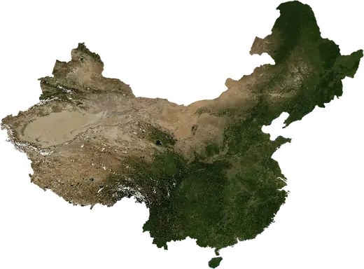
 Xingtai
: earthquakes and wildfires
Was there an earthquake or a fire near Xingtai just now? Live map within 100 km, the strongest earthquakes, the largest fires and statistics for Xingtai, China.
Live map – Xingtai
Earthquakes within 100 km of the city centre.
Key statistics (30 days)
Earthquakes M2.5+ and the wildfire fronts shown on the map.
Recent events in Xingtai
- 3 days agoWildfire near Hecun, China76 km² · 22 km N of Hecun, China
- 3 days agoWildfire near Handan, China9.8 km² · 7 km WSW of Handan, China
- 3 days agoWildfire near Hecun, China23 km² · 6 km N of Hecun, China
- 3 days agoWildfire near Hecun, China12 km² · 11 km E of Hecun, China
- 3 days agoWildfire near Hecun, China21 km² · 28 km NW of Hecun, China
- 4 days agoWildfire near Xingtai, China8.0 km² · 9 km NNE of Xingtai, China
Historical overview
Earthquakes M3.0+ and significant events of other hazards.
About Xingtai
Xingtai has recorded 12 earthquakes of magnitude 3.0 or more since 1981. The strongest was M5.5 in 1981.
Satellites have detected 8 significant wildfires here; the largest burned about 76 km².
Know the official emergency number, prepare an emergency kit and follow the instructions of your civil protection authority.
Learn more ›Did you feel an earthquake in Xingtai?
No reports yet.
Earthquakes
12 earthquakes of magnitude 3.0 or more since 1981 within 100 km. The strongest was M5.5.
Recent earthquakes
No earthquakes of magnitude 2.5+ in the last 12 months.
Strongest earthquakes on record
| Mag | Location | Time (UTC) | Depth |
|---|---|---|---|
| 5.5 | 88 km NNE of Handan, China | 14.0 km | |
| 4.9 | 40 km ENE of Xingtai, China | 15.3 km | |
| 4.8 | 70 km S of Shijiazhuang, China | 25.7 km | |
| 4.6 | 80 km SSE of Shijiazhuang, China | 33.0 km |
Earthquakes per year (M3.0+)
Year
| 2002 | 2 | M4.8 |
| 1995 | 1 | M3.8 |
| 1993 | 2 | M3.9 |
| 1992 | 1 | M3.5 |
| 1990 | 1 | M3.7 |
| 1986 | 1 | M3.7 |
| 1985 | 1 | M4.9 |
| 1983 | 1 | M4.4 |
| 1982 | 1 | M4.6 |
| 1981 | 1 | M5.5 |
Wildfires
8 major fires since 2026 within 100 km. The largest covered about 76 km².
Recent fires
| Area | Location | Since | Status |
|---|---|---|---|
| 76 km² | 22 km N of Hecun, China | Inactive | |
| 9.8 km² | 7 km WSW of Handan, China | Inactive | |
| 23 km² | 6 km N of Hecun, China | Inactive | |
| 12 km² | 11 km E of Hecun, China | Inactive | |
| 21 km² | 28 km NW of Hecun, China | Inactive | |
| 8.0 km² | 9 km NNE of Xingtai, China | Inactive | |
| 17 km² | 10 km N of Hecun, China | Inactive | |
| 5.3 km² | near Hecun, China | Inactive | |
| 15 km² | 33 km W of Hecun, China | Inactive | |
| 9.6 km² | 31 km WNW of Hecun, China | Inactive |
Show all (14)
| Area | Location | Since | Status |
|---|---|---|---|
| 6.9 km² | 16 km NW of Hecun, China | Inactive | |
| 12 km² | 25 km NNW of Anyang, China | Inactive | |
| 4.3 km² | 15 km N of Hecun, China | Inactive | |
| 14 km² | 34 km S of Xinji, China | Inactive |
Largest fires on record
| Area | Location | Since | Status |
|---|---|---|---|
| 76 km² | 22 km N of Hecun, China | Inactive | |
| 23 km² | 6 km N of Hecun, China | Inactive | |
| 21 km² | 28 km NW of Hecun, China | Inactive | |
| 17 km² | 10 km N of Hecun, China | Inactive | |
| 15 km² | 33 km W of Hecun, China | Inactive | |
| 14 km² | 34 km S of Xinji, China | Inactive | |
| 12 km² | 11 km E of Hecun, China | Inactive | |
| 12 km² | 25 km NNW of Anyang, China | Inactive |
Nearby places
- Shahecheng 14 km
- Handan 50 km
- Hecun 68 km
- Linshui 75 km
- Pengcheng 76 km
- Huaiyang 78 km
- Nangong 86 km
- Luancheng 92 km
- Anyang 108 km
- Shijiazhuang 109 km
- Jizhou 110 km
- Qingnian 111 km
- Tianchang 112 km
- Xinji 115 km
- Kuangshi 119 km
- Zhengding 121 km
- Yangquan 121 km
- Beisu 125 km
- Hengshui 129 km
- Yanta 139 km
- Yigou 140 km
- Xinle 144 km
- Anxiang 147 km
- Hebi 149 km